
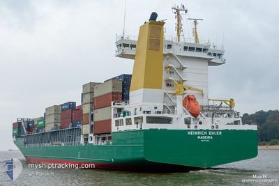
HEINRICH EHLER
Container Ship
Current Trip
| Time Travelled | 6 h, 33 mins |
|---|---|
| Remaining Time | 2 days |
| Distance Travelled | 78.14 nm |
| Remaining Distance | 723.63 nm |
| AVG Speed | 13.7 Knots |
| MAX Speed | 16.6 Knots |
| AVG Wind | 3.7 knots |
| MAX Wind | 16.4 knots |
| MIN Temp | 10.5°C / 50.9°F |
| MAX Temp | 14.4°C / 57.92°F |
| Draught | 9.6 m |
| Position Received | 3 m ago |
Current Position
| Longitude | -5.33650° |
|---|---|
| Latitude | 54.80567° |
| Status | Under way using engine |
| Speed | 11.9 Knots |
| Course | 166° |
| Area | Inner Seas off the West Coast of Scotland |
| Station | T-AIS |
| Position Received | 3 m ago |
Info
Information
The current position of HEINRICH EHLER is in Inner Seas off the West Coast of Scotland with coordinates 54.80567° / -5.33650° as reported on 2024-05-18 02:38 by AIS to our vessel tracker app. The vessel's current speed is 11.9 Knots and is heading at the port of ROTTERDAM. The estimated time of arrival as calculated by vessel tracking app is 2024-05-20 13:36 LT
The vessel HEINRICH EHLER (IMO: 9372200, MMSI: 255806191) is a Container Ship that was built in 2008 ( 16 years old ). It's sailing under the flag of [PT] Portugal.
In this page you can find informations about the vessels current position, last detected port calls, and current voyage information. If the vessels is not in coverage by AIS you will find the latest position.
The current position of HEINRICH EHLER is detected by our AIS receivers and we are not responsible for the reliability of the data. The last position was recorded while the vessel was in Coverage by the Ais receivers of our vessel tracking app.
The current draught of HEINRICH EHLER as reported by AIS is 9.6 meters
Weather
| Temperature | 10.5°C / 50.9°F |
|---|---|
| Wind Speed | 15 knots |
| Direction | 346° NNW |
| Pressure | 1015.1 hPa |
| Humidity | 96.6 % |
| Cloud Coverage | 21 % |
Featured Company
Last Port Calls
| Port | Arrival | Departure | Time In Port |
|---|---|---|---|
| 2024-05-17 11:29 | 2024-05-17 20:09 | 8 h | |
| 2024-05-15 03:58 | 2024-05-16 01:30 | 21 h | |
| 2024-05-13 20:58 | 2024-05-14 15:02 | 18 h | |
| 2024-05-12 11:06 | 2024-05-13 11:40 | 1 d | |
| 2024-05-09 21:43 | 2024-05-10 11:35 | 13 h | |
| 2024-05-05 19:29 | 2024-05-09 12:45 | 3 d | |
| 2024-05-02 13:37 | 2024-05-03 04:17 | 14 h | |
| 2024-05-01 05:46 | 2024-05-02 06:26 | 1 d | |
| 2024-04-28 23:35 | 2024-04-30 21:52 | 1 d | |
| 2024-04-27 09:51 | 2024-04-28 13:06 | 1 d |
Last Trips
| Origin | Departure | Destination | Arrival | Distance | |
|---|---|---|---|---|---|
| 2024-05-16 02:30 | 2024-05-17 12:29 | 95.08 nm | |||
| 2024-05-14 16:02 | 2024-05-15 04:58 | 111.85 nm | |||
| 2024-05-13 12:40 | 2024-05-13 21:58 | 119.12 nm | |||
| 2024-05-10 13:35 | 2024-05-12 12:06 | 605.28 nm | |||
| 2024-05-09 14:45 | 2024-05-09 23:43 | 144.92 nm | |||
| 2024-05-03 05:17 | 2024-05-05 21:29 | 848.04 nm | |||
| 2024-05-02 07:26 | 2024-05-02 14:37 | 92.27 nm | |||
| 2024-04-30 22:52 | 2024-05-01 06:46 | 112.39 nm | |||
| 2024-04-28 14:06 | 2024-04-29 00:35 | 118.16 nm | |||
| 2024-04-25 05:04 | 2024-04-27 10:51 | 606.48 nm |
Events
| Time | Event | Details | Position / Dest | Info |
|---|---|---|---|---|
| 2024-05-18 02:25 | Status Changed | Under way using engine Default |
54.84967 / -5.35617
ROTTERDAM
|
Speed: 12.2 kn Course: 163° |
| 2024-05-18 02:11 | IN Coverage |
54.84904 / -5.35592
Inner Seas off the West Coast of Scotland
ROTTERDAM
|
Speed: 12.2 kn Course: 167° |
|
| 2024-05-17 22:22 | Status Changed | Default Under way using engine |
55.59783 / -4.99100
ROTTERDAM
|
Speed: 12.1 kn Course: 178° |
| 2024-05-17 22:14 | OUT of Coverage |
55.62567 / -4.99183
Inner Seas off the West Coast of Scotland
ROTTERDAM
|
Speed: 12.1 kn Course: 178° |
|
| 2024-05-17 21:47 | Status Changed | Under way using engine Default |
55.71550 / -4.98833
ROTTERDAM
|
Speed: 12.1 kn Course: 188° |
| 2024-05-17 21:34 | Status Changed | Default Under way using engine |
55.75850 / -4.97650
ROTTERDAM
|
Speed: 11.4 kn Course: 189° |
| 2024-05-17 21:28 | Status Changed | Under way using engine Default |
55.77933 / -4.97017
ROTTERDAM
|
Speed: 11.4 kn Course: 190° |
| 2024-05-17 21:22 | Status Changed | Default Under way using engine |
55.79562 / -4.96543
ROTTERDAM
|
Speed: 8 kn Course: 193° |
| 2024-05-17 20:09 | PORT DEPARTURE |
|
55.95950 / -4.76233
ROTTERDAM
|
Speed: 3.7 kn Course: 172° |
| 2024-05-17 20:07 | START Moving |
55.95777 / -4.76198
[GB] GREENOCK
|
Speed: 3.2 kn Course: 162° |