
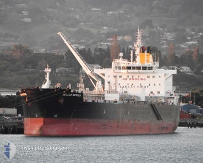
HELLAS NEMESIS
Tanker
Current Trip
| Time Travelled | 4 days |
|---|---|
| Remaining Time | --- |
| Distance Travelled | 1225.74 nm |
| Remaining Distance | --- |
| AVG Speed | 12 Knots |
| MAX Speed | 15.1 Knots |
| AVG Wind | 5.5 knots |
| MAX Wind | 12 knots |
| MIN Temp | 27.3°C / 81.14°F |
| MAX Temp | 30.3°C / 86.54°F |
| Draught | 10.9 m |
| Position Received | 4 d ago |
Current Position
| Longitude | 104.18627° |
|---|---|
| Latitude | 1.26627° |
| Status | Under way using engine |
| Speed | 11.8 Knots |
| Course | 83.2° |
| Area | Singapore Strait |
| Station | T-AIS |
| Position Received | 4 d ago |
Info
Information
The current position of HELLAS NEMESIS is in Singapore Strait with coordinates 1.26627° / 104.18627° as reported on 2024-05-16 14:39 by AIS to our vessel tracker app. The vessel's current speed is 11.8 Knots and is heading at the port of LOS ANGELES. The estimated time of arrival as calculated by vessel tracking app is 2024-06-08 14:00 LT
The vessel HELLAS NEMESIS (IMO: 9722649, MMSI: 249451000) is a Tanker It's sailing under the flag of [MT] Malta.
In this page you can find informations about the vessels current position, last detected port calls, and current voyage information. If the vessels is not in coverage by AIS you will find the latest position.
The current position of HELLAS NEMESIS is detected by our AIS receivers and we are not responsible for the reliability of the data. The last position was recorded while the vessel was in Coverage by the Ais receivers of our vessel tracking app.
The current draught of HELLAS NEMESIS as reported by AIS is 10.9 meters
Weather
| Temperature | 28.9°C / 84.02°F |
|---|---|
| Wind Speed | 3 knots |
| Direction | 139° SE |
| Pressure | 1007.7 hPa |
| Humidity | 65.7 % |
| Cloud Coverage | 100 % |
Featured Company
Last Port Calls
| Port | Arrival | Departure | Time In Port |
|---|---|---|---|
| 2024-05-15 09:12 | 2024-05-16 11:25 | 1 d | |
| 2024-05-11 20:51 | 2024-05-12 18:59 | 22 h | |
| 2024-05-07 07:05 | 2024-05-11 19:42 | 4 d | |
| 2024-04-22 11:11 | 2024-04-24 17:09 | 2 d | |
| 2024-04-08 23:56 | 2024-04-10 14:27 | 1 d | |
| 2024-04-06 10:15 | 2024-04-08 18:42 | 2 d | |
| 2024-03-18 19:49 | 2024-03-21 01:53 | 2 d | |
| 2024-03-05 02:53 | 2024-03-06 09:36 | 1 d |
Most Visited Ports (Last year)
| Port | Arrivals | |
|---|---|---|
| 6 | ||
| 3 | ||
| 2 | ||
| 2 | ||
| 2 | ||
| 1 |
Last Trips
| Origin | Departure | Destination | Arrival | Distance | |
|---|---|---|---|---|---|
| 2024-05-13 02:59 | 2024-05-15 17:12 | 17.26 nm | |||
| 2024-05-12 03:42 | 2024-05-12 04:51 | 8.02 nm | |||
| 2024-04-25 02:39 | 2024-05-07 15:05 | 3803.42 nm | |||
| 2024-04-10 22:27 | 2024-04-22 20:41 | 3797.71 nm | |||
| 2024-04-09 02:42 | 2024-04-09 07:56 | 37.13 nm | |||
| 2024-03-21 12:23 | 2024-04-06 18:15 | 3810.20 nm | |||
| 2024-03-06 17:36 | 2024-03-19 06:19 | 3763.41 nm | |||
| 2024-02-29 09:03 | 2024-03-05 10:53 | 54.88 nm |
Events
| Time | Event | Details | Position / Dest | Info |
|---|---|---|---|---|
| 2024-05-16 14:45 | Status Changed | Default Under way using engine |
1.26852 / 104.20477
USLGB
|
Speed: 11.8 kn Course: 83.2° |
| 2024-05-16 14:39 | OUT of Coverage |
1.26627 / 104.18627
Singapore Strait
USLGB
|
Speed: 11.8 kn Course: 83.2° |
|
| 2024-05-16 14:26 | Change Sea Area | Malaysian part of the Singapore Strait Indonesian part of the Singapore Strait |
1.26022 / 104.14443
Singapore Strait
USLGB
|
Speed: 11.8 kn Course: 82.7° |
| 2024-05-16 12:35 | Change Sea Area | Indonesian part of the Singapore Strait Singaporean part of the Singapore Strait |
1.18005 / 103.83679
Singapore Strait
USLGB
|
Speed: 8 kn Course: 105.5° |
| 2024-05-16 11:25 | PORT DEPARTURE |
|
1.24136 / 103.69586
USLGB
|
Speed: 8.4 kn Course: 122° |
| 2024-05-16 11:24 | Draught Changed | 10.9 10 |
1.24341 / 103.69457
[SG] JURONG ISLAND
|
Speed: 8.3 kn Course: 141° |
| 2024-05-16 11:24 | Destination Changed | USLGB SGSIN PGBG |
1.24341 / 103.69457
[SG] JURONG ISLAND
|
Speed: 8.3 kn Course: 141° |
| 2024-05-16 11:24 | ETA Changed | 2024/06/08 14:00 2024/05/06 06:45 |
1.24341 / 103.69457
[SG] JURONG ISLAND
|
Speed: 8.3 kn Course: 141° |
| 2024-05-16 11:15 | Status Changed | Under way using engine Moored |
1.25834 / 103.68875
[SG] JURONG ISLAND
|
Speed: 3.6 kn Course: 152° |
| 2024-05-16 11:15 | IN Coverage |
1.25683 / 103.68958
Singapore Strait
[SG] JURONG ISLAND
|
Speed: 4.8 kn Course: 152.5° |