
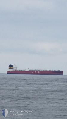
HELLAS POSEIDON
Tanker
Current Trip
| Time Travelled | 13 days |
|---|---|
| Remaining Time | --- |
| Distance Travelled | 4528.56 nm |
| Remaining Distance | 8.78 nm |
| AVG Speed | 14.3 Knots |
| MAX Speed | 16.6 Knots |
| AVG Wind | 12.4 knots |
| MAX Wind | 19.8 knots |
| MIN Temp | 24.5°C / 76.1°F |
| MAX Temp | 29.1°C / 84.38°F |
| Draught | 11.8 m |
| Position Received | 7 d ago |
Current Position
| Longitude | -64.11399° |
|---|---|
| Latitude | 13.03618° |
| Status | Under way using engine |
| Speed | 14.2 Knots |
| Course | 127.8° |
| Area | Caribbean Sea |
| Station | T-AIS |
| Position Received | 7 d ago |
Info
Information
The current position of HELLAS POSEIDON is in Caribbean Sea with coordinates 13.03618° / -64.11399° as reported on 2024-05-25 06:34 by AIS to our vessel tracker app. The vessel's current speed is 14.2 Knots and is heading at the port of SUAPE. The estimated time of arrival as calculated by vessel tracking app is 2024-05-31 15:00 LT
The vessel HELLAS POSEIDON (IMO: 9721140, MMSI: 256732000) is a Tanker It's sailing under the flag of [MT] Malta.
In this page you can find informations about the vessels current position, last detected port calls, and current voyage information. If the vessels is not in coverage by AIS you will find the latest position.
The current position of HELLAS POSEIDON is detected by our AIS receivers and we are not responsible for the reliability of the data. The last position was recorded while the vessel was in Coverage by the Ais receivers of our vessel tracking app.
The current draught of HELLAS POSEIDON as reported by AIS is 11.8 meters
Weather
| Temperature | 27.8°C / 82.04°F |
|---|---|
| Wind Speed | 15 knots |
| Direction | 109° ESE |
| Pressure | 1015.9 hPa |
| Humidity | 75.6 % |
| Cloud Coverage | 14 % |
Featured Company
Last Port Calls
| Port | Arrival | Departure | Time In Port |
|---|---|---|---|
| 2024-05-17 07:22 | 2024-05-19 04:06 | 1 d | |
| 2024-04-21 07:32 |
Most Visited Ports (Last year)
| Port | Arrivals | |
|---|---|---|
| 4 | ||
| 3 | ||
| 2 | ||
| 2 | ||
| 2 | ||
| 2 |
Last Trips
| Origin | Departure | Destination | Arrival | Distance | |
|---|---|---|---|---|---|
| 2024-04-21 10:32 | 2024-05-17 02:22 | 7188.08 nm |
Events
| Time | Event | Details | Position / Dest | Info |
|---|---|---|---|---|
| 2024-06-01 00:32 | STOP Moving | 6.54 nm, East of SUAPE |
-8.37167 / -34.84667
BR SUA
|
Speed: Course: -1° |
| 2024-05-25 06:41 | Status Changed | Default Under way using engine |
13.01894 / -64.09102
BR SUA
|
Speed: 14.2 kn Course: 127.8° |
| 2024-05-25 06:34 | OUT of Coverage |
13.03618 / -64.11399
Caribbean Sea
BR SUA
|
Speed: 14.2 kn Course: 127.8° |
|
| 2024-05-25 05:17 | Draught Changed | 11.8 12.1 |
13.16938 / -64.39317
BR SUA
|
Speed: 13.9 kn Course: 108.9° |
| 2024-05-25 05:17 | Destination Changed | BR SUA BRA SUA |
13.16938 / -64.39317
BR SUA
|
Speed: 13.9 kn Course: 108.9° |
| 2024-05-25 05:17 | ETA Changed | 2024/05/31 15:00 2024/05/31 08:00 |
13.16938 / -64.39317
BR SUA
|
Speed: 13.9 kn Course: 108.9° |
| 2024-05-25 03:38 | Change Sea Area | Venezuelan part of the Caribbean Sea United States part of the Gulf of Mexico |
13.28625 / -64.76363
Caribbean Sea
BRA SUA
|
Speed: 13.7 kn Course: 109.8° |
| 2024-05-25 03:38 | Status Changed | Under way using engine Default |
13.28625 / -64.76363
BRA SUA
|
Speed: 13.7 kn Course: 110° |
| 2024-05-25 03:38 | IN Coverage |
13.28625 / -64.76363
Caribbean Sea
BRA SUA
|
Speed: 13.7 kn Course: 109.8° |