
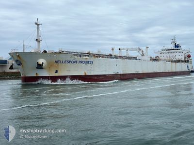
HELLESPONT PROGRESS
Oil Products Tanker
Current Trip
BS FPO
| Time Travelled | 13 h, 44 mins |
|---|---|
| Remaining Time | --- |
| Distance Travelled | 33.53 nm |
| Remaining Distance | --- |
| AVG Speed | 7.2 Knots |
| MAX Speed | 9.4 Knots |
| AVG Wind | 11.1 knots |
| MAX Wind | 18.9 knots |
| MIN Temp | 27.4°C / 81.32°F |
| MAX Temp | 28.6°C / 83.48°F |
| Draught | 11.7 m |
| Position Received | 2 m ago |
Current Position
| Longitude | -79.00108° |
|---|---|
| Latitude | 26.44304° |
| Status | Under way using engine |
| Speed | 0.2 Knots |
| Course | 9° |
| Area | North Atlantic Ocean |
| Station | T-AIS |
| Position Received | 2 m ago |
Info
Information
The current position of HELLESPONT PROGRESS is in North Atlantic Ocean with coordinates 26.44304° / -79.00108° as reported on 2024-05-31 23:37 by AIS to our vessel tracker app. The vessel's current speed is 0.2 Knots
The vessel HELLESPONT PROGRESS (IMO: 9351426, MMSI: 232013527) is a Oil Products Tanker that was built in 2006 ( 18 years old ). It's sailing under the flag of [GB] United Kingdom.
In this page you can find informations about the vessels current position, last detected port calls, and current voyage information. If the vessels is not in coverage by AIS you will find the latest position.
The current position of HELLESPONT PROGRESS is detected by our AIS receivers and we are not responsible for the reliability of the data. The last position was recorded while the vessel was in Coverage by the Ais receivers of our vessel tracking app.
The current draught of HELLESPONT PROGRESS as reported by AIS is 11.7 meters
Weather
| Temperature | 27.8°C / 82.04°F |
|---|---|
| Wind Speed | 18 knots |
| Direction | 28° NNE |
| Pressure | 1017.9 hPa |
| Humidity | 59.2 % |
| Cloud Coverage | --- |
Featured Company
Last Port Calls
| Port | Arrival | Departure | Time In Port |
|---|---|---|---|
| 2024-05-29 02:20 | 2024-05-31 09:55 | 2 d | |
| 2024-05-18 21:46 | 2024-05-21 12:30 | 2 d | |
| 2024-05-12 12:18 | 2024-05-15 02:38 | 2 d | |
| 2024-04-21 00:50 | 2024-04-21 21:06 | 20 h | |
| 2024-03-31 14:08 | 2024-04-03 05:05 | 2 d | |
| 2024-03-19 03:30 | 2024-03-20 01:18 | 21 h |
Most Visited Ports (Last year)
| Port | Arrivals | |
|---|---|---|
| 10 | ||
| 9 | ||
| 2 | ||
| 1 | ||
| 1 | ||
| 1 |
Last Trips
| Origin | Departure | Destination | Arrival | Distance | |
|---|---|---|---|---|---|
| 2024-05-21 07:30 | 2024-05-28 22:20 | 1230.80 nm | |||
| 2024-05-14 21:38 | 2024-05-18 16:46 | 439.01 nm | |||
| 2024-04-21 16:06 | 2024-05-12 07:18 | 422.02 nm | |||
| 2024-04-03 00:05 | 2024-04-20 19:50 | 3691.36 nm | |||
| 2024-03-19 20:18 | 2024-03-31 09:08 | 411.72 nm | |||
| 2024-02-15 20:56 | 2024-03-18 22:30 | 4453.94 nm |
Events
| Time | Event | Details | Position / Dest | Info |
|---|---|---|---|---|
| 2024-05-31 23:35 | Status Changed | Under way using engine Default |
26.44305 / -79.00096
BS FPO
|
Speed: 0.8 kn Course: 10° |
| 2024-05-31 23:35 | STOP Moving | 13.11 nm, West of FREEPORT (BS) |
26.44305 / -79.00096
BS FPO
|
Speed: 0.2 kn Course: 11° |
| 2024-05-31 23:32 | Status Changed | Default Under way using engine |
26.44260 / -79.00083
BS FPO
|
Speed: 2.4 kn Course: 7° |
| 2024-05-31 23:14 | Status Changed | Under way using engine Default |
26.41987 / -78.99735
BS FPO
|
Speed: 9 kn Course: 346° |
| 2024-05-31 23:04 | IN Coverage |
26.42482 / -78.99863
North Atlantic Ocean
|
Speed: 9 kn Course: 346.9° |
|
| 2024-05-31 22:12 | START Moving | 18.33 nm, South West of FREEPORT (BS) |
26.26433 / -78.95654
BS FPO
|
Speed: 5.8 kn Course: 348° |
| 2024-05-31 14:12 | Status Changed | Default Under way using engine |
26.41865 / -78.80508
BS FPO
|
Speed: 1.6 kn Course: 306° |
| 2024-05-31 14:04 | OUT of Coverage |
26.42238 / -78.80515
North Atlantic Ocean
|
Speed: 1.6 kn Course: 171° |
|
| 2024-05-31 13:55 | Status Changed | Under way using engine Default |
26.42600 / -78.80552
BS FPO
|
Speed: 1.5 kn Course: 319° |
| 2024-05-31 13:40 | IN Coverage |
26.42600 / -78.80552
North Atlantic Ocean
|
Speed: 1.6 kn Course: 167° |