
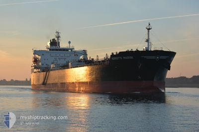
HENRIETTE MAERSK
Oil/Chemical Tanker
Current Trip
CV MIN
| Time Travelled | 2 days |
|---|---|
| Remaining Time | --- |
| Distance Travelled | 909.10 nm |
| Remaining Distance | --- |
| AVG Speed | 12.5 Knots |
| MAX Speed | 13.8 Knots |
| AVG Wind | 11.4 knots |
| MAX Wind | 19.6 knots |
| MIN Temp | 18.8°C / 65.84°F |
| MAX Temp | 28.3°C / 82.94°F |
| Draught | 9.3 m |
| Position Received | 9 h, 31 m ago |
Current Position
| Longitude | -15.90977° |
|---|---|
| Latitude | 26.94648° |
| Status | Under way using engine |
| Speed | 12.3 Knots |
| Course | 217.8° |
| Area | North Atlantic Ocean |
| Station | T-AIS |
| Position Received | 9 h, 31 m ago |
Info
Information
The current position of HENRIETTE MAERSK is in North Atlantic Ocean with coordinates 26.94648° / -15.90977° as reported on 2024-06-02 03:57 by AIS to our vessel tracker app. The vessel's current speed is 12.3 Knots
The vessel HENRIETTE MAERSK (IMO: 9399349, MMSI: 563097900) is a Oil/Chemical Tanker that was built in 2010 ( 14 years old ). It's sailing under the flag of [SG] Singapore.
In this page you can find informations about the vessels current position, last detected port calls, and current voyage information. If the vessels is not in coverage by AIS you will find the latest position.
The current position of HENRIETTE MAERSK is detected by our AIS receivers and we are not responsible for the reliability of the data. The last position was recorded while the vessel was in Coverage by the Ais receivers of our vessel tracking app.
The current draught of HENRIETTE MAERSK as reported by AIS is 9.3 meters
Weather
| Temperature | 21°C / 69.8°F |
|---|---|
| Wind Speed | 10 knots |
| Direction | 23° NNE |
| Pressure | 1017.7 hPa |
| Humidity | 82.3 % |
| Cloud Coverage | --- |
Featured Company
Last Port Calls
| Port | Arrival | Departure | Time In Port |
|---|---|---|---|
| 2024-05-29 08:55 | 2024-05-30 14:08 | 1 d | |
| 2024-05-22 15:05 | 2024-05-25 05:23 | 2 d | |
| 2024-05-17 15:51 | 2024-05-19 04:19 | 1 d | |
| 2024-05-11 13:28 | 2024-05-13 22:24 | 2 d | |
| 2024-05-06 01:43 | 2024-05-07 11:57 | 1 d | |
| 2024-04-25 08:00 | 2024-04-27 11:04 | 2 d | |
| 2024-04-23 18:46 | 2024-04-23 19:18 | 31 m | |
| 2024-04-19 15:52 | 2024-04-20 15:47 | 23 h | |
| 2024-04-10 06:05 | 2024-04-12 11:23 | 2 d | |
| 2024-04-06 11:16 | 2024-04-07 16:43 | 1 d |
Most Visited Ports (Last year)
| Port | Arrivals | |
|---|---|---|
| 5 | ||
| 5 | ||
| 4 | ||
| 2 | ||
| 2 | ||
| 2 |
Last Trips
| Origin | Departure | Destination | Arrival | Distance | |
|---|---|---|---|---|---|
| 2024-05-25 07:23 | 2024-05-29 10:55 | 601.64 nm | |||
| 2024-05-19 05:19 | 2024-05-22 17:05 | 615.84 nm | |||
| 2024-05-14 00:24 | 2024-05-17 16:51 | 1082.46 nm | |||
| 2024-05-07 14:57 | 2024-05-11 15:28 | 820.34 nm | |||
| 2024-04-27 13:04 | 2024-05-06 04:43 | 668.45 nm | |||
| 2024-04-23 21:18 | 2024-04-25 10:00 | 5.32 nm | |||
| 2024-04-20 18:47 | 2024-04-23 20:46 | 652.01 nm | |||
| 2024-04-12 13:23 | 2024-04-19 18:52 | 663.67 nm | |||
| 2024-04-07 18:43 | 2024-04-10 08:05 | 750.91 nm | |||
| 2024-03-21 09:05 | 2024-04-06 13:16 | 1398.67 nm |
Events
| Time | Event | Details | Position / Dest | Info |
|---|---|---|---|---|
| 2024-06-02 04:02 | Status Changed | Default Under way using engine |
26.93129 / -15.92299
CV MIN
|
Speed: 12.3 kn Course: 217.8° |
| 2024-06-02 03:57 | OUT of Coverage |
26.94648 / -15.90977
North Atlantic Ocean
CV MIN
|
Speed: 12.3 kn Course: 217.8° |
|
| 2024-06-02 03:57 | Status Changed | Under way using engine Default |
26.94692 / -15.90938
CV MIN
|
Speed: 12.3 kn Course: 219° |
| 2024-06-02 03:42 | Status Changed | Default Under way using engine |
26.98480 / -15.87551
CV MIN
|
Speed: 12.4 kn Course: 218.8° |
| 2024-06-02 03:39 | Status Changed | Under way using engine Default |
26.99417 / -15.86683
CV MIN
|
Speed: 12.4 kn Course: 220° |
| 2024-06-02 03:19 | Status Changed | Default Under way using engine |
27.04769 / -15.81803
CV MIN
|
Speed: 12.4 kn Course: 219.2° |
| 2024-06-02 03:09 | Status Changed | Under way using engine Default |
27.07533 / -15.79277
CV MIN
|
Speed: 12.3 kn Course: 219° |
| 2024-06-02 03:03 | IN Coverage |
27.07077 / -15.79677
North Atlantic Ocean
CV MIN
|
Speed: 12.3 kn Course: 218.4° |
|
| 2024-06-02 01:24 | Status Changed | Default Under way using engine |
27.36227 / -15.52008
CV MIN
|
Speed: 13.3 kn Course: 220.3° |
| 2024-06-02 01:18 | OUT of Coverage |
27.37785 / -15.50560
North Atlantic Ocean
CV MIN
|
Speed: 13.3 kn Course: 220.3° |