
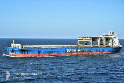
HERANGER
General Cargo
Current Trip
| Time Travelled | 31 days |
|---|---|
| Remaining Time | --- |
| Distance Travelled | 8951.10 nm |
| Remaining Distance | --- |
| AVG Speed | 12.1 Knots |
| MAX Speed | 16 Knots |
| AVG Wind | 14.1 knots |
| MAX Wind | 29.6 knots |
| MIN Temp | 15.5°C / 59.9°F |
| MAX Temp | 30.4°C / 86.72°F |
| Draught | 8.5 m |
| Position Received | 1 d ago |
Current Position
| Longitude | 11.97455° |
|---|---|
| Latitude | -28.94147° |
| Status | Under way using engine |
| Speed | 12.7 Knots |
| Course | 317.4° |
| Area | South Atlantic Ocean |
| Station | T-AIS |
| Position Received | 1 d ago |
Info
Information
The current position of HERANGER is in South Atlantic Ocean with coordinates -28.94147° / 11.97455° as reported on 2024-06-29 01:56 by AIS to our vessel tracker app. The vessel's current speed is 12.7 Knots and is heading at the port of EMDEN. The estimated time of arrival as calculated by vessel tracking app is 2024-07-18 18:00 LT
The vessel HERANGER (IMO: 9079121, MMSI: 538009776) is a General Cargo that was built in 1995 ( 29 years old ). It's sailing under the flag of [MH] Marshall Is.
In this page you can find informations about the vessels current position, last detected port calls, and current voyage information. If the vessels is not in coverage by AIS you will find the latest position.
The current position of HERANGER is detected by our AIS receivers and we are not responsible for the reliability of the data. The last position was recorded while the vessel was in Coverage by the Ais receivers of our vessel tracking app.
The current draught of HERANGER as reported by AIS is 8.5 meters
Weather
| Temperature | 18.3°C / 64.94°F |
|---|---|
| Wind Speed | 13 knots |
| Direction | 206° SSW |
| Pressure | 1016.2 hPa |
| Humidity | 85 % |
| Cloud Coverage | 19 % |
Featured Company
Events
| Time | Event | Details | Position / Dest | Info |
|---|---|---|---|---|
| 2024-06-29 01:56 | Status Changed | Default Under way using engine |
-28.94060 / 11.97361
DEEME
|
Speed: 12.7 kn Course: 317.4° |
| 2024-06-29 01:56 | Status Changed | Under way using engine Default |
-28.94147 / 11.97455
DEEME
|
Speed: 12.7 kn Course: 318° |
| 2024-06-29 01:56 | OUT of Coverage |
-28.94147 / 11.97455
South Atlantic Ocean
DEEME
|
Speed: 12.7 kn Course: 317.4° |
|
| 2024-06-29 01:56 | Change Sea Area | High seas of the South Atlantic Ocean Namibian part of the South Atlantic Ocean |
-28.94147 / 11.97455
South Atlantic Ocean
DEEME
|
Speed: 12.7 kn Course: 317.4° |
| 2024-06-29 01:26 | Status Changed | Default Under way using engine |
-29.01998 / 12.05453
DEEME
|
Speed: 12.8 kn Course: 318.7° |
| 2024-06-29 01:11 | Status Changed | Under way using engine Default |
-29.06123 / 12.09398
DEEME
|
Speed: 13.2 kn Course: 318° |
| 2024-06-29 01:08 | Status Changed | Default Under way using engine |
-29.07050 / 12.10320
DEEME
|
Speed: 13.1 kn Course: 317.8° |
| 2024-06-29 00:26 | Status Changed | Under way using engine Default |
-29.18278 / 12.21680
DEEME
|
Speed: 13.2 kn Course: 317° |
| 2024-06-29 00:26 | IN Coverage |
-29.17829 / 12.21208
South Atlantic Ocean
DEEME
|
Speed: 13.2 kn Course: 316.5° |
|
| 2024-06-28 23:06 | OUT of Coverage |
-29.40250 / 12.44006
South Atlantic Ocean
DEEME
|
Speed: 13.3 kn Course: 317.8° |