
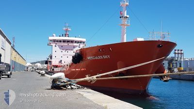
HERCULES SKY
Tanker
Current Trip
| Trip Time | 1 day |
|---|---|
| Trip Distance | 14.09 nm |
| AVG Speed | 4.4 Knots |
| MAX Speed | 6.4 Knots |
| Draught | 4.9 m |
| AVG Wind | 15.1 knots |
| MAX Wind | 18 knots |
| MIN Temp | 16.7°C / 62.06°F |
| MAX Temp | 22.4°C / 72.32°F |
| Position Received | 1 m ago |
Current Position
| Longitude | -5.39945° |
|---|---|
| Latitude | 36.17726° |
| Status | Under way using engine |
| Speed | |
| Course | 266° |
| Area | Strait of Gibraltar |
| Station | T-AIS |
| Position Received | 1 m ago |
Info
Information
The current position of HERCULES SKY is in Strait of Gibraltar with coordinates 36.17726° / -5.39945° as reported on 2024-06-02 17:09 by AIS to our vessel tracker app. The vessel's current speed is 0 Knots and is currently inside the port of CARTEYA GUADARRANQUE.
The vessel HERCULES SKY (IMO: 9585481, MMSI: 255965000) is a Tanker It's sailing under the flag of [PT] Portugal.
In this page you can find informations about the vessels current position, last detected port calls, and current voyage information. If the vessels is not in coverage by AIS you will find the latest position.
The current position of HERCULES SKY is detected by our AIS receivers and we are not responsible for the reliability of the data. The last position was recorded while the vessel was in Coverage by the Ais receivers of our vessel tracking app.
The current draught of HERCULES SKY as reported by AIS is 4.9 meters
Weather
| Temperature | 20.6°C / 69.08°F |
|---|---|
| Wind Speed | 14 knots |
| Direction | 101° E |
| Pressure | 1014.9 hPa |
| Humidity | 65.4 % |
| Cloud Coverage | 11 % |
Featured Company
Last Port Calls
| Port | Arrival | Departure | Time In Port |
|---|---|---|---|
| 2024-06-02 13:31 | |||
| 2024-05-31 02:09 | 2024-06-01 05:45 | 1 d | |
| 2024-05-29 17:48 | 2024-05-30 02:36 | 8 h | |
| 2024-05-23 21:48 | 2024-05-24 15:24 | 17 h | |
| 2024-05-18 04:05 | 2024-05-18 19:39 | 15 h | |
| 2024-05-16 08:41 | 2024-05-16 13:13 | 4 h | |
| 2024-05-14 10:15 | 2024-05-15 03:12 | 16 h | |
| 2024-05-12 03:33 | 2024-05-12 22:31 | 18 h | |
| 2024-05-10 15:16 | 2024-05-10 15:38 | 21 m | |
| 2024-05-09 20:33 | 2024-05-10 07:53 | 11 h |
Most Visited Ports (Last year)
| Port | Arrivals | |
|---|---|---|
| 127 | ||
| 78 | ||
| 2 | ||
| 1 | ||
| 1 |
Last Trips
| Origin | Departure | Destination | Arrival | Distance | |
|---|---|---|---|---|---|
| 2024-06-01 07:45 | 2024-06-02 15:31 | 14.09 nm | |||
| 2024-05-30 04:36 | 2024-05-31 04:09 | 8.51 nm | |||
| 2024-05-24 17:24 | 2024-05-29 19:48 | 72.39 nm | |||
| 2024-05-18 21:39 | 2024-05-23 23:48 | 68.21 nm | |||
| 2024-05-16 15:13 | 2024-05-18 06:05 | 19.07 nm | |||
| 2024-05-15 05:12 | 2024-05-16 10:41 | 17.95 nm | |||
| 2024-05-13 00:31 | 2024-05-14 12:15 | 11.79 nm | |||
| 2024-05-10 17:38 | 2024-05-12 05:33 | 15.98 nm | |||
| 2024-05-10 09:53 | 2024-05-10 17:16 | 5.50 nm | |||
| 2024-05-09 22:18 | 2024-05-09 22:33 | 0.70 nm |
Events
| Time | Event | Details | Position / Dest | Info |
|---|---|---|---|---|
| 2024-06-02 13:33 | STOP Moving |
36.17723 / -5.39953
[ES] CARTEYA GUADARRANQUE
|
Speed: 0.3 kn Course: 267° |
|
| 2024-06-02 13:31 | PORT ARRIVAL |
|
36.17734 / -5.39971
[ES] CARTEYA GUADARRANQUE
|
Speed: 0.6 kn Course: 265° |
| 2024-06-02 13:06 | ETA Changed | 2024/06/02 13:30 2024/06/01 06:30 |
36.16302 / -5.39259
ALGECIRAS
|
Speed: 6.7 kn Course: 312.3° |
| 2024-06-02 13:00 | Destination Changed | ALGECIRAS GIBRALTAR NORTH ANCH |
36.15444 / -5.38422
ALGECIRAS
|
Speed: 5.6 kn Course: 335° |
| 2024-06-02 12:58 | Change Sea Area | Spanish part of the Strait of Gibraltar Gibraltarian part of the Strait of Gibraltar |
36.15236 / -5.38272
Strait of Gibraltar
|
Speed: 5.2 kn Course: 317.6° |
| 2024-06-02 12:55 | Change Sea Area | Gibraltarian part of the Strait of Gibraltar Spanish part of the Strait of Gibraltar |
36.15052 / -5.37835
Strait of Gibraltar
|
Speed: 4.9 kn Course: 258.9° |
| 2024-06-02 12:53 | START Moving | 0.7 nm, North West of GIBRALTAR |
36.15232 / -5.37585
GIBRALTAR NORTH ANCH
|
Speed: 3.9 kn Course: 219° |
| 2024-06-02 12:47 | Status Changed | Under way using engine At anchor |
36.15394 / -5.37498
GIBRALTAR NORTH ANCH
|
Speed: 0.5 kn Course: 77° |
| 2024-06-02 11:46 | Status Changed | At anchor Under way using engine |
36.15332 / -5.37544
GIBRALTAR NORTH ANCH
|
Speed: 0.1 kn Course: 59° |
| 2024-06-02 11:35 | STOP Moving | 0.68 nm, North West of GIBRALTAR |
36.15370 / -5.37438
GIBRALTAR NORTH ANCH
|
Speed: 0.3 kn Course: 43° |