
HERMANN SCHULTE
Cargo
Current Trip
| Time Travelled | 6 days |
|---|---|
| Remaining Time | 2 days |
| Distance Travelled | 2694.83 nm |
| Remaining Distance | 948.19 nm |
| AVG Speed | 17.3 Knots |
| MAX Speed | 20.8 Knots |
| AVG Wind | 13.1 knots |
| MAX Wind | 26.9 knots |
| MIN Temp | 11°C / 51.8°F |
| MAX Temp | 18°C / 64.4°F |
| Draught | 12.5 m |
| Position Received | 4 d ago |
Current Position
| Longitude | -8.26921° |
|---|---|
| Latitude | 49.83502° |
| Status | Under way using engine |
| Speed | 19.1 Knots |
| Course | 280.7° |
| Area | Celtic Sea |
| Station | T-AIS |
| Position Received | 4 d ago |
Info
Information
The current position of HERMANN SCHULTE is in Celtic Sea with coordinates 49.83502° / -8.26921° as reported on 2024-06-09 00:54 by AIS to our vessel tracker app. The vessel's current speed is 19.1 Knots and is heading at the port of NEW YORK. The estimated time of arrival as calculated by vessel tracking app is 2024-06-15 21:43 LT
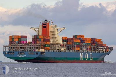
The vessel HERMANN SCHULTE (IMO: 9535187, MMSI: 477462400) is a Cargo It's sailing under the flag of [HK] Hong Kong.
In this page you can find informations about the vessels current position, last detected port calls, and current voyage information. If the vessels is not in coverage by AIS you will find the latest position.
The current position of HERMANN SCHULTE is detected by our AIS receivers and we are not responsible for the reliability of the data. The last position was recorded while the vessel was in Coverage by the Ais receivers of our vessel tracking app.
The current draught of HERMANN SCHULTE as reported by AIS is 12.5 meters
Weather
| Temperature | 15°C / 59°F |
|---|---|
| Wind Speed | 5 knots |
| Direction | 27° NNE |
| Pressure | 1021.3 hPa |
| Humidity | 92.4 % |
| Cloud Coverage | 100 % |
Featured Company
Last Port Calls
| Port | Arrival | Departure | Time In Port |
|---|---|---|---|
| 2024-06-05 22:04 | 2024-06-07 06:37 | 1 d | |
| 2024-06-03 12:34 | 2024-06-04 06:36 | 18 h | |
| 2024-06-02 01:18 | 2024-06-03 01:00 | 23 h | |
| 2024-05-23 19:54 | 2024-05-24 15:39 | 19 h | |
| 2024-05-20 14:30 | 2024-05-22 01:34 | 1 d | |
| 2024-05-10 11:46 | 2024-05-11 06:58 | 19 h | |
| 2024-05-08 16:06 | 2024-05-09 13:50 | 21 h | |
| 2024-05-04 19:31 | 2024-05-05 15:14 | 19 h | |
| 2024-04-30 07:12 | 2024-05-01 08:42 | 1 d | |
| 2024-04-20 11:14 | 2024-04-21 16:19 | 1 d |
Most Visited Ports (Last year)
| Port | Arrivals | |
|---|---|---|
| 10 | ||
| 8 | ||
| 8 | ||
| 8 | ||
| 6 | ||
| 5 |
Last Trips
| Origin | Departure | Destination | Arrival | Distance | |
|---|---|---|---|---|---|
| 2024-06-04 08:36 | 2024-06-06 00:04 | 295.93 nm | |||
| 2024-06-03 03:00 | 2024-06-03 14:34 | 128.91 nm | |||
| 2024-05-24 11:39 | 2024-06-02 03:18 | 3891.13 nm | |||
| 2024-05-21 21:34 | 2024-05-23 15:54 | 402.57 nm | |||
| 2024-05-11 01:58 | 2024-05-20 10:30 | 1067.50 nm | |||
| 2024-05-09 08:50 | 2024-05-10 06:46 | 232.45 nm | |||
| 2024-05-05 11:14 | 2024-05-08 11:06 | 1164.21 nm | |||
| 2024-05-01 04:42 | 2024-05-04 15:31 | 637.27 nm | |||
| 2024-04-21 18:19 | 2024-04-30 03:12 | 3515.29 nm | |||
| 2024-04-19 15:39 | 2024-04-20 13:14 | 291.95 nm |
Events
| Time | Event | Details | Position / Dest | Info |
|---|---|---|---|---|
| 2024-06-09 00:58 | Status Changed | Default Under way using engine |
49.83727 / -8.30179
USNYC
|
Speed: 19.1 kn Course: 280.7° |
| 2024-06-09 00:54 | Status Changed | Under way using engine Default |
49.83502 / -8.26921
USNYC
|
Speed: 19.1 kn Course: 280° |
| 2024-06-09 00:54 | IN Coverage |
49.83502 / -8.26921
Celtic Sea
USNYC
|
Speed: 19.1 kn Course: 280.7° |
|
| 2024-06-09 00:54 | OUT of Coverage |
49.83502 / -8.26921
Celtic Sea
USNYC
|
Speed: 19.1 kn Course: 280.7° |
|
| 2024-06-08 23:47 | Status Changed | Default Under way using engine |
49.79157 / -7.71714
USNYC
|
Speed: 19.4 kn Course: 274.4° |
| 2024-06-08 23:39 | Status Changed | Under way using engine Default |
49.78731 / -7.64690
USNYC
|
Speed: 19.3 kn Course: 275° |
| 2024-06-08 23:39 | OUT of Coverage |
49.78731 / -7.64690
Celtic Sea
USNYC
|
Speed: 19.4 kn Course: 274.4° |
|
| 2024-06-08 22:51 | Status Changed | Default Under way using engine |
49.76555 / -7.25469
USNYC
|
Speed: 19.3 kn Course: 277.7° |
| 2024-06-08 22:40 | Status Changed | Under way using engine Default |
49.75855 / -7.16449
USNYC
|
Speed: 19.3 kn Course: 278° |
| 2024-06-08 22:27 | IN Coverage |
49.75869 / -7.16613
Celtic Sea
USNYC
|
Speed: 19.3 kn Course: 277.8° |