
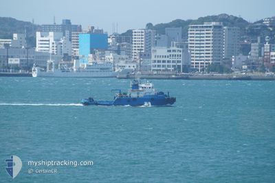
HIROKAI
Tug
Current Trip
| Time Travelled | 1 day |
|---|---|
| Remaining Time | --- |
| Distance Travelled | 315.68 nm |
| Remaining Distance | --- |
| AVG Speed | 7.7 Knots |
| MAX Speed | 8.8 Knots |
| AVG Wind | 8.9 knots |
| MAX Wind | 14.9 knots |
| MIN Temp | 14.5°C / 58.1°F |
| MAX Temp | 20.5°C / 68.9°F |
| Draught | 0 m |
| Position Received | 5 m ago |
Current Position
| Longitude | 141.66143° |
|---|---|
| Latitude | 41.01947° |
| Status | Under way using engine |
| Speed | 7.8 Knots |
| Course | 342.5° |
| Area | North Pacific Ocean |
| Station | T-AIS |
| Position Received | 5 m ago |
Info
Information
The current position of HIROKAI is in North Pacific Ocean with coordinates 41.01947° / 141.66143° as reported on 2024-06-10 01:57 by AIS to our vessel tracker app. The vessel's current speed is 7.8 Knots
The vessel HIROKAI (IMO: 8514681, MMSI: 431401642) is a Tug It's sailing under the flag of [JP] Japan.
In this page you can find informations about the vessels current position, last detected port calls, and current voyage information. If the vessels is not in coverage by AIS you will find the latest position.
The current position of HIROKAI is detected by our AIS receivers and we are not responsible for the reliability of the data. The last position was recorded while the vessel was in Coverage by the Ais receivers of our vessel tracking app.
Weather
| Temperature | 15.4°C / 59.72°F |
|---|---|
| Wind Speed | 4 knots |
| Direction | 193° SSW |
| Pressure | 1008.9 hPa |
| Humidity | 98.1 % |
| Cloud Coverage | 100 % |
Featured Company
Last Port Calls
| Port | Arrival | Departure | Time In Port |
|---|---|---|---|
| 2024-06-07 05:13 | 2024-06-08 08:33 | 1 d | |
| 2024-06-01 07:18 | 2024-06-04 03:12 | 2 d | |
| 2024-05-27 18:35 | 2024-05-28 23:06 | 1 d | |
| 2024-05-25 21:41 | 2024-05-26 04:16 | 6 h | |
| 2024-05-18 19:44 | 2024-05-18 20:04 | 20 m | |
| 2024-05-15 09:40 | 2024-05-15 09:52 | 12 m | |
| 2024-05-15 05:24 | 2024-05-15 06:20 | 55 m | |
| 2024-05-15 03:40 | 2024-05-15 04:32 | 52 m | |
| 2024-05-14 21:56 | 2024-05-15 01:44 | 3 h | |
| 2024-05-09 05:56 | 2024-05-09 06:08 | 11 m |
Last Trips
| Origin | Departure | Destination | Arrival | Distance | |
|---|---|---|---|---|---|
| 2024-06-04 12:12 | 2024-06-07 14:13 | 582.77 nm | |||
| 2024-05-29 08:06 | 2024-06-01 16:18 | 599.12 nm | |||
| 2024-05-26 13:16 | 2024-05-28 03:35 | 294.94 nm | |||
| 2024-05-19 05:04 | 2024-05-26 06:41 | 26.58 nm | |||
| 2024-05-15 18:52 | 2024-05-19 04:44 | 3.57 nm | |||
| 2024-05-15 15:20 | 2024-05-15 18:40 | 22.93 nm | |||
| 2024-05-15 13:32 | 2024-05-15 14:24 | 8.19 nm | |||
| 2024-05-15 10:44 | 2024-05-15 12:40 | 9.20 nm | |||
| 2024-05-09 15:08 | 2024-05-15 06:56 | 10.95 nm | |||
| 2024-05-09 08:44 | 2024-05-09 14:56 | 18.34 nm |
Events
| Time | Event | Details | Position / Dest | Info |
|---|---|---|---|---|
| 2024-06-10 01:47 | Destination Changed | JP ISW JP KSM |
40.99795 / 141.67122
JP ISW
|
Speed: 7.9 kn Course: 339.5° |
| 2024-06-10 01:47 | ETA Changed | 2024/06/12 06:00 2024/06/07 17:00 |
40.99795 / 141.67122
JP ISW
|
Speed: 7.9 kn Course: 339.5° |
| 2024-06-10 01:35 | Status Changed | Under way using engine Default |
40.97262 / 141.68375
JP KSM
|
Speed: 8.2 kn Course: 339° |
| 2024-06-10 01:33 | Status Changed | Default Under way using engine |
40.96982 / 141.68518
JP KSM
|
Speed: 8.2 kn Course: 338.4° |
| 2024-06-10 01:33 | Status Changed | Under way using engine Default |
40.96875 / 141.68573
JP KSM
|
Speed: 8.2 kn Course: 339° |
| 2024-06-10 01:25 | Status Changed | Default Under way using engine |
40.95282 / 141.69405
JP KSM
|
Speed: 8.1 kn Course: 337.1° |
| 2024-06-10 01:19 | Status Changed | Under way using engine Default |
40.93907 / 141.70145
JP KSM
|
Speed: 8.2 kn Course: 338° |
| 2024-06-10 00:45 | Status Changed | Default Under way using engine |
40.86704 / 141.73999
JP KSM
|
Speed: 8 kn Course: 338.9° |
| 2024-06-10 00:40 | Status Changed | Under way using engine Default |
40.85513 / 141.74635
JP KSM
|
Speed: 8 kn Course: 338° |
| 2024-06-10 00:25 | IN Coverage |
40.85513 / 141.74635
North Pacific Ocean
|
Speed: 8 kn Course: 338.9° |