
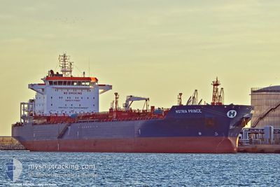
HISTRIA PRINCE
Oil/Chemical Tanker
Current Trip
| Trip Time | 6 days |
|---|---|
| Trip Distance | 1654.70 nm |
| AVG Speed | 10.7 Knots |
| MAX Speed | 14.1 Knots |
| Draught | 7 m |
| AVG Wind | 7.2 knots |
| MAX Wind | 28 knots |
| MIN Temp | 15.8°C / 60.44°F |
| MAX Temp | 27°C / 80.6°F |
| Position Received | 14 h, 53 m ago |
Current Position
| Longitude | 29.04491° |
|---|---|
| Latitude | 41.49995° |
| Status | Under way using engine |
| Speed | 8.5 Knots |
| Course | 338.7° |
| Area | Black Sea |
| Station | T-AIS |
| Position Received | 14 h, 53 m ago |
Info
Information
The current position of HISTRIA PRINCE is in Black Sea with coordinates 41.49995° / 29.04491° as reported on 2024-06-07 02:41 by AIS to our vessel tracker app. The vessel's current speed is 8.5 Knots and is currently inside the port of BURGAS.
The vessel HISTRIA PRINCE (IMO: 9436666, MMSI: 538003431) is a Oil/Chemical Tanker that was built in 2008 ( 16 years old ). It's sailing under the flag of [MH] Marshall Is.
In this page you can find informations about the vessels current position, last detected port calls, and current voyage information. If the vessels is not in coverage by AIS you will find the latest position.
The current position of HISTRIA PRINCE is detected by our AIS receivers and we are not responsible for the reliability of the data. The last position was recorded while the vessel was in Coverage by the Ais receivers of our vessel tracking app.
The current draught of HISTRIA PRINCE as reported by AIS is 7 meters
Weather
| Temperature | 21.9°C / 71.42°F |
|---|---|
| Wind Speed | 8 knots |
| Direction | 103° ESE |
| Pressure | 1015.9 hPa |
| Humidity | 75.3 % |
| Cloud Coverage | --- |
Featured Company
Last Port Calls
| Port | Arrival | Departure | Time In Port |
|---|---|---|---|
| 2024-06-07 11:21 | |||
| 2024-05-28 21:52 | 2024-06-01 00:50 | 3 d | |
| 2024-05-19 13:16 | 2024-05-21 07:55 | 1 d | |
| 2024-05-16 01:00 | 2024-05-18 19:36 | 2 d | |
| 2024-05-14 12:36 | 2024-05-15 22:10 | 1 d | |
| 2024-05-05 11:56 | 2024-05-08 04:24 | 2 d | |
| 2024-04-24 07:27 | 2024-04-29 10:41 | 5 d | |
| 2024-04-13 05:16 | 2024-04-15 10:13 | 2 d | |
| 2024-04-02 08:48 |
Most Visited Ports (Last year)
| Port | Arrivals | |
|---|---|---|
| 4 | ||
| 4 | ||
| 3 | ||
| 2 | ||
| 2 | ||
| 2 |
Last Trips
| Origin | Departure | Destination | Arrival | Distance | |
|---|---|---|---|---|---|
| 2024-06-01 02:50 | 2024-06-07 14:21 | 1654.70 nm | |||
| 2024-05-21 10:55 | 2024-05-28 23:52 | 1626.37 nm | |||
| 2024-05-18 22:36 | 2024-05-19 16:16 | 157.47 nm | |||
| 2024-05-16 01:10 | 2024-05-16 04:00 | 20.85 nm | |||
| 2024-05-08 06:24 | 2024-05-14 15:36 | 1051.31 nm | |||
| 2024-04-29 12:41 | 2024-05-05 13:56 | 854.80 nm | |||
| 2024-04-15 11:13 | 2024-04-24 09:27 | 1267.95 nm | |||
| 2024-04-02 10:48 | 2024-04-13 06:16 | 1810.42 nm |
Events
| Time | Event | Details | Position / Dest | Info |
|---|---|---|---|---|
| 2024-06-07 11:54 | STOP Moving |
42.45306 / 27.53464
[BG] BURGAS
|
Speed: Course: 140° |
|
| 2024-06-07 11:21 | PORT ARRIVAL |
|
42.46411 / 27.52784
[BG] BURGAS
|
Speed: 7.4 kn Course: 213° |
| 2024-06-07 02:49 | Status Changed | Default Under way using engine |
41.52016 / 29.03540
BGBOJ
|
Speed: 8.5 kn Course: 338.7° |
| 2024-06-07 02:41 | OUT of Coverage |
41.49995 / 29.04491
Black Sea
BGBOJ
|
Speed: 8.5 kn Course: 338.7° |
|
| 2024-06-07 01:43 | Status Changed | Under way using engine Default |
41.49988 / 29.05386
BGBOJ
|
Speed: 0.9 kn Course: 344° |
| 2024-06-07 01:33 | IN Coverage |
41.49988 / 29.05386
Black Sea
BGBOJ
|
Speed: 1 kn Course: 185.8° |
|
| 2024-06-06 22:39 | OUT of Coverage |
41.47990 / 29.09406
Black Sea
BGBOJ
|
Speed: 11.9 kn Course: 323.1° |
|
| 2024-06-06 21:13 | Change Sea Area | Turkish part of the Black Sea Turkish part of the Sea of Marmara |
41.23342 / 29.14600
Black Sea
BGBOJ
|
Speed: 12.1 kn Course: 37.7° |
| 2024-06-06 17:03 | ETA Changed | 2024/06/07 11:00 2024/06/06 19:00 |
40.71052 / 28.75318
BGBOJ
|
Speed: 1.3 kn Course: 148° |
| 2024-06-05 23:02 | IN Coverage |
40.53509 / 27.06861
Sea of Marmara
BGBOJ
|
Speed: 11.8 kn Course: 62.2° |