
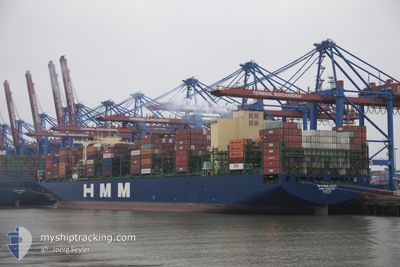
HMM HANBADA
Cargo
Current Trip
| Time Travelled | 1 day |
|---|---|
| Remaining Time | 25 days |
| Distance Travelled | 535.41 nm |
| Remaining Distance | 11331.33 nm |
| AVG Speed | 14.9 Knots |
| MAX Speed | 19.7 Knots |
| AVG Wind | 15.4 knots |
| MAX Wind | 28 knots |
| MIN Temp | 10.3°C / 50.54°F |
| MAX Temp | 14.8°C / 58.64°F |
| Draught | 14.5 m |
| Position Received | 5 h, 58 m ago |
Current Position
| Longitude | -5.26131° |
|---|---|
| Latitude | 49.29985° |
| Status | Under way using engine |
| Speed | 16.9 Knots |
| Course | 240.7° |
| Area | Celtic Sea |
| Station | T-AIS |
| Position Received | 5 h, 58 m ago |
Info
Information
The current position of HMM HANBADA is in Celtic Sea with coordinates 49.29985° / -5.26131° as reported on 2024-06-01 12:42 by AIS to our vessel tracker app. The vessel's current speed is 16.9 Knots and is heading at the port of SINGAPORE. The estimated time of arrival as calculated by vessel tracking app is 2024-06-27 18:23 LT
The vessel HMM HANBADA (IMO: 9869203, MMSI: 636020707) is a Cargo It's sailing under the flag of [LR] Liberia.
In this page you can find informations about the vessels current position, last detected port calls, and current voyage information. If the vessels is not in coverage by AIS you will find the latest position.
The current position of HMM HANBADA is detected by our AIS receivers and we are not responsible for the reliability of the data. The last position was recorded while the vessel was in Coverage by the Ais receivers of our vessel tracking app.
The current draught of HMM HANBADA as reported by AIS is 14.5 meters
Weather
| Temperature | 14.7°C / 58.46°F |
|---|---|
| Wind Speed | 12 knots |
| Direction | 40° NE |
| Pressure | 1028.4 hPa |
| Humidity | 81.5 % |
| Cloud Coverage | 9 % |
Featured Company
Last Port Calls
| Port | Arrival | Departure | Time In Port |
|---|---|---|---|
| 2024-05-28 01:00 | 2024-05-31 10:25 | 3 d | |
| 2024-05-24 13:49 | 2024-05-25 12:54 | 23 h | |
| 2024-05-21 19:48 | 2024-05-23 03:45 | 1 d | |
| 2024-05-18 20:13 | 2024-05-21 05:17 | 2 d | |
| 2024-04-14 02:35 | 2024-04-15 06:23 | 1 d | |
| 2024-04-07 14:56 | 2024-04-08 14:29 | 23 h | |
| 2024-04-06 13:49 | 2024-04-07 03:23 | 13 h |
Most Visited Ports (Last year)
| Port | Arrivals | |
|---|---|---|
| 7 | ||
| 5 | ||
| 4 | ||
| 4 | ||
| 3 | ||
| 3 |
Last Trips
| Origin | Departure | Destination | Arrival | Distance | |
|---|---|---|---|---|---|
| 2024-05-25 14:54 | 2024-05-28 03:00 | 267.11 nm | |||
| 2024-05-23 05:45 | 2024-05-24 15:49 | 448.74 nm | |||
| 2024-05-21 06:17 | 2024-05-21 21:48 | 113.79 nm | |||
| 2024-04-15 14:23 | 2024-05-18 21:13 | 12012.75 nm | |||
| 2024-04-08 22:29 | 2024-04-14 10:35 | 1482.57 nm | |||
| 2024-04-07 11:23 | 2024-04-07 22:56 | 130.66 nm | |||
| 2024-03-28 08:38 | 2024-04-06 21:49 | 1588.01 nm |
Events
| Time | Event | Details | Position / Dest | Info |
|---|---|---|---|---|
| 2024-06-01 12:48 | Status Changed | Default Under way using engine |
49.28589 / -5.29960
SGSIN PWBGA
|
Speed: 16.9 kn Course: 240.7° |
| 2024-06-01 12:42 | OUT of Coverage |
49.29985 / -5.26131
Celtic Sea
SGSIN PWBGA
|
Speed: 16.9 kn Course: 240.7° |
|
| 2024-06-01 12:23 | Change Sea Area | United Kingdom part of the Celtic Sea United Kingdom part of the English Channel |
49.34819 / -5.14628
Celtic Sea
SGSIN PWBGA
|
Speed: 16.9 kn Course: 226.8° |
| 2024-06-01 11:29 | Status Changed | Under way using engine Default |
49.50277 / -4.84704
SGSIN PWBGA
|
Speed: 16.6 kn Course: 246° |
| 2024-06-01 11:28 | Status Changed | Default Under way using engine |
49.50547 / -4.83787
SGSIN PWBGA
|
Speed: 16.7 kn Course: 247.3° |
| 2024-06-01 11:13 | Status Changed | Under way using engine Default |
49.53664 / -4.73990
SGSIN PWBGA
|
Speed: 16.8 kn Course: 237° |
| 2024-06-01 11:08 | Status Changed | Default Under way using engine |
49.54868 / -4.71178
SGSIN PWBGA
|
Speed: 16.7 kn Course: 236.7° |
| 2024-06-01 07:05 | Status Changed | Under way using engine Default |
50.30070 / -3.42318
SGSIN PWBGA
|
Speed: 17.8 kn Course: 176° |
| 2024-06-01 06:56 | Status Changed | Default Under way using engine |
50.34342 / -3.42798
SGSIN PWBGA
|
Speed: 14.6 kn Course: 175.5° |
| 2024-06-01 06:50 | Status Changed | Under way using engine Default |
50.36856 / -3.43101
SGSIN PWBGA
|
Speed: 12.2 kn Course: 176° |