
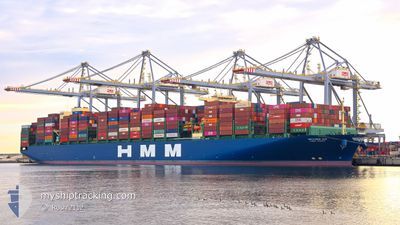
HMM HANUL
Cargo
Current Trip
AE DXB>OM SOH
| Time Travelled | 12 days |
|---|---|
| Remaining Time | --- |
| Distance Travelled | 3225.74 nm |
| Remaining Distance | --- |
| AVG Speed | 11.4 Knots |
| MAX Speed | 17.8 Knots |
| AVG Wind | 13.6 knots |
| MAX Wind | 22.6 knots |
| MIN Temp | 27.7°C / 81.86°F |
| MAX Temp | 35.4°C / 95.72°F |
| Draught | 14.1 m |
| Position Received | 7 d ago |
Current Position
| Longitude | 77.09605° |
|---|---|
| Latitude | 6.75065° |
| Status | Under way using engine |
| Speed | 11.7 Knots |
| Course | 116.9° |
| Area | Laccadive Sea |
| Station | T-AIS |
| Position Received | 7 d ago |
Info
Information
The current position of HMM HANUL is in Laccadive Sea with coordinates 6.75065° / 77.09605° as reported on 2024-06-02 10:15 by AIS to our vessel tracker app. The vessel's current speed is 11.7 Knots
The vessel HMM HANUL (IMO: 9869239, MMSI: 636020744) is a Cargo It's sailing under the flag of [LR] Liberia.
In this page you can find informations about the vessels current position, last detected port calls, and current voyage information. If the vessels is not in coverage by AIS you will find the latest position.
The current position of HMM HANUL is detected by our AIS receivers and we are not responsible for the reliability of the data. The last position was recorded while the vessel was in Coverage by the Ais receivers of our vessel tracking app.
The current draught of HMM HANUL as reported by AIS is 14.1 meters
Weather
| Temperature | 29°C / 84.2°F |
|---|---|
| Wind Speed | 7 knots |
| Direction | 343° NNW |
| Pressure | 1009.4 hPa |
| Humidity | 75.3 % |
| Cloud Coverage | 100 % |
Featured Company
Last Port Calls
| Port | Arrival | Departure | Time In Port |
|---|---|---|---|
| 2024-05-27 03:57 | 2024-05-28 07:22 | 1 d | |
| 2024-05-24 07:44 | 2024-05-26 11:23 | 2 d | |
| 2024-05-21 13:20 | 2024-05-22 16:47 | 1 d | |
| 2024-05-17 18:33 | 2024-05-18 20:49 | 1 d | |
| 2024-05-13 04:58 | 2024-05-16 08:38 | 3 d | |
| 2024-05-07 22:42 | 2024-05-10 02:24 | 2 d | |
| 2024-04-25 14:40 | 2024-04-26 18:51 | 1 d | |
| 2024-04-19 17:12 | |||
| 2024-04-17 11:15 | 2024-04-18 00:25 | 13 h | |
| 2024-04-06 15:29 | 2024-04-07 14:08 | 22 h |
Last Trips
| Origin | Departure | Destination | Arrival | Distance | |
|---|---|---|---|---|---|
| 2024-05-26 15:23 | 2024-05-27 07:57 | 260.55 nm | |||
| 2024-05-22 20:47 | 2024-05-24 11:44 | 47.57 nm | |||
| 2024-05-18 23:49 | 2024-05-21 17:20 | 457.92 nm | |||
| 2024-05-16 11:38 | 2024-05-17 21:33 | 152.93 nm | |||
| 2024-05-10 06:24 | 2024-05-13 07:58 | 399.75 nm | |||
| 2024-04-27 02:51 | 2024-05-08 02:42 | 3594.98 nm | |||
| 2024-04-20 01:12 | 2024-04-25 22:40 | 1498.47 nm | |||
| 2024-04-07 23:08 | 2024-04-17 19:15 | 1223.59 nm | |||
| 2024-04-04 18:01 | 2024-04-07 00:29 | 524.58 nm | |||
| 2024-03-28 15:11 | 2024-04-03 06:21 | 1248.64 nm |
Events
| Time | Event | Details | Position / Dest | Info |
|---|---|---|---|---|
| 2024-06-05 15:26 | STOP Moving |
5.89833 / 90.52167
AE DXB>OM SOH
|
Speed: Course: -1° |
|
| 2024-06-02 10:20 | Status Changed | Default Under way using engine |
6.74333 / 77.10833
AE DXB>OM SOH
|
Speed: 11.7 kn Course: 116.9° |
| 2024-06-02 10:15 | Status Changed | Under way using engine Default |
6.75065 / 77.09605
AE DXB>OM SOH
|
Speed: 11 kn Course: 116° |
| 2024-06-02 10:15 | IN Coverage |
6.75065 / 77.09605
Laccadive Sea
|
Speed: 11.7 kn Course: 116.9° |
|
| 2024-06-02 10:15 | OUT of Coverage |
6.75065 / 77.09605
Laccadive Sea
|
Speed: 11.7 kn Course: 116.9° |
|
| 2024-06-02 08:56 | Status Changed | Default Under way using engine |
6.87167 / 76.86667
AE DXB>OM SOH
|
Speed: 11.5 kn Course: 117.9° |
| 2024-06-02 08:52 | Status Changed | Under way using engine Default |
6.87844 / 76.85531
AE DXB>OM SOH
|
Speed: 11.3 kn Course: 118° |
| 2024-06-02 08:52 | OUT of Coverage |
6.87844 / 76.85531
Laccadive Sea
|
Speed: 11.5 kn Course: 117.9° |
|
| 2024-06-02 08:08 | Status Changed | Default Under way using engine |
6.94614 / 76.72894
AE DXB>OM SOH
|
Speed: 11.6 kn Course: 114.5° |
| 2024-06-02 08:02 | Change Sea Area | Indian part of the Laccadive Sea Omani part of the Gulf of Oman |
6.95282 / 76.71474
Laccadive Sea
|
Speed: 11.5 kn Course: 115.1° |