
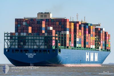
HMM MIR
Cargo
Current Trip
| Time Travelled | 8 h, 37 mins |
|---|---|
| Remaining Time | 9 h, 49 mins |
| Distance Travelled | 113.14 nm |
| Remaining Distance | 137.28 nm |
| AVG Speed | 13.4 Knots |
| MAX Speed | 13.9 Knots |
| AVG Wind | 8.7 knots |
| MAX Wind | 20.4 knots |
| MIN Temp | 21°C / 69.8°F |
| MAX Temp | 21.5°C / 70.7°F |
| Draught | 12.4 m |
| Position Received | Now |
Current Position
| Longitude | 7.58577° |
|---|---|
| Latitude | 43.13756° |
| Status | Under way using engine |
| Speed | 13.6 Knots |
| Course | 242.5° |
| Area | Mediterranean Sea - Western Basin |
| Station | T-AIS |
| Position Received | Now |
Info
Information
The current position of HMM MIR is in Mediterranean Sea - Western Basin with coordinates 43.13756° / 7.58577° as reported on 2024-06-18 11:56 by AIS to our vessel tracker app. The vessel's current speed is 13.6 Knots and is heading at the port of FOS. The estimated time of arrival as calculated by vessel tracking app is 2024-06-18 21:45 LT
The vessel HMM MIR (IMO: 9869198, MMSI: 636020615) is a Cargo It's sailing under the flag of [LR] Liberia.
In this page you can find informations about the vessels current position, last detected port calls, and current voyage information. If the vessels is not in coverage by AIS you will find the latest position.
The current position of HMM MIR is detected by our AIS receivers and we are not responsible for the reliability of the data. The last position was recorded while the vessel was in Coverage by the Ais receivers of our vessel tracking app.
The current draught of HMM MIR as reported by AIS is 12.4 meters
Weather
| Temperature | 21.6°C / 70.88°F |
|---|---|
| Wind Speed | 20 knots |
| Direction | 63° ENE |
| Pressure | 1016.2 hPa |
| Humidity | 78.8 % |
| Cloud Coverage | 16 % |
Featured Company
Last Port Calls
| Port | Arrival | Departure | Time In Port |
|---|---|---|---|
| 2024-06-15 07:16 | 2024-06-18 03:19 | 2 d | |
| 2024-06-12 03:22 | 2024-06-14 07:29 | 2 d | |
| 2024-06-07 05:20 | 2024-06-09 03:44 | 1 d | |
| 2024-05-05 11:24 | 2024-05-06 18:23 | 1 d | |
| 2024-04-28 00:43 | 2024-04-29 04:08 | 1 d | |
| 2024-04-25 02:10 | 2024-04-25 20:48 | 18 h | |
| 2024-04-15 18:18 | 2024-04-16 16:42 | 22 h | |
| 2024-04-11 16:48 | 2024-04-12 07:05 | 14 h | |
| 2024-04-06 11:36 | 2024-04-07 20:55 | 1 d |
Last Trips
| Origin | Departure | Destination | Arrival | Distance | |
|---|---|---|---|---|---|
| 2024-06-14 09:29 | 2024-06-15 09:16 | 89.87 nm | |||
| 2024-06-09 06:44 | 2024-06-12 05:22 | 1025.94 nm | |||
| 2024-05-07 02:23 | 2024-06-07 08:20 | 12352.67 nm | |||
| 2024-04-29 12:08 | 2024-05-05 19:24 | 1550.80 nm | |||
| 2024-04-26 04:48 | 2024-04-28 08:43 | 431.60 nm | |||
| 2024-04-17 01:42 | 2024-04-25 10:10 | 1311.85 nm | |||
| 2024-04-12 15:05 | 2024-04-16 03:18 | 1187.87 nm | |||
| 2024-04-08 04:55 | 2024-04-12 00:48 | 1474.04 nm | |||
| 2024-02-24 09:37 | 2024-04-06 19:36 | 9489.50 nm |
Events
| Time | Event | Details | Position / Dest | Info |
|---|---|---|---|---|
| 2024-06-18 11:44 | Detected in Sea | French part of the Mediterranean Sea - Western Basin |
43.15830 / 7.64079
Mediterranean Sea - Western Basin
FRFOS
|
Speed: 13.7 kn Course: 242.7° |
| 2024-06-18 11:37 | Change Sea Area | Mon�gasque part of the Mediterranean Sea - Western Basin French part of the Mediterranean Sea - Western Basin |
43.17067 / 7.67326
Mediterranean Sea - Western Basin
FRFOS
|
Speed: 13.9 kn Course: 242.6° |
| 2024-06-18 11:14 | Change Sea Area | French part of the Mediterranean Sea - Western Basin Italian part of the Mediterranean Sea - Western Basin |
43.21231 / 7.78107
Mediterranean Sea - Western Basin
FRFOS
|
Speed: 13.8 kn Course: 242.4° |
| 2024-06-18 09:11 | Detected in Sea | Italian part of the Mediterranean Sea - Western Basin |
43.43901 / 8.34488
Mediterranean Sea - Western Basin
FRFOS
|
Speed: 13.7 kn Course: 239.2° |
| 2024-06-18 03:53 | Change Sea Area | Italian part of the Ligurian Sea Italian part of the Tyrrhenian Sea |
43.97910 / 9.82158
Ligurian Sea
FRFOS
|
Speed: 13.6 kn Course: 247.4° |
| 2024-06-18 03:19 | PORT DEPARTURE |
|
44.07355 / 9.85122
FRFOS
|
Speed: 8.5 kn Course: 163° |
| 2024-06-18 03:01 | START Moving |
44.10388 / 9.84665
[IT] LA SPEZIA
|
Speed: 3.1 kn Course: 198° |
|
| 2024-06-18 02:45 | Status Changed | Under way using engine Moored |
44.10578 / 9.84686
[IT] LA SPEZIA
|
Speed: Course: 199° |
| 2024-06-18 01:36 | Draught Changed | 12.4 12.5 |
44.10575 / 9.84682
[IT] LA SPEZIA
|
Speed: Course: 198° |
| 2024-06-18 01:36 | Destination Changed | FRFOS ITSPE |
44.10575 / 9.84682
[IT] LA SPEZIA
|
Speed: Course: 198° |