
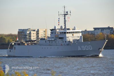
NATO WARSHIP A900
Military ops
Current Trip
Unknown
| Time Travelled | 9 days |
|---|---|
| Remaining Time | --- |
| Distance Travelled | 695.07 nm |
| Remaining Distance | --- |
| AVG Speed | 6.4 Knots |
| MAX Speed | 13.5 Knots |
| AVG Wind | 12.4 knots |
| MAX Wind | 29 knots |
| MIN Temp | 8.4°C / 47.12°F |
| MAX Temp | 17°C / 62.6°F |
| Draught | 6.5 m |
| Position Received | 1 m ago |
Current Position
| Longitude | 18.19407° |
|---|---|
| Latitude | 58.94898° |
| Status | At anchor |
| Speed | |
| Course | 119° |
| Area | Baltic Sea |
| Station | T-AIS |
| Position Received | 1 m ago |
Info
Information
The current position of NATO WARSHIP A900 is in Baltic Sea with coordinates 58.94898° / 18.19407° as reported on 2024-06-16 21:07 by AIS to our vessel tracker app. The vessel's current speed is 0 Knots
The vessel NATO WARSHIP A900 (MMSI: 245974000) is a Military ops It's sailing under the flag of [NL] Netherlands.
In this page you can find informations about the vessels current position, last detected port calls, and current voyage information. If the vessels is not in coverage by AIS you will find the latest position.
The current position of NATO WARSHIP A900 is detected by our AIS receivers and we are not responsible for the reliability of the data. The last position was recorded while the vessel was in Coverage by the Ais receivers of our vessel tracking app.
The current draught of NATO WARSHIP A900 as reported by AIS is 6.5 meters
Weather
| Temperature | 13.8°C / 56.84°F |
|---|---|
| Wind Speed | 5 knots |
| Direction | 178° S |
| Pressure | 1013.4 hPa |
| Humidity | 80.8 % |
| Cloud Coverage | 100 % |
Featured Company
Last Port Calls
| Port | Arrival | Departure | Time In Port |
|---|---|---|---|
| 2024-06-02 15:26 | 2024-06-07 07:06 | 4 d | |
| 2024-04-26 07:44 | 2024-05-16 14:27 | 20 d | |
| 2024-04-15 17:03 | 2024-04-15 18:01 | 58 m | |
| 2024-04-11 06:15 | 2024-04-15 10:34 | 4 d | |
| 2024-04-04 14:21 | 2024-04-08 08:18 | 3 d | |
| 2024-04-04 09:25 |
Last Trips
| Origin | Departure | Destination | Arrival | Distance | |
|---|---|---|---|---|---|
| 2024-04-15 20:01 | 2024-04-26 09:44 | 1541.52 nm | |||
| 2024-04-15 12:34 | 2024-04-15 19:03 | 55.94 nm | |||
| 2024-04-08 10:18 | 2024-04-11 08:15 | 621.08 nm | |||
| 2024-04-04 11:25 | 2024-04-04 16:21 | 30.87 nm |
Events
| Time | Event | Details | Position / Dest | Info |
|---|---|---|---|---|
| 2024-06-16 16:39 | Status Changed | At anchor Under way using engine |
58.94905 / 18.19425
|
Speed: 0.5 kn Course: 162° |
| 2024-06-16 16:35 | STOP Moving | 4.24 nm, West of UTO |
58.94873 / 18.19445
|
Speed: 0.1 kn Course: 164° |
| 2024-06-16 12:39 | Status Changed | Under way using engine Restricted manoeuverability |
58.95576 / 18.15743
|
Speed: 3.5 kn Course: 58° |
| 2024-06-16 09:13 | Status Changed | Restricted manoeuverability Under way using engine |
58.97549 / 18.21426
|
Speed: 4.3 kn Course: 185° |
| 2024-06-16 08:15 | START Moving | 1.36 nm, West of UTO |
58.97386 / 18.28104
|
Speed: 3.3 kn Course: 277° |
| 2024-06-16 06:53 | STOP Moving | 1.27 nm, West of UTO |
58.97650 / 18.28493
|
Speed: 0.2 kn Course: 263° |
| 2024-06-15 18:26 | START Moving | 1.02 nm, North West of SKANSEN |
59.06681 / 17.67853
|
Speed: 8.2 kn Course: 158.2° |
| 2024-06-15 17:17 | STOP Moving | 1.57 nm, North West of SKANSEN |
59.07560 / 17.67319
|
Speed: 0.3 kn Course: 165° |
| 2024-06-15 16:52 | START Moving | 0.69 nm, South East of SKANSEN |
59.04258 / 17.70681
|
Speed: 5.5 kn Course: 314.4° |
| 2024-06-15 16:40 | STOP Moving | 0.87 nm, South East of SKANSEN |
59.04092 / 17.71195
|
Speed: 0.3 kn Course: 87° |