
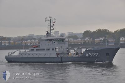
HNLMS SNELLIUS
Naval Research Vessel
Current Trip
SURVEY AREA
| Time Travelled | 5 days |
|---|---|
| Remaining Time | --- |
| Distance Travelled | 1112.85 nm |
| Remaining Distance | --- |
| AVG Speed | 8.7 Knots |
| MAX Speed | 14.1 Knots |
| AVG Wind | 19.2 knots |
| MAX Wind | 30.9 knots |
| MIN Temp | 9.3°C / 48.74°F |
| MAX Temp | 14.8°C / 58.64°F |
| Draught | 4.2 m |
| Position Received | 1 h, 37 m ago |
Current Position
| Longitude | 4.16337° |
|---|---|
| Latitude | 53.06265° |
| Status | Restricted manoeuverability |
| Speed | 6.4 Knots |
| Course | 231.7° |
| Area | North Sea |
| Station | T-AIS |
| Position Received | 1 h, 37 m ago |
Info
Information
The current position of HNLMS SNELLIUS is in North Sea with coordinates 53.06265° / 4.16337° as reported on 2024-06-16 08:07 by AIS to our vessel tracker app. The vessel's current speed is 6.4 Knots
The vessel HNLMS SNELLIUS (IMO: 9271858, MMSI: 245690000) is a Naval Research Vessel that was built in 2003 ( 21 years old ). It's sailing under the flag of [NL] Netherlands.
In this page you can find informations about the vessels current position, last detected port calls, and current voyage information. If the vessels is not in coverage by AIS you will find the latest position.
The current position of HNLMS SNELLIUS is detected by our AIS receivers and we are not responsible for the reliability of the data. The last position was recorded while the vessel was in Coverage by the Ais receivers of our vessel tracking app.
The current draught of HNLMS SNELLIUS as reported by AIS is 4.2 meters
Weather
| Temperature | 13.6°C / 56.48°F |
|---|---|
| Wind Speed | 22 knots |
| Direction | 204° SSW |
| Pressure | 1002.1 hPa |
| Humidity | 86.6 % |
| Cloud Coverage | 96 % |
Featured Company
Last Port Calls
| Port | Arrival | Departure | Time In Port |
|---|---|---|---|
| 2024-05-27 07:12 | 2024-06-10 13:14 | 14 d | |
| 2024-05-17 07:46 | 2024-05-21 08:16 | 4 d | |
| 2024-04-26 07:07 | 2024-05-13 11:28 | 17 d | |
| 2024-04-23 18:25 | 2024-04-23 18:49 | 24 m | |
| 2024-04-19 14:19 | 2024-04-19 14:36 | 16 m | |
| 2024-04-17 08:18 |
Most Visited Ports (Last year)
| Port | Arrivals | |
|---|---|---|
| 32 | ||
| 1 | ||
| 1 | ||
| 1 | ||
| 1 | ||
| 1 |
Last Trips
| Origin | Departure | Destination | Arrival | Distance | |
|---|---|---|---|---|---|
| 2024-05-21 10:16 | 2024-05-27 09:12 | 1039.11 nm | |||
| 2024-05-13 13:28 | 2024-05-17 09:46 | 858.67 nm | |||
| 2024-04-23 20:49 | 2024-04-26 09:07 | 441.26 nm | |||
| 2024-04-19 16:36 | 2024-04-23 20:25 | 715.33 nm | |||
| 2024-04-17 10:18 | 2024-04-19 16:19 | 369.84 nm |
Events
| Time | Event | Details | Position / Dest | Info |
|---|---|---|---|---|
| 2024-06-16 08:14 | Status Changed | Default Restricted manoeuverability |
53.05333 / 4.14500
SURVEY AREA
|
Speed: 6.4 kn Course: 231.7° |
| 2024-06-16 08:07 | Status Changed | Restricted manoeuverability Default |
53.06265 / 4.16337
SURVEY AREA
|
Speed: 7.6 kn Course: 228° |
| 2024-06-16 08:07 | OUT of Coverage |
53.06265 / 4.16337
North Sea
|
Speed: 6.4 kn Course: 231.7° |
|
| 2024-06-16 07:54 | Status Changed | Default Restricted manoeuverability |
53.08054 / 4.19933
SURVEY AREA
|
Speed: 7.1 kn Course: 228.7° |
| 2024-06-16 07:22 | Status Changed | Restricted manoeuverability Default |
53.12510 / 4.28821
SURVEY AREA
|
Speed: 6.8 kn Course: 202° |
| 2024-06-16 07:22 | IN Coverage |
53.12357 / 4.28494
North Sea
|
Speed: 8.4 kn Course: 234.1° |
|
| 2024-06-15 10:05 | Status Changed | Default Restricted manoeuverability |
53.12667 / 4.25833
SURVEY AREA
|
Speed: 8.8 kn Course: 229.9° |
| 2024-06-15 09:58 | Status Changed | Restricted manoeuverability Default |
53.11986 / 4.27887
SURVEY AREA
|
Speed: 8.8 kn Course: 230° |
| 2024-06-15 08:04 | Status Changed | Default Restricted manoeuverability |
53.34167 / 4.50500
SURVEY AREA
|
Speed: 9.4 kn Course: 198° |
| 2024-06-15 07:49 | OUT of Coverage |
53.37442 / 4.52381
North Sea
|
Speed: 9.4 kn Course: 198° |