
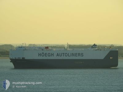
HOEGH MANILA
Ro-Ro/Passenger Ship
Current Trip
| Time Travelled | 5 days |
|---|---|
| Remaining Time | 5 days |
| Distance Travelled | 1933.90 nm |
| Remaining Distance | 2004.66 nm |
| AVG Speed | 15.7 Knots |
| MAX Speed | 17.4 Knots |
| AVG Wind | 12.4 knots |
| MAX Wind | 18.8 knots |
| MIN Temp | 18°C / 64.4°F |
| MAX Temp | 27.2°C / 80.96°F |
| Draught | 7.4 m |
| Position Received | 4 d ago |
Current Position
| Longitude | -64.86768° |
|---|---|
| Latitude | 18.96707° |
| Status | Under way using engine |
| Speed | 15.6 Knots |
| Course | 44.3° |
| Area | North Atlantic Ocean |
| Station | T-AIS |
| Position Received | 4 d ago |
Info
Information
The current position of HOEGH MANILA is in North Atlantic Ocean with coordinates 18.96707° / -64.86768° as reported on 2024-05-11 08:39 by AIS to our vessel tracker app. The vessel's current speed is 15.6 Knots and is heading at the port of ANTWERP. The estimated time of arrival as calculated by vessel tracking app is 2024-05-21 14:17 LT
The vessel HOEGH MANILA (IMO: 9368912, MMSI: 259709000) is a Ro-Ro/Passenger Ship that was built in 2007 ( 17 years old ). It's sailing under the flag of [NO] Norway.
In this page you can find informations about the vessels current position, last detected port calls, and current voyage information. If the vessels is not in coverage by AIS you will find the latest position.
The current position of HOEGH MANILA is detected by our AIS receivers and we are not responsible for the reliability of the data. The last position was recorded while the vessel was in Coverage by the Ais receivers of our vessel tracking app.
The current draught of HOEGH MANILA as reported by AIS is 7.4 meters
Weather
| Temperature | 18.2°C / 64.76°F |
|---|---|
| Wind Speed | 14 knots |
| Direction | 147° SSE |
| Pressure | 1024.5 hPa |
| Humidity | 74.6 % |
| Cloud Coverage | 24 % |
Featured Company
Last Port Calls
| Port | Arrival | Departure | Time In Port |
|---|---|---|---|
| 2024-05-10 13:43 | 2024-05-11 03:31 | 13 h | |
| 2024-05-05 12:42 | 2024-05-06 01:34 | 12 h | |
| 2024-05-01 12:13 | 2024-05-01 19:38 | 7 h | |
| 2024-04-25 18:41 | 2024-04-28 06:25 | 2 d | |
| 2024-04-16 09:15 | 2024-04-17 01:12 | 15 h | |
| 2024-04-15 09:07 | 2024-04-15 19:30 | 10 h | |
| 2024-04-04 18:48 | 2024-04-06 03:13 | 1 d | |
| 2024-03-30 15:36 | 2024-04-01 13:46 | 1 d | |
| 2024-03-28 09:37 | 2024-03-28 22:43 | 13 h | |
| 2024-03-27 02:00 | 2024-03-28 00:06 | 22 h |
Most Visited Ports (Last year)
| Port | Arrivals | |
|---|---|---|
| 9 | ||
| 7 | ||
| 7 | ||
| 7 | ||
| 6 | ||
| 6 |
Last Trips
| Origin | Departure | Destination | Arrival | Distance | |
|---|---|---|---|---|---|
| 2024-05-05 20:34 | 2024-05-10 09:43 | 1280.24 nm | |||
| 2024-05-01 14:38 | 2024-05-05 07:42 | 1285.13 nm | |||
| 2024-04-28 01:25 | 2024-05-01 07:13 | 251.75 nm | |||
| 2024-04-16 21:12 | 2024-04-25 13:41 | 2498.30 nm | |||
| 2024-04-15 15:30 | 2024-04-16 05:15 | 137.06 nm | |||
| 2024-04-06 05:13 | 2024-04-15 05:07 | 3303.35 nm | |||
| 2024-04-01 15:46 | 2024-04-04 20:48 | 941.68 nm | |||
| 2024-03-28 23:43 | 2024-03-30 16:36 | 536.04 nm | |||
| 2024-03-28 01:06 | 2024-03-28 10:37 | 116.08 nm | |||
| 2024-03-26 03:01 | 2024-03-27 03:00 | 339.51 nm |
Events
| Time | Event | Details | Position / Dest | Info |
|---|---|---|---|---|
| 2024-05-11 08:43 | Status Changed | Default Under way using engine |
18.97833 / -64.85333
BEANR
|
Speed: 15.6 kn Course: 44.3° |
| 2024-05-11 08:39 | OUT of Coverage |
18.96707 / -64.86768
North Atlantic Ocean
BEANR
|
Speed: 15.6 kn Course: 44.3° |
|
| 2024-05-11 08:14 | Change Sea Area | British Virgin Islands part of the North Atlantic Ocean British Virgin Islands part of the Caribbean Sea |
18.88627 / -64.94911
North Atlantic Ocean
BEANR
|
Speed: 15.9 kn Course: 43.1° |
| 2024-05-11 07:56 | Change Sea Area | British Virgin Islands part of the Caribbean Sea Puerto Rican part of the Caribbean Sea |
18.82991 / -65.00729
Caribbean Sea
BEANR
|
Speed: 15.6 kn Course: 49° |
| 2024-05-11 05:40 | Change Sea Area | Puerto Rican part of the Caribbean Sea Puerto Rican part of the North Atlantic Ocean |
18.67912 / -65.61963
Caribbean Sea
BEANR
|
Speed: 15.9 kn Course: 78.6° |
| 2024-05-11 04:31 | Status Changed | Under way using engine Default |
18.60467 / -65.92785
BEANR
|
Speed: 15.3 kn Course: 73° |
| 2024-05-11 04:27 | Status Changed | Default Under way using engine |
18.59946 / -65.94586
BEANR
|
Speed: 15.6 kn Course: 72.8° |
| 2024-05-11 04:15 | Draught Changed | 7.4 8.5 |
18.58334 / -66.00040
BEANR
|
Speed: 15.7 kn Course: 72.8° |
| 2024-05-11 04:15 | Destination Changed | BEANR PRSJU |
18.58334 / -66.00040
BEANR
|
Speed: 15.7 kn Course: 72.8° |
| 2024-05-11 04:15 | ETA Changed | 2024/05/22 14:00 2024/05/10 10:00 |
18.58334 / -66.00040
BEANR
|
Speed: 15.7 kn Course: 72.8° |