
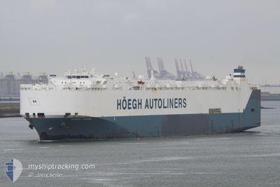
HOEGH TRADER
Vehicles Carrier
Current Trip
| Time Travelled | 15 days |
|---|---|
| Remaining Time | --- |
| Distance Travelled | 5016.50 nm |
| Remaining Distance | --- |
| AVG Speed | 13 Knots |
| MAX Speed | 17.8 Knots |
| AVG Wind | 14.4 knots |
| MAX Wind | 28.8 knots |
| MIN Temp | 3.6°C / 38.48°F |
| MAX Temp | 28.4°C / 83.12°F |
| Draught | 8.9 m |
| Position Received | 1 d ago |
Current Position
| Longitude | -75.31421° |
|---|---|
| Latitude | 24.72921° |
| Status | Under way using engine |
| Speed | 14.5 Knots |
| Course | 146.8° |
| Area | North Atlantic Ocean |
| Station | T-AIS |
| Position Received | 1 d ago |
Info
Information
The current position of HOEGH TRADER is in North Atlantic Ocean with coordinates 24.72921° / -75.31421° as reported on 2024-05-14 10:58 by AIS to our vessel tracker app. The vessel's current speed is 14.5 Knots and is heading at the port of JACKSONVILLE. The estimated time of arrival as calculated by vessel tracking app is 2024-05-10 02:00 LT
The vessel HOEGH TRADER (IMO: 9171280, MMSI: 258882000) is a Vehicles Carrier that was built in 1998 ( 26 years old ). It's sailing under the flag of [NO] Norway.
In this page you can find informations about the vessels current position, last detected port calls, and current voyage information. If the vessels is not in coverage by AIS you will find the latest position.
The current position of HOEGH TRADER is detected by our AIS receivers and we are not responsible for the reliability of the data. The last position was recorded while the vessel was in Coverage by the Ais receivers of our vessel tracking app.
The current draught of HOEGH TRADER as reported by AIS is 8.9 meters
Weather
| Temperature | 28.3°C / 82.94°F |
|---|---|
| Wind Speed | 18 knots |
| Direction | 88° E |
| Pressure | 1012.3 hPa |
| Humidity | 82.6 % |
| Cloud Coverage | 100 % |
Featured Company
Last Port Calls
| Port | Arrival | Departure | Time In Port |
|---|---|---|---|
| 2024-04-29 12:44 | 2024-04-30 06:27 | 17 h | |
| 2024-04-27 00:06 | 2024-04-28 15:21 | 1 d | |
| 2024-04-23 11:59 | 2024-04-25 23:13 | 2 d | |
| 2024-04-03 13:19 | 2024-04-05 01:38 | 1 d | |
| 2024-03-30 13:03 | 2024-03-31 02:15 | 13 h | |
| 2024-03-03 22:27 | 2024-03-05 07:09 | 1 d | |
| 2024-03-01 21:42 | 2024-03-02 15:19 | 17 h |
Last Trips
| Origin | Departure | Destination | Arrival | Distance | |
|---|---|---|---|---|---|
| 2024-04-28 17:21 | 2024-04-29 13:44 | 270.65 nm | |||
| 2024-04-26 01:13 | 2024-04-27 02:06 | 351.18 nm | |||
| 2024-04-04 20:38 | 2024-04-23 13:59 | 6055.02 nm | |||
| 2024-03-30 21:15 | 2024-04-03 08:19 | 1287.12 nm | |||
| 2024-03-05 16:09 | 2024-03-30 08:03 | 9061.39 nm | |||
| 2024-03-03 00:19 | 2024-03-04 07:27 | 284.14 nm | |||
| 2024-02-29 15:18 | 2024-03-02 06:42 | 490.91 nm |
Events
| Time | Event | Details | Position / Dest | Info |
|---|---|---|---|---|
| 2024-05-14 11:00 | Status Changed | Default Under way using engine |
24.71768 / -75.30599
USJAX
|
Speed: 14.5 kn Course: 146.8° |
| 2024-05-14 10:58 | Status Changed | Under way using engine Default |
24.72921 / -75.31421
USJAX
|
Speed: 14.6 kn Course: 147° |
| 2024-05-14 10:58 | OUT of Coverage |
24.72921 / -75.31421
North Atlantic Ocean
|
Speed: 14.5 kn Course: 146.8° |
|
| 2024-05-14 10:41 | IN Coverage |
24.72921 / -75.31421
North Atlantic Ocean
|
Speed: 14.5 kn Course: 146.8° |
|
| 2024-05-14 05:48 | Status Changed | Default Under way using engine |
25.79760 / -76.12386
USJAX
|
Speed: 15 kn Course: 146° |
| 2024-05-14 05:38 | Status Changed | Under way using engine Default |
25.83336 / -76.14980
USJAX
|
Speed: 15 kn Course: 147° |
| 2024-05-14 05:38 | OUT of Coverage |
25.83336 / -76.14980
North Atlantic Ocean
|
Speed: 15 kn Course: 146° |
|
| 2024-05-14 05:23 | IN Coverage |
25.83336 / -76.14980
North Atlantic Ocean
|
Speed: 15 kn Course: 146° |
|
| 2024-05-14 03:42 | Status Changed | Default Under way using engine |
26.22572 / -76.42934
USJAX
|
Speed: 13.6 kn Course: 145.9° |
| 2024-05-14 03:34 | OUT of Coverage |
26.25275 / -76.45012
North Atlantic Ocean
|
Speed: 13.6 kn Course: 145.9° |