
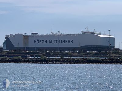
HOEGH TROTTER
Cargo
Current Trip
| Time Travelled | 4 days |
|---|---|
| Remaining Time | 10 days |
| Distance Travelled | 1890.68 nm |
| Remaining Distance | 4414.56 nm |
| AVG Speed | 16.3 Knots |
| MAX Speed | 17.5 Knots |
| AVG Wind | 17.3 knots |
| MAX Wind | 25 knots |
| MIN Temp | 14.5°C / 58.1°F |
| MAX Temp | 21°C / 69.8°F |
| Draught | 10 m |
| Position Received | 1 d ago |
Current Position
| Longitude | -15.23470° |
|---|---|
| Latitude | 27.57159° |
| Status | Under way using engine |
| Speed | 16.7 Knots |
| Course | 200.2° |
| Area | North Atlantic Ocean |
| Station | T-AIS |
| Position Received | 1 d ago |
Info
Information
The current position of HOEGH TROTTER is in North Atlantic Ocean with coordinates 27.57159° / -15.23470° as reported on 2024-06-14 08:18 by AIS to our vessel tracker app. The vessel's current speed is 16.7 Knots and is heading at the port of PORT ELIZABETH. The estimated time of arrival as calculated by vessel tracking app is 2024-06-26 15:45 LT
The vessel HOEGH TROTTER (IMO: 9710749, MMSI: 259274000) is a Cargo It's sailing under the flag of [NO] Norway.
In this page you can find informations about the vessels current position, last detected port calls, and current voyage information. If the vessels is not in coverage by AIS you will find the latest position.
The current position of HOEGH TROTTER is detected by our AIS receivers and we are not responsible for the reliability of the data. The last position was recorded while the vessel was in Coverage by the Ais receivers of our vessel tracking app.
The current draught of HOEGH TROTTER as reported by AIS is 10 meters
Weather
| Temperature | 21°C / 69.8°F |
|---|---|
| Wind Speed | 12 knots |
| Direction | 359° N |
| Pressure | 1012.9 hPa |
| Humidity | 87.3 % |
| Cloud Coverage | 7 % |
Featured Company
Last Port Calls
| Port | Arrival | Departure | Time In Port |
|---|---|---|---|
| 2024-06-10 08:25 | 2024-06-11 03:13 | 18 h | |
| 2024-06-08 06:57 | 2024-06-08 15:57 | 8 h | |
| 2024-06-05 11:32 | 2024-06-06 23:29 | 1 d | |
| 2024-06-02 12:20 | 2024-06-04 12:08 | 1 d | |
| 2024-05-31 06:53 | 2024-05-31 18:26 | 11 h | |
| 2024-05-28 17:57 | 2024-05-29 17:11 | 23 h | |
| 2024-05-26 23:50 | 2024-05-27 14:30 | 14 h | |
| 2024-05-24 23:13 | 2024-05-26 01:51 | 1 d | |
| 2024-05-16 12:25 | 2024-05-17 18:26 | 1 d | |
| 2024-05-14 04:56 | 2024-05-15 03:18 | 22 h |
Last Trips
| Origin | Departure | Destination | Arrival | Distance | |
|---|---|---|---|---|---|
| 2024-06-08 16:57 | 2024-06-10 10:25 | 588.56 nm | |||
| 2024-06-07 01:29 | 2024-06-08 07:57 | 479.86 nm | |||
| 2024-06-04 14:08 | 2024-06-05 13:32 | 342.38 nm | |||
| 2024-05-31 20:26 | 2024-06-02 14:20 | 572.80 nm | |||
| 2024-05-29 19:11 | 2024-05-31 08:53 | 475.41 nm | |||
| 2024-05-27 15:30 | 2024-05-28 19:57 | 285.15 nm | |||
| 2024-05-26 03:51 | 2024-05-27 00:50 | 320.21 nm | |||
| 2024-05-17 20:26 | 2024-05-25 01:13 | 2225.93 nm | |||
| 2024-05-15 05:18 | 2024-05-16 14:25 | 548.51 nm | |||
| 2024-04-04 18:25 | 2024-05-14 06:56 | 14554.66 nm |
Events
| Time | Event | Details | Position / Dest | Info |
|---|---|---|---|---|
| 2024-06-14 08:23 | Status Changed | Default Under way using engine |
27.54878 / -15.24452
ES SDR>ZA PLZ
|
Speed: 16.7 kn Course: 200.2° |
| 2024-06-14 08:18 | Status Changed | Under way using engine Default |
27.57159 / -15.23470
ES SDR>ZA PLZ
|
Speed: 16.6 kn Course: 199° |
| 2024-06-14 08:18 | OUT of Coverage |
27.57159 / -15.23470
North Atlantic Ocean
ES SDR>ZA PLZ
|
Speed: 16.7 kn Course: 200.2° |
|
| 2024-06-14 08:15 | Status Changed | Default Under way using engine |
27.58520 / -15.22887
ES SDR>ZA PLZ
|
Speed: 16.6 kn Course: 199.9° |
| 2024-06-14 04:04 | Change Sea Area | Spanish (Canary Islands) part of the North Atlantic Ocean Portuguese part of the North Atlantic Ocean |
28.70414 / -14.79761
North Atlantic Ocean
ES SDR>ZA PLZ
|
Speed: 16.9 kn Course: 195.8° |
| 2024-06-14 04:02 | Status Changed | Under way using engine Default |
28.71460 / -14.79425
ES SDR>ZA PLZ
|
Speed: 16.8 kn Course: 197° |
| 2024-06-14 03:56 | IN Coverage |
28.70414 / -14.79761
North Atlantic Ocean
ES SDR>ZA PLZ
|
Speed: 16.9 kn Course: 195.8° |
|
| 2024-06-12 23:18 | Status Changed | Default Under way using engine |
36.42786 / -12.32936
ES SDR>ZA PLZ
|
Speed: 16.6 kn Course: 196.3° |
| 2024-06-12 23:12 | OUT of Coverage |
36.45700 / -12.31904
North Atlantic Ocean
ES SDR>ZA PLZ
|
Speed: 16.6 kn Course: 196.3° |
|
| 2024-06-12 23:01 | Status Changed | Under way using engine Default |
36.50273 / -12.30319
ES SDR>ZA PLZ
|
Speed: 16.7 kn Course: 195° |