
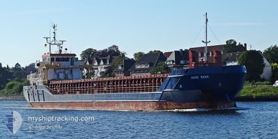
HOHE BANK
General Cargo
Current Trip
| Time Travelled | 2 days |
|---|---|
| Remaining Time | --- |
| Distance Travelled | 594.85 nm |
| Remaining Distance | --- |
| AVG Speed | 10.4 Knots |
| MAX Speed | 11.9 Knots |
| AVG Wind | 23 knots |
| MAX Wind | 32.8 knots |
| MIN Temp | 13.8°C / 56.84°F |
| MAX Temp | 17.5°C / 63.5°F |
| Draught | 4.2 m |
| Position Received | 1 d ago |
Current Position
| Longitude | 0.22334° |
|---|---|
| Latitude | 36.87737° |
| Status | Under way using engine |
| Speed | 9.7 Knots |
| Course | 73.6° |
| Area | Mediterranean Sea - Western Basin |
| Station | T-AIS |
| Position Received | 1 d ago |
Info
Information
The current position of HOHE BANK is in Mediterranean Sea - Western Basin with coordinates 36.87737° / 0.22334° as reported on 2024-05-01 16:44 by AIS to our vessel tracker app. The vessel's current speed is 9.7 Knots and is heading at the port of VENEZIA. The estimated time of arrival as calculated by vessel tracking app is 2024-05-07 06:30 LT
The vessel HOHE BANK (IMO: 9505302, MMSI: 236568000) is a General Cargo that was built in 2010 ( 14 years old ). It's sailing under the flag of [GI] Gibraltar.
In this page you can find informations about the vessels current position, last detected port calls, and current voyage information. If the vessels is not in coverage by AIS you will find the latest position.
The current position of HOHE BANK is detected by our AIS receivers and we are not responsible for the reliability of the data. The last position was recorded while the vessel was in Coverage by the Ais receivers of our vessel tracking app.
The current draught of HOHE BANK as reported by AIS is 4.2 meters
Weather
| Temperature | 16.2°C / 61.16°F |
|---|---|
| Wind Speed | 12 knots |
| Direction | 285° WNW |
| Pressure | 1019.1 hPa |
| Humidity | 61.9 % |
| Cloud Coverage | 13 % |
Featured Company
Last Port Calls
| Port | Arrival | Departure | Time In Port |
|---|---|---|---|
| 2024-04-30 10:55 | 2024-04-30 14:25 | 3 h | |
| 2024-04-25 22:46 | 2024-04-26 12:28 | 13 h | |
| 2024-04-21 23:18 | 2024-04-22 15:09 | 15 h | |
| 2024-04-19 23:20 | 2024-04-20 14:48 | 15 h | |
| 2024-04-18 11:38 | 2024-04-19 22:38 | 1 d | |
| 2024-04-18 11:03 | 2024-04-18 11:32 | 29 m | |
| 2024-04-18 01:22 | |||
| 2024-04-13 03:13 | 2024-04-15 10:08 | 2 d | |
| 2024-04-03 20:14 | 2024-04-04 20:58 | 1 d | |
| 2024-03-26 18:49 | 2024-03-28 19:35 | 2 d |
Last Trips
| Origin | Departure | Destination | Arrival | Distance | |
|---|---|---|---|---|---|
| 2024-04-26 14:28 | 2024-04-30 12:55 | 936.62 nm | |||
| 2024-04-22 17:09 | 2024-04-26 00:46 | 807.01 nm | |||
| 2024-04-20 16:48 | 2024-04-22 01:18 | 301.17 nm | |||
| 2024-04-20 00:38 | 2024-04-20 01:20 | 6.51 nm | |||
| 2024-04-18 13:32 | 2024-04-18 13:38 | 0.17 nm | |||
| 2024-04-15 13:08 | 2024-04-18 13:03 | 542.27 nm | |||
| 2024-04-15 13:08 | 2024-04-18 03:22 | 541.39 nm | |||
| 2024-04-04 21:58 | 2024-04-13 06:13 | 1832.96 nm | |||
| 2024-03-28 19:35 | 2024-04-03 21:14 | 1241.09 nm | |||
| 2024-03-20 10:04 | 2024-03-26 18:49 | 957.14 nm |
Events
| Time | Event | Details | Position / Dest | Info |
|---|---|---|---|---|
| 2024-05-01 17:21 | Status Changed | Default Under way using engine |
36.91779 / .36939
ITPMA
|
Speed: 9.7 kn Course: 73.6° |
| 2024-05-01 16:44 | OUT of Coverage |
36.87737 / .22334
Mediterranean Sea - Western Basin
ITPMA
|
Speed: 9.7 kn Course: 73.6° |
|
| 2024-05-01 10:54 | Change Sea Area | Algerian part of the Mediterranean Sea - Western Basin Spanish part of the Mediterranean Sea - Western Basin |
36.63543 / -.94465
Mediterranean Sea - Western Basin
ITPMA
|
Speed: 10.3 kn Course: 67.4° |
| 2024-05-01 10:33 | Status Changed | Under way using engine Default |
36.60899 / -1.03014
ITPMA
|
Speed: 10.2 kn Course: 68° |
| 2024-05-01 10:29 | Status Changed | Default Under way using engine |
36.61311 / -1.01704
ITPMA
|
Speed: 10.4 kn Course: 67.8° |
| 2024-05-01 07:16 | Detected in Sea | Spanish part of the Mediterranean Sea - Western Basin |
36.45070 / -1.74526
Mediterranean Sea - Western Basin
ITPMA
|
Speed: 11.2 kn Course: 76.5° |
| 2024-05-01 07:16 | Status Changed | Under way using engine Default |
36.45070 / -1.74526
ITPMA
|
Speed: 11.2 kn Course: 74° |
| 2024-05-01 07:01 | Status Changed | Default Under way using engine |
36.44751 / -1.76067
ITPMA
|
Speed: 10.8 kn Course: 72.6° |
| 2024-05-01 07:01 | IN Coverage |
36.45070 / -1.74526
Mediterranean Sea - Western Basin
ITPMA
|
Speed: 11.2 kn Course: 76.5° |
|
| 2024-05-01 06:08 | OUT of Coverage |
36.39015 / -2.01637
Alboran Sea
ITPMA
|
Speed: 10.8 kn Course: 72.6° |