
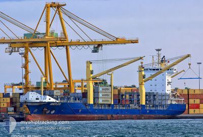
HOHEPLATE
Container Ship
Current Trip
VELAG
| Time Travelled | 9 h, 8 mins |
|---|---|
| Remaining Time | --- |
| Distance Travelled | 39.32 nm |
| Remaining Distance | --- |
| AVG Speed | 12.4 Knots |
| MAX Speed | 13.5 Knots |
| AVG Wind | 11.4 knots |
| MAX Wind | 16 knots |
| MIN Temp | 25.4°C / 77.72°F |
| MAX Temp | 27.8°C / 82.04°F |
| Draught | 7.5 m |
| Position Received | 3 d ago |
Current Position
| Longitude | -69.95053° |
|---|---|
| Latitude | 18.22352° |
| Status | Under way using engine |
| Speed | 13 Knots |
| Course | 164.1° |
| Area | Caribbean Sea |
| Station | T-AIS |
| Position Received | 3 d ago |
Info
Information
The current position of HOHEPLATE is in Caribbean Sea with coordinates 18.22352° / -69.95053° as reported on 2024-05-29 22:41 by AIS to our vessel tracker app. The vessel's current speed is 13 Knots
The vessel HOHEPLATE (IMO: 9366237, MMSI: 305236000) is a Container Ship that was built in 2007 ( 17 years old ). It's sailing under the flag of [AG] Antigua Barbuda.
In this page you can find informations about the vessels current position, last detected port calls, and current voyage information. If the vessels is not in coverage by AIS you will find the latest position.
The current position of HOHEPLATE is detected by our AIS receivers and we are not responsible for the reliability of the data. The last position was recorded while the vessel was in Coverage by the Ais receivers of our vessel tracking app.
The current draught of HOHEPLATE as reported by AIS is 7.5 meters
Weather
| Temperature | 27.6°C / 81.68°F |
|---|---|
| Wind Speed | 17 knots |
| Direction | 82° E |
| Pressure | 1008.8 hPa |
| Humidity | 86.9 % |
| Cloud Coverage | 41 % |
Featured Company
Last Port Calls
| Port | Arrival | Departure | Time In Port |
|---|---|---|---|
| 2024-05-31 20:26 | 2024-06-01 14:12 | 17 h | |
| 2024-05-29 11:34 | 2024-05-29 21:46 | 10 h | |
| 2024-05-27 16:18 | 2024-05-28 01:43 | 9 h | |
| 2024-05-24 11:52 | 2024-05-25 11:18 | 23 h | |
| 2024-05-24 01:15 | 2024-05-24 11:32 | 10 h | |
| 2024-05-23 09:26 | |||
| 2024-05-19 10:19 | 2024-05-19 21:41 | 11 h | |
| 2024-05-18 01:06 | 2024-05-18 06:21 | 5 h | |
| 2024-05-16 21:54 | 2024-05-17 14:45 | 16 h | |
| 2024-05-14 10:37 | 2024-05-14 18:06 | 7 h |
Most Visited Ports (Last year)
| Port | Arrivals | |
|---|---|---|
| 33 | ||
| 24 | ||
| 9 | ||
| 6 | ||
| 4 | ||
| 2 |
Last Trips
| Origin | Departure | Destination | Arrival | Distance | |
|---|---|---|---|---|---|
| 2024-05-29 17:46 | 2024-05-31 16:26 | 500.11 nm | |||
| 2024-05-27 21:43 | 2024-05-29 07:34 | 429.80 nm | |||
| 2024-05-25 07:18 | 2024-05-27 12:18 | 672.46 nm | |||
| 2024-05-24 07:32 | 2024-05-24 07:52 | 0.73 nm | |||
| 2024-05-19 17:41 | 2024-05-23 21:15 | 955.95 nm | |||
| 2024-05-19 17:41 | 2024-05-23 05:26 | 954.88 nm | |||
| 2024-05-18 02:21 | 2024-05-19 06:19 | 388.30 nm | |||
| 2024-05-17 10:45 | 2024-05-17 21:06 | 149.55 nm | |||
| 2024-05-14 14:06 | 2024-05-16 17:54 | 505.84 nm | |||
| 2024-05-11 03:18 | 2024-05-14 06:37 | 956.10 nm |
Events
| Time | Event | Details | Position / Dest | Info |
|---|---|---|---|---|
| 2024-06-01 14:19 | START Moving | 1.27 nm, North West of LA GUAIRA |
10.62107 / -66.96362
VELAG
|
Speed: 11.8 kn Course: -1° |
| 2024-06-01 14:12 | PORT DEPARTURE |
|
10.62107 / -66.96362
VELAG
|
Speed: Course: -1° |
| 2024-05-31 20:26 | PORT ARRIVAL |
|
10.60383 / -66.94825
[VE] LA GUAIRA
|
Speed: 7.5 kn Course: 146° |
| 2024-05-29 22:44 | Status Changed | Default Under way using engine |
18.21417 / -69.94776
VELAG
|
Speed: 13 kn Course: 164.1° |
| 2024-05-29 22:41 | OUT of Coverage |
18.22352 / -69.95053
Caribbean Sea
VELAG
|
Speed: 13 kn Course: 164.1° |
|
| 2024-05-29 22:13 | Draught Changed | 7.5 8 |
18.32372 / -69.98121
VELAG
|
Speed: 13 kn Course: 163.2° |
| 2024-05-29 22:13 | Destination Changed | VELAG DOHAI |
18.32372 / -69.98121
VELAG
|
Speed: 13 kn Course: 163.2° |
| 2024-05-29 22:13 | ETA Changed | 2024/05/31 10:00 2024/05/29 07:00 |
18.32372 / -69.98121
VELAG
|
Speed: 13 kn Course: 163.2° |
| 2024-05-29 22:00 | Status Changed | Under way using engine Default |
18.36803 / -69.99626
DOHAI
|
Speed: 6.8 kn Course: -1° |
| 2024-05-29 22:00 | IN Coverage |
18.36471 / -69.99501
Caribbean Sea
|
Speed: 13 kn Course: 161.2° |