
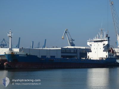
HOHEWIND
Cargo
Current Trip
| Time Travelled | 1 day |
|---|---|
| Remaining Time | --- |
| Distance Travelled | 411.11 nm |
| Remaining Distance | --- |
| AVG Speed | 11.9 Knots |
| MAX Speed | 13.2 Knots |
| AVG Wind | 12.9 knots |
| MAX Wind | 22 knots |
| MIN Temp | 17.4°C / 63.32°F |
| MAX Temp | 20.3°C / 68.54°F |
| Draught | 4.7 m |
| Position Received | 1 m ago |
Current Position
| Longitude | -5.61663° |
|---|---|
| Latitude | 35.95900° |
| Status | Under way using engine |
| Speed | 12.8 Knots |
| Course | 271° |
| Area | Strait of Gibraltar |
| Station | T-AIS |
| Position Received | 1 m ago |
Info
Information
The current position of HOHEWIND is in Strait of Gibraltar with coordinates 35.95900° / -5.61663° as reported on 2024-05-29 06:30 by AIS to our vessel tracker app. The vessel's current speed is 12.8 Knots and is heading at the port of MOIN. The estimated time of arrival as calculated by vessel tracking app is 2024-06-13 06:00 LT
The vessel HOHEWIND (IMO: 9116187, MMSI: 305102000) is a Cargo that was built in 1995 ( 29 years old ). It's sailing under the flag of [AG] Antigua Barbuda.
In this page you can find informations about the vessels current position, last detected port calls, and current voyage information. If the vessels is not in coverage by AIS you will find the latest position.
The current position of HOHEWIND is detected by our AIS receivers and we are not responsible for the reliability of the data. The last position was recorded while the vessel was in Coverage by the Ais receivers of our vessel tracking app.
The current draught of HOHEWIND as reported by AIS is 4.7 meters
Weather
| Temperature | 17.5°C / 63.5°F |
|---|---|
| Wind Speed | 15 knots |
| Direction | 67° ENE |
| Pressure | 1016.7 hPa |
| Humidity | 93.1 % |
| Cloud Coverage | 67 % |
Featured Company
Last Port Calls
| Port | Arrival | Departure | Time In Port |
|---|---|---|---|
| 2024-05-27 10:10 | 2024-05-27 20:39 | 10 h | |
| 2024-03-11 11:19 | 2024-05-17 13:17 | ||
| 2024-03-07 16:37 |
Last Trips
| Origin | Departure | Destination | Arrival | Distance | |
|---|---|---|---|---|---|
| 2024-05-17 15:17 | 2024-05-27 12:10 | 2696.57 nm | |||
| 2024-03-07 17:37 | 2024-03-11 12:19 | 917.24 nm |
Events
| Time | Event | Details | Position / Dest | Info |
|---|---|---|---|---|
| 2024-05-29 05:16 | Change Sea Area | Spanish part of the Strait of Gibraltar Gibraltarian part of the Strait of Gibraltar |
36.02044 / -5.33795
Strait of Gibraltar
CRPMN
|
Speed: 10.4 kn Course: 255° |
| 2024-05-29 05:14 | Change Sea Area | Gibraltarian part of the Strait of Gibraltar Gibraltarian part of the Alboran Sea |
36.02182 / -5.33108
Strait of Gibraltar
CRPMN
|
Speed: 10.3 kn Course: 256° |
| 2024-05-29 03:20 | Change Sea Area | Gibraltarian part of the Alboran Sea Spanish part of the Alboran Sea |
36.08535 / -4.91640
Alboran Sea
CRPMN
|
Speed: 10.8 kn Course: 259° |
| 2024-05-29 02:10 | Status Changed | Under way using engine Default |
36.11895 / -4.65886
CRPMN
|
Speed: 10.5 kn Course: 261° |
| 2024-05-29 02:06 | Status Changed | Default Under way using engine |
36.12104 / -4.64395
CRPMN
|
Speed: 10.5 kn Course: 260° |
| 2024-05-29 01:57 | Status Changed | Under way using engine Default |
36.12580 / -4.60978
CRPMN
|
Speed: 10.4 kn Course: 263° |
| 2024-05-29 01:54 | Status Changed | Default Under way using engine |
36.12673 / -4.60153
CRPMN
|
Speed: 10.5 kn Course: 262° |
| 2024-05-29 01:11 | Status Changed | Under way using engine Default |
36.14488 / -4.45109
CRPMN
|
Speed: 10.2 kn Course: 266° |
| 2024-05-29 00:40 | Status Changed | Default Under way using engine |
36.15261 / -4.34165
CRPMN
|
Speed: 10.4 kn Course: 264° |
| 2024-05-29 00:32 | Status Changed | Under way using engine Default |
36.15508 / -4.31252
CRPMN
|
Speed: 10 kn Course: 262° |