
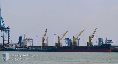
HONG BO 9
Cargo
Current Trip
| Time Travelled | 34 days |
|---|---|
| Remaining Time | 5 days |
| Distance Travelled | 4713.80 nm |
| Remaining Distance | 1197.76 nm |
| AVG Speed | 9.7 Knots |
| MAX Speed | 13 Knots |
| AVG Wind | 12 knots |
| MAX Wind | 26.6 knots |
| MIN Temp | 9.4°C / 48.92°F |
| MAX Temp | 30.5°C / 86.9°F |
| Draught | 11.2 m |
| Position Received | 1 m ago |
Current Position
| Longitude | 77.25428° |
|---|---|
| Latitude | 7.68274° |
| Status | Under way using engine |
| Speed | 8.8 Knots |
| Course | 301.8° |
| Area | Laccadive Sea |
| Station | T-AIS |
| Position Received | 1 m ago |
Info
Information
The current position of HONG BO 9 is in Laccadive Sea with coordinates 7.68274° / 77.25428° as reported on 2024-05-29 03:57 by AIS to our vessel tracker app. The vessel's current speed is 8.8 Knots and is heading at the port of KARACHI. The estimated time of arrival as calculated by vessel tracking app is 2024-06-03 16:12 LT
The vessel HONG BO 9 (IMO: 9628049, MMSI: 413339610) is a Cargo It's sailing under the flag of [CN] China.
In this page you can find informations about the vessels current position, last detected port calls, and current voyage information. If the vessels is not in coverage by AIS you will find the latest position.
The current position of HONG BO 9 is detected by our AIS receivers and we are not responsible for the reliability of the data. The last position was recorded while the vessel was in Coverage by the Ais receivers of our vessel tracking app.
The current draught of HONG BO 9 as reported by AIS is 11.2 meters
Weather
| Temperature | 28.5°C / 83.3°F |
|---|---|
| Wind Speed | 24 knots |
| Direction | 286° WNW |
| Pressure | 1008.4 hPa |
| Humidity | 82.6 % |
| Cloud Coverage | 100 % |
Featured Company
Last Port Calls
| Port | Arrival | Departure | Time In Port |
|---|---|---|---|
| 2024-04-24 09:28 | |||
| 2024-04-08 05:25 | 2024-04-11 06:49 | 3 d | |
| 2024-03-10 16:23 | |||
| 2024-03-09 21:46 |
Last Trips
| Origin | Departure | Destination | Arrival | Distance | |
|---|---|---|---|---|---|
| 2024-03-10 05:46 | 2024-03-11 00:23 | 194.46 nm |
Events
| Time | Event | Details | Position / Dest | Info |
|---|---|---|---|---|
| 2024-05-29 02:35 | ETA Changed | 2024/06/03 15:00 2024/06/01 21:00 |
7.57329 / 77.43309
PK KHI
|
Speed: 9 kn Course: 298.2° |
| 2024-05-29 02:34 | Status Changed | Under way using engine Default |
7.57183 / 77.43570
PK KHI
|
Speed: 9 kn Course: 299° |
| 2024-05-29 02:29 | Status Changed | Default Under way using engine |
7.56500 / 77.44500
PK KHI
|
Speed: 9.2 kn Course: 302.1° |
| 2024-05-29 02:02 | Change Sea Area | Indian part of the Laccadive Sea Malaysian part of the Singapore Strait |
7.52948 / 77.50747
Laccadive Sea
PK KHI
|
Speed: 9.2 kn Course: 300.5° |
| 2024-05-29 02:02 | Status Changed | Under way using engine Default |
7.52948 / 77.50747
PK KHI
|
Speed: 9 kn Course: 300° |
| 2024-05-29 01:44 | IN Coverage |
7.52948 / 77.50747
Laccadive Sea
PK KHI
|
Speed: 9.2 kn Course: 300.5° |
|
| 2024-05-21 07:00 | Status Changed | Default Under way using engine |
1.22151 / 103.50131
PK KHI
|
Speed: 12.1 kn Course: 282.8° |
| 2024-05-21 06:53 | OUT of Coverage |
1.21540 / 103.52678
Singapore Strait
PK KHI
|
Speed: 12.1 kn Course: 282.8° |
|
| 2024-05-21 06:35 | Change Sea Area | Malaysian part of the Singapore Strait Indonesian part of the Singapore Strait |
1.20056 / 103.58571
Singapore Strait
PK KHI
|
Speed: 11.8 kn Course: 284.8° |
| 2024-05-21 06:15 | Draught Changed | 11.2 11.7 |
1.18388 / 103.64796
PK KHI
|
Speed: 11.3 kn Course: 281.9° |