
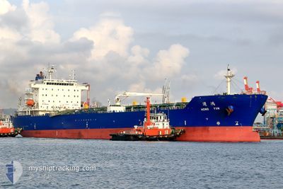
HONG YUN
Tanker A
Current Trip
| Time Travelled | 22 h, 15 mins |
|---|---|
| Remaining Time | 36 mins |
| Distance Travelled | 237.55 nm |
| Remaining Distance | 10.42 nm |
| AVG Speed | 9.3 Knots |
| MAX Speed | 14.4 Knots |
| AVG Wind | 12.2 knots |
| MAX Wind | 20.1 knots |
| MIN Temp | 22.7°C / 72.86°F |
| MAX Temp | 29.2°C / 84.56°F |
| Draught | 10 m |
| Position Received | Now |
Current Position
| Longitude | 121.72795° |
|---|---|
| Latitude | 25.28607° |
| Status | Under way using engine |
| Speed | 5 Knots |
| Course | 149.8° |
| Area | Eastern China Sea |
| Station | T-AIS |
| Position Received | Now |
Info
Information
The current position of HONG YUN is in Eastern China Sea with coordinates 25.28607° / 121.72795° as reported on 2024-06-02 00:08 by AIS to our vessel tracker app. The vessel's current speed is 5 Knots and is heading at the port of KEELUNG. The estimated time of arrival as calculated by vessel tracking app is 2024-06-02 00:45 LT
The vessel HONG YUN (IMO: 9737010, MMSI: 416018000) is a Tanker A It's sailing under the flag of [TW] Taiwan.
In this page you can find informations about the vessels current position, last detected port calls, and current voyage information. If the vessels is not in coverage by AIS you will find the latest position.
The current position of HONG YUN is detected by our AIS receivers and we are not responsible for the reliability of the data. The last position was recorded while the vessel was in Coverage by the Ais receivers of our vessel tracking app.
The current draught of HONG YUN as reported by AIS is 10 meters
Weather
| Temperature | 24.2°C / 75.56°F |
|---|---|
| Wind Speed | 17 knots |
| Direction | 59° ENE |
| Pressure | 1009.3 hPa |
| Humidity | 90.5 % |
| Cloud Coverage | 100 % |
Featured Company
Last Port Calls
| Port | Arrival | Departure | Time In Port |
|---|---|---|---|
| 2024-05-30 01:30 | 2024-06-01 01:54 | 2 d | |
| 2024-05-26 06:15 | 2024-05-27 06:37 | 1 d | |
| 2024-05-24 23:57 | 2024-05-26 03:34 | 1 d | |
| 2024-05-22 08:19 | 2024-05-24 00:58 | 1 d | |
| 2024-05-17 04:24 | 2024-05-18 03:36 | 23 h | |
| 2024-05-14 04:26 | 2024-05-16 23:34 | 2 d | |
| 2024-05-12 06:02 | 2024-05-13 10:07 | 1 d | |
| 2024-05-08 14:49 | 2024-05-11 07:49 | 2 d | |
| 2024-05-06 10:59 | 2024-05-07 16:20 | 1 d | |
| 2024-05-04 00:36 | 2024-05-05 09:48 | 1 d |
Last Trips
| Origin | Departure | Destination | Arrival | Distance | |
|---|---|---|---|---|---|
| 2024-05-27 14:37 | 2024-05-30 09:30 | 293.64 nm | |||
| 2024-05-26 11:34 | 2024-05-26 14:15 | 17.61 nm | |||
| 2024-05-24 08:58 | 2024-05-25 07:57 | 252.01 nm | |||
| 2024-05-18 11:36 | 2024-05-22 16:19 | 245.70 nm | |||
| 2024-05-17 07:34 | 2024-05-17 12:24 | 45.60 nm | |||
| 2024-05-13 18:07 | 2024-05-14 12:26 | 204.39 nm | |||
| 2024-05-11 15:49 | 2024-05-12 14:02 | 243.97 nm | |||
| 2024-05-08 00:20 | 2024-05-08 22:49 | 239.28 nm | |||
| 2024-05-05 17:48 | 2024-05-06 18:59 | 241.13 nm | |||
| 2024-05-04 00:48 | 2024-05-04 08:36 | 74.49 nm |
Events
| Time | Event | Details | Position / Dest | Info |
|---|---|---|---|---|
| 2024-06-01 21:49 | Status Changed | Under way using engine Default |
25.41565 / 121.47235
TW KEL
|
Speed: 8.7 kn Course: 56° |
| 2024-06-01 21:05 | Status Changed | Default Under way using engine |
25.35689 / 121.38090
TW KEL
|
Speed: 8.1 kn Course: 52.4° |
| 2024-06-01 20:53 | Status Changed | Under way using engine Default |
25.34087 / 121.35673
TW KEL
|
Speed: 8.3 kn Course: 48° |
| 2024-06-01 20:32 | Status Changed | Default Under way using engine |
25.30996 / 121.31525
TW KEL
|
Speed: 8.6 kn Course: 68.3° |
| 2024-06-01 20:21 | Detected in Sea | Taiwanese part of the Eastern China Sea |
25.29891 / 121.28922
Eastern China Sea
TW KEL
|
Speed: 8.2 kn Course: 64.3° |
| 2024-06-01 19:52 | ETA Changed | 2024/06/02 01:00 2024/06/02 04:00 |
25.26951 / 121.22210
TW KEL
|
Speed: 8.3 kn Course: 64.4° |
| 2024-06-01 19:48 | Status Changed | Under way using engine Default |
25.26533 / 121.21253
TW KEL
|
Speed: 8.7 kn Course: 66° |
| 2024-06-01 19:38 | IN Coverage |
25.26748 / 121.21749
South China Sea
TW KEL
|
Speed: 8.5 kn Course: 62.4° |
|
| 2024-06-01 05:13 | Status Changed | Default Under way using engine |
22.90814 / 119.97699
TW KEL
|
Speed: 11.3 kn Course: 348.9° |
| 2024-06-01 05:07 | OUT of Coverage |
22.88946 / 119.98431
South China Sea
TW KEL
|
Speed: 11.3 kn Course: 348.9° |