
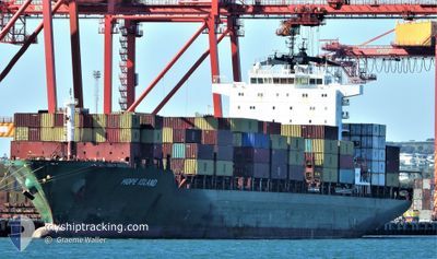
HOPE ISLAND
Container Ship
Current Trip
| Time Travelled | 1 day |
|---|---|
| Remaining Time | 3 days |
| Distance Travelled | 73.87 nm |
| Remaining Distance | 1624.11 nm |
| AVG Speed | 12.8 Knots |
| MAX Speed | 13.8 Knots |
| AVG Wind | 14.1 knots |
| MAX Wind | 19.4 knots |
| MIN Temp | 26.7°C / 80.06°F |
| MAX Temp | 28.4°C / 83.12°F |
| Draught | 9 m |
| Position Received | 1 d ago |
Current Position
| Longitude | 104.29800° |
|---|---|
| Latitude | 1.27358° |
| Status | Under way using engine |
| Speed | 12.5 Knots |
| Course | 81.7° |
| Area | Singapore Strait |
| Station | T-AIS |
| Position Received | 1 d ago |
Info
Information
The current position of HOPE ISLAND is in Singapore Strait with coordinates 1.27358° / 104.29800° as reported on 2024-06-01 11:42 by AIS to our vessel tracker app. The vessel's current speed is 12.5 Knots and is heading at the port of XIAMEN. The estimated time of arrival as calculated by vessel tracking app is 2024-06-06 18:18 LT
The vessel HOPE ISLAND (IMO: 9263320, MMSI: 538006207) is a Container Ship that was built in 2006 ( 18 years old ). It's sailing under the flag of [MH] Marshall Is.
In this page you can find informations about the vessels current position, last detected port calls, and current voyage information. If the vessels is not in coverage by AIS you will find the latest position.
The current position of HOPE ISLAND is detected by our AIS receivers and we are not responsible for the reliability of the data. The last position was recorded while the vessel was in Coverage by the Ais receivers of our vessel tracking app.
The current draught of HOPE ISLAND as reported by AIS is 9 meters
Weather
| Temperature | 29.3°C / 84.74°F |
|---|---|
| Wind Speed | 12 knots |
| Direction | 228° SW |
| Pressure | 1009.8 hPa |
| Humidity | 75.6 % |
| Cloud Coverage | 100 % |
Featured Company
Last Port Calls
| Port | Arrival | Departure | Time In Port |
|---|---|---|---|
| 2024-05-31 19:34 | 2024-06-01 06:42 | 11 h | |
| 2024-05-21 08:02 | 2024-05-22 06:32 | 22 h | |
| 2024-05-17 20:45 | 2024-05-19 04:43 | 1 d | |
| 2024-05-15 12:00 | 2024-05-16 09:34 | 21 h | |
| 2024-05-14 00:12 | 2024-05-15 03:02 | 1 d | |
| 2024-05-11 19:16 | 2024-05-12 17:31 | 22 h | |
| 2024-05-07 07:33 | 2024-05-11 11:36 | 4 d | |
| 2024-05-05 01:00 | 2024-05-06 16:46 | 1 d | |
| 2024-04-27 04:09 | 2024-04-27 21:45 | 17 h | |
| 2024-04-16 06:50 | 2024-04-19 18:07 | 3 d |
Most Visited Ports (Last year)
| Port | Arrivals | |
|---|---|---|
| 6 | ||
| 4 | ||
| 4 | ||
| 4 | ||
| 3 | ||
| 3 |
Last Trips
| Origin | Departure | Destination | Arrival | Distance | |
|---|---|---|---|---|---|
| 2024-05-22 11:32 | 2024-06-01 03:34 | 2981.08 nm | |||
| 2024-05-19 08:43 | 2024-05-21 13:02 | 775.49 nm | |||
| 2024-05-16 12:34 | 2024-05-18 00:45 | 353.27 nm | |||
| 2024-05-15 06:02 | 2024-05-15 15:00 | 122.45 nm | |||
| 2024-05-12 21:31 | 2024-05-14 03:12 | 336.04 nm | |||
| 2024-05-11 15:36 | 2024-05-11 23:16 | 51.13 nm | |||
| 2024-05-06 20:46 | 2024-05-07 11:33 | 57.71 nm | |||
| 2024-04-28 03:15 | 2024-05-05 05:00 | 1177.71 nm | |||
| 2024-04-19 21:07 | 2024-04-27 09:39 | 2428.53 nm | |||
| 2024-04-05 03:34 | 2024-04-16 09:50 | 1676.02 nm |
Events
| Time | Event | Details | Position / Dest | Info |
|---|---|---|---|---|
| 2024-06-01 11:46 | Status Changed | Default Under way using engine |
1.27678 / 104.31272
CNXMG
|
Speed: 12.5 kn Course: 81.7° |
| 2024-06-01 11:42 | OUT of Coverage |
1.27358 / 104.29800
Singapore Strait
CNXMG
|
Speed: 12.5 kn Course: 81.7° |
|
| 2024-06-01 11:10 | Change Sea Area | Malaysian part of the Singapore Strait Indonesian part of the Singapore Strait |
1.25742 / 104.18501
Singapore Strait
CNXMG
|
Speed: 13.5 kn Course: 82.3° |
| 2024-06-01 08:59 | Draught Changed | 9 8.8 |
1.12109 / 103.74858
CNXMG
|
Speed: 12.4 kn Course: 46.2° |
| 2024-06-01 08:59 | Destination Changed | CNXMG MYTPP |
1.12109 / 103.74858
CNXMG
|
Speed: 12.4 kn Course: 46.2° |
| 2024-06-01 08:59 | ETA Changed | 2024/06/06 22:00 2024/05/31 18:00 |
1.12109 / 103.74858
CNXMG
|
Speed: 12.4 kn Course: 46.2° |
| 2024-06-01 08:33 | Status Changed | Under way using engine Default |
1.05759 / 103.68299
MYTPP
|
Speed: 12.5 kn Course: 70° |
| 2024-06-01 08:22 | Status Changed | Default Under way using engine |
1.04982 / 103.64662
MYTPP
|
Speed: 12.7 kn Course: 114.7° |
| 2024-06-01 08:02 | Status Changed | Under way using engine Default |
1.08383 / 103.58688
MYTPP
|
Speed: 12.5 kn Course: 126° |
| 2024-06-01 07:54 | Status Changed | Default Under way using engine |
1.10135 / 103.56445
MYTPP
|
Speed: 12.2 kn Course: 135.7° |