
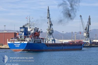
HOPTERIX
Cargo
Current Trip
| Time Travelled | 5 days |
|---|---|
| Remaining Time | --- |
| Distance Travelled | 1246.78 nm |
| Remaining Distance | --- |
| AVG Speed | 9.9 Knots |
| MAX Speed | 13.7 Knots |
| AVG Wind | 16 knots |
| MAX Wind | 35.3 knots |
| MIN Temp | 12.8°C / 55.04°F |
| MAX Temp | 19.1°C / 66.38°F |
| Draught | 6 m |
| Position Received | 1 m ago |
Current Position
| Longitude | -9.58938° |
|---|---|
| Latitude | 36.94818° |
| Status | Under way using engine |
| Speed | 9 Knots |
| Course | 166.2° |
| Area | North Atlantic Ocean |
| Station | T-AIS |
| Position Received | 1 m ago |
Info
Information
The current position of HOPTERIX is in North Atlantic Ocean with coordinates 36.94818° / -9.58938° as reported on 2024-06-02 12:00 by AIS to our vessel tracker app. The vessel's current speed is 9 Knots and is heading at the port of ISKENDERUN. The estimated time of arrival as calculated by vessel tracking app is 2024-06-12 16:00 LT
The vessel HOPTERIX (IMO: 9645841, MMSI: 314645000) is a Cargo It's sailing under the flag of [BB] Barbados.
In this page you can find informations about the vessels current position, last detected port calls, and current voyage information. If the vessels is not in coverage by AIS you will find the latest position.
The current position of HOPTERIX is detected by our AIS receivers and we are not responsible for the reliability of the data. The last position was recorded while the vessel was in Coverage by the Ais receivers of our vessel tracking app.
The current draught of HOPTERIX as reported by AIS is 6 meters
Weather
| Temperature | 18.9°C / 66.02°F |
|---|---|
| Wind Speed | 6 knots |
| Direction | 207° SSW |
| Pressure | 1015 hPa |
| Humidity | 87.7 % |
| Cloud Coverage | 11 % |
Featured Company
Last Trips
| Origin | Departure | Destination | Arrival | Distance | |
|---|---|---|---|---|---|
| 2024-05-17 14:35 | 2024-05-26 17:50 | 642.14 nm | |||
| 2024-04-27 20:12 | 2024-05-13 23:04 | 3239.27 nm | |||
| 2024-04-15 22:26 | 2024-04-25 12:58 | 325.49 nm | |||
| 2024-04-14 03:25 | 2024-04-15 10:59 | 60.96 nm | |||
| 2024-03-26 18:38 | 2024-04-11 14:35 | 2838.60 nm |
Events
| Time | Event | Details | Position / Dest | Info |
|---|---|---|---|---|
| 2024-06-02 11:51 | Status Changed | Under way using engine Default |
36.97164 / -9.59588
TRISK
|
Speed: 9.1 kn Course: 170° |
| 2024-06-02 11:48 | Status Changed | Default Under way using engine |
36.97830 / -9.59765
TRISK
|
Speed: 9.1 kn Course: 168.6° |
| 2024-06-02 11:48 | Status Changed | Under way using engine Default |
36.97913 / -9.59786
TRISK
|
Speed: 9.3 kn Course: 167° |
| 2024-06-02 11:40 | Status Changed | Default Under way using engine |
36.99834 / -9.60299
TRISK
|
Speed: 9.1 kn Course: 167.9° |
| 2024-06-01 13:46 | ETA Changed | 2024/06/12 16:00 2024/06/11 16:00 |
40.76003 / -10.13230
TRISK
|
Speed: 10.7 kn Course: 179.7° |
| 2024-06-01 13:12 | Status Changed | Under way using engine Default |
40.85960 / -10.12974
TRISK
|
Speed: 10.6 kn Course: 182° |
| 2024-06-01 13:08 | Status Changed | Default Under way using engine |
40.87201 / -10.12922
TRISK
|
Speed: 10.7 kn Course: 180.9° |
| 2024-06-01 12:48 | Status Changed | Under way using engine Default |
40.93176 / -10.12708
TRISK
|
Speed: 11.1 kn Course: 180° |
| 2024-06-01 12:44 | IN Coverage |
40.92007 / -10.12741
North Atlantic Ocean
TRISK
|
Speed: 10.9 kn Course: 180.6° |
|
| 2024-06-01 10:46 | OUT of Coverage |
41.29462 / -10.13566
North Atlantic Ocean
TRISK
|
Speed: 10.3 kn Course: 175.6° |