
HUBERT SCHULTE
Cargo
Current Trip
| Time Travelled | 1 day |
|---|---|
| Remaining Time | 1 day |
| Distance Travelled | 802.61 nm |
| Remaining Distance | 732.94 nm |
| AVG Speed | 17.5 Knots |
| MAX Speed | 21.3 Knots |
| AVG Wind | 10.2 knots |
| MAX Wind | 14.9 knots |
| MIN Temp | 25.3°C / 77.54°F |
| MAX Temp | 29°C / 84.2°F |
| Draught | 10.3 m |
| Position Received | 3 h, 20 m ago |
Current Position
| Longitude | -83.87116° |
|---|---|
| Latitude | 23.51945° |
| Status | Under way using engine |
| Speed | 18.7 Knots |
| Course | 265.1° |
| Area | Gulf of Mexico |
| Station | T-AIS |
| Position Received | 3 h, 20 m ago |
Info
Information
The current position of HUBERT SCHULTE is in Gulf of Mexico with coordinates 23.51945° / -83.87116° as reported on 2024-05-29 02:23 by AIS to our vessel tracker app. The vessel's current speed is 18.7 Knots and is heading at the port of ALTAMIRA. The estimated time of arrival as calculated by vessel tracking app is 2024-05-30 17:08 LT
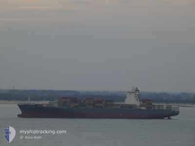
The vessel HUBERT SCHULTE (IMO: 9535204, MMSI: 477947100) is a Cargo It's sailing under the flag of [HK] Hong Kong.
In this page you can find informations about the vessels current position, last detected port calls, and current voyage information. If the vessels is not in coverage by AIS you will find the latest position.
The current position of HUBERT SCHULTE is detected by our AIS receivers and we are not responsible for the reliability of the data. The last position was recorded while the vessel was in Coverage by the Ais receivers of our vessel tracking app.
The current draught of HUBERT SCHULTE as reported by AIS is 10.3 meters
Weather
| Temperature | 28.6°C / 83.48°F |
|---|---|
| Wind Speed | 6 knots |
| Direction | 68° ENE |
| Pressure | 1017.3 hPa |
| Humidity | 75.9 % |
| Cloud Coverage | --- |
Featured Company
Last Port Calls
| Port | Arrival | Departure | Time In Port |
|---|---|---|---|
| 2024-05-26 14:00 | 2024-05-27 07:30 | 17 h | |
| 2024-05-22 23:11 | 2024-05-24 02:53 | 1 d | |
| 2024-05-13 20:13 | 2024-05-14 13:54 | 17 h | |
| 2024-05-11 02:15 | 2024-05-12 10:20 | 1 d | |
| 2024-05-08 22:27 | 2024-05-10 03:04 | 1 d | |
| 2024-04-28 13:03 | 2024-04-29 10:30 | 21 h | |
| 2024-04-21 04:50 | 2024-04-22 00:30 | 19 h | |
| 2024-04-17 05:00 | 2024-04-18 20:45 | 1 d | |
| 2024-04-12 17:30 | 2024-04-13 07:02 | 13 h | |
| 2024-04-06 05:55 | 2024-04-07 05:41 | 23 h |
Most Visited Ports (Last year)
| Port | Arrivals | |
|---|---|---|
| 10 | ||
| 8 | ||
| 7 | ||
| 6 | ||
| 5 | ||
| 5 |
Last Trips
| Origin | Departure | Destination | Arrival | Distance | |
|---|---|---|---|---|---|
| 2024-05-23 22:53 | 2024-05-26 10:00 | 658.05 nm | |||
| 2024-05-14 15:54 | 2024-05-22 19:11 | 3406.19 nm | |||
| 2024-05-12 12:20 | 2024-05-13 22:13 | 300.45 nm | |||
| 2024-05-10 05:04 | 2024-05-11 04:15 | 372.18 nm | |||
| 2024-04-29 06:30 | 2024-05-09 00:27 | 4083.60 nm | |||
| 2024-04-21 19:30 | 2024-04-28 09:03 | 1069.00 nm | |||
| 2024-04-18 15:45 | 2024-04-20 23:50 | 229.89 nm | |||
| 2024-04-13 02:02 | 2024-04-17 00:00 | 760.20 nm | |||
| 2024-04-07 01:41 | 2024-04-12 12:30 | 1577.09 nm | |||
| 2024-04-04 08:41 | 2024-04-06 01:55 | 642.15 nm |
Events
| Time | Event | Details | Position / Dest | Info |
|---|---|---|---|---|
| 2024-05-29 02:24 | Status Changed | Default Under way using engine |
23.51932 / -83.87285
MXATM
|
Speed: 18.7 kn Course: 265.1° |
| 2024-05-29 02:23 | Status Changed | Under way using engine Default |
23.51945 / -83.87116
MXATM
|
Speed: 18 kn Course: 265° |
| 2024-05-29 02:23 | IN Coverage |
23.51945 / -83.87116
Gulf of Mexico
MXATM
|
Speed: 18.7 kn Course: 265.1° |
|
| 2024-05-29 02:23 | OUT of Coverage |
23.51945 / -83.87116
Gulf of Mexico
MXATM
|
Speed: 18.7 kn Course: 265.1° |
|
| 2024-05-29 00:29 | Status Changed | Default Under way using engine |
23.57253 / -83.25369
MXATM
|
Speed: 18.1 kn Course: 264.1° |
| 2024-05-29 00:26 | OUT of Coverage |
23.57431 / -83.23562
Gulf of Mexico
MXATM
|
Speed: 18.1 kn Course: 264.1° |
|
| 2024-05-29 00:14 | Status Changed | Under way using engine Default |
23.58057 / -83.17102
MXATM
|
Speed: 18.1 kn Course: 264° |
| 2024-05-28 23:46 | Status Changed | Default Under way using engine |
23.59445 / -83.01987
MXATM
|
Speed: 18.1 kn Course: 263.8° |
| 2024-05-28 23:42 | Change Sea Area | Cuban part of the Gulf of Mexico Cuban part of the North Atlantic Ocean |
23.59633 / -83.00011
Gulf of Mexico
MXATM
|
Speed: 18.1 kn Course: 263.8° |
| 2024-05-28 22:40 | Status Changed | Under way using engine Default |
23.62768 / -82.66011
MXATM
|
Speed: 18.1 kn Course: 264° |