
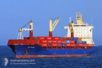
HUTTON
Container Ship
Current Trip
| Time Travelled | 1 day |
|---|---|
| Remaining Time | 12 h, 2 mins |
| Distance Travelled | 359.81 nm |
| Remaining Distance | 191.14 nm |
| AVG Speed | 13.9 Knots |
| MAX Speed | 16 Knots |
| AVG Wind | 10.6 knots |
| MAX Wind | 16 knots |
| MIN Temp | 22.6°C / 72.68°F |
| MAX Temp | 26.3°C / 79.34°F |
| Draught | 9.4 m |
| Position Received | 16 h, 35 m ago |
Current Position
| Longitude | -74.43560° |
|---|---|
| Latitude | 35.51413° |
| Status | Under way using engine |
| Speed | 11.9 Knots |
| Course | 182° |
| Area | North Atlantic Ocean |
| Station | T-AIS |
| Position Received | 16 h, 35 m ago |
Info
Information
The current position of HUTTON is in North Atlantic Ocean with coordinates 35.51413° / -74.43560° as reported on 2024-06-14 07:49 by AIS to our vessel tracker app. The vessel's current speed is 11.9 Knots and is heading at the port of SAVANNAH. The estimated time of arrival as calculated by vessel tracking app is 2024-06-15 12:27 LT
The vessel HUTTON (IMO: 9311787, MMSI: 636022635) is a Container Ship that was built in 2006 ( 18 years old ). It's sailing under the flag of [LR] Liberia.
In this page you can find informations about the vessels current position, last detected port calls, and current voyage information. If the vessels is not in coverage by AIS you will find the latest position.
The current position of HUTTON is detected by our AIS receivers and we are not responsible for the reliability of the data. The last position was recorded while the vessel was in Coverage by the Ais receivers of our vessel tracking app.
The current draught of HUTTON as reported by AIS is 9.4 meters
Weather
| Temperature | 26.3°C / 79.34°F |
|---|---|
| Wind Speed | 2 knots |
| Direction | 156° SSE |
| Pressure | 1012.2 hPa |
| Humidity | 74.1 % |
| Cloud Coverage | --- |
Featured Company
Last Port Calls
| Port | Arrival | Departure | Time In Port |
|---|---|---|---|
| 2024-06-13 08:19 | 2024-06-13 21:56 | 13 h | |
| 2024-06-11 09:10 | 2024-06-12 06:33 | 21 h | |
| 2024-06-02 06:33 | 2024-06-03 00:38 | 18 h | |
| 2024-05-26 18:54 | 2024-05-28 06:37 | 1 d | |
| 2024-05-23 06:47 | 2024-05-23 19:30 | 12 h | |
| 2024-05-20 22:53 | 2024-05-21 23:54 | 1 d | |
| 2024-05-15 19:00 | 2024-05-17 07:32 | 1 d | |
| 2024-05-13 17:26 | 2024-05-14 17:53 | 1 d | |
| 2024-04-28 08:10 | 2024-04-29 07:40 | 23 h | |
| 2024-04-23 12:59 | 2024-04-24 05:24 | 16 h |
Last Trips
| Origin | Departure | Destination | Arrival | Distance | |
|---|---|---|---|---|---|
| 2024-06-12 02:33 | 2024-06-13 04:19 | 311.04 nm | |||
| 2024-06-03 01:38 | 2024-06-11 05:10 | 3032.33 nm | |||
| 2024-05-28 08:37 | 2024-06-02 07:33 | 1356.92 nm | |||
| 2024-05-23 22:30 | 2024-05-26 20:54 | 846.70 nm | |||
| 2024-05-22 02:54 | 2024-05-23 09:47 | 310.48 nm | |||
| 2024-05-17 10:32 | 2024-05-21 01:53 | 874.61 nm | |||
| 2024-05-14 19:53 | 2024-05-15 22:00 | 365.54 nm | |||
| 2024-04-29 03:40 | 2024-05-13 19:26 | 5674.69 nm | |||
| 2024-04-24 01:24 | 2024-04-28 04:10 | 569.16 nm | |||
| 2024-04-22 06:57 | 2024-04-23 08:59 | 312.67 nm |
Events
| Time | Event | Details | Position / Dest | Info |
|---|---|---|---|---|
| 2024-06-14 07:54 | Status Changed | Default Under way using engine |
35.49833 / -74.43667
USSAV
|
Speed: 11.9 kn Course: 182° |
| 2024-06-14 07:49 | Status Changed | Under way using engine Default |
35.51413 / -74.43560
USSAV
|
Speed: 11.9 kn Course: 182° |
| 2024-06-14 07:49 | OUT of Coverage |
35.51413 / -74.43560
North Atlantic Ocean
USSAV
|
Speed: 11.9 kn Course: 182° |
|
| 2024-06-14 07:47 | Status Changed | Default Under way using engine |
35.52253 / -74.43520
USSAV
|
Speed: 11.7 kn Course: 182.1° |
| 2024-06-14 07:40 | Status Changed | Under way using engine Default |
35.54547 / -74.43395
USSAV
|
Speed: 12 kn Course: 180° |
| 2024-06-14 07:27 | Status Changed | Default Under way using engine |
35.58667 / -74.43166
USSAV
|
Speed: 11.4 kn Course: 181.7° |
| 2024-06-14 06:07 | Status Changed | Under way using engine Default |
35.84213 / -74.42985
USSAV
|
Speed: 12 kn Course: 171° |
| 2024-06-14 06:07 | IN Coverage |
35.83832 / -74.42955
North Atlantic Ocean
USSAV
|
Speed: 11.8 kn Course: 175.5° |
|
| 2024-06-14 03:32 | Status Changed | Default Under way using engine |
36.31750 / -74.88760
USSAV
|
Speed: 14.5 kn Course: 126° |
| 2024-06-14 03:30 | OUT of Coverage |
36.32307 / -74.89727
North Atlantic Ocean
USSAV
|
Speed: 14.5 kn Course: 126° |