
HUYGENS
Tanker
Current Trip
| Time Travelled | 3 days |
|---|---|
| Remaining Time | --- |
| Distance Travelled | 228.72 nm |
| Remaining Distance | --- |
| AVG Speed | 5.4 Knots |
| MAX Speed | 12.6 Knots |
| AVG Wind | 5.2 knots |
| MAX Wind | 8 knots |
| MIN Temp | 9.3°C / 48.74°F |
| MAX Temp | 25.3°C / 77.54°F |
| Draught | 1.6 m |
| Position Received | 3 h, 0 m ago |
Current Position
| Longitude | 8.41629° |
|---|---|
| Latitude | 49.54022° |
| Status | Moored |
| Speed | |
| Course | 82° |
| Area | North Sea |
| Station | T-AIS |
| Position Received | 3 h, 0 m ago |
Info
Information
The current position of HUYGENS is in North Sea with coordinates 49.54022° / 8.41629° as reported on 2024-05-14 09:07 by AIS to our vessel tracker app. The vessel's current speed is 0 Knots
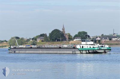
The vessel HUYGENS (MMSI: 244131247) is a Tanker It's sailing under the flag of [NL] Netherlands.
In this page you can find informations about the vessels current position, last detected port calls, and current voyage information. If the vessels is not in coverage by AIS you will find the latest position.
The current position of HUYGENS is detected by our AIS receivers and we are not responsible for the reliability of the data. The last position was recorded while the vessel was in Coverage by the Ais receivers of our vessel tracking app.
The current draught of HUYGENS as reported by AIS is 1.6 meters
Weather
| Temperature | 23.3°C / 73.94°F |
|---|---|
| Wind Speed | 7 knots |
| Direction | 115° ESE |
| Pressure | 1006.9 hPa |
| Humidity | 44.8 % |
| Cloud Coverage | --- |
Featured Company
Last Port Calls
| Port | Arrival | Departure | Time In Port |
|---|---|---|---|
| 2024-05-10 22:32 | 2024-05-10 23:45 | 1 h | |
| 2024-05-10 11:25 | 2024-05-10 13:31 | 2 h | |
| 2024-05-09 05:43 | 2024-05-10 07:00 | 1 d | |
| 2024-05-02 10:59 | 2024-05-02 11:42 | 42 m | |
| 2024-04-29 14:28 | 2024-05-01 23:50 | 2 d | |
| 2024-04-23 05:20 | 2024-04-24 16:28 | 1 d | |
| 2024-04-21 03:24 | 2024-04-22 13:09 | 1 d | |
| 2024-04-15 00:20 | 2024-04-15 17:16 | 16 h | |
| 2024-04-10 12:59 | 2024-04-14 16:45 | 4 d | |
| 2024-04-04 11:48 | 2024-04-04 12:31 | 43 m |
Most Visited Ports (Last year)
| Port | Arrivals | |
|---|---|---|
| 33 | ||
| 22 | ||
| 21 | ||
| 19 | ||
| 18 | ||
| 12 |
Last Trips
| Origin | Departure | Destination | Arrival | Distance | |
|---|---|---|---|---|---|
| 2024-05-10 15:31 | 2024-05-11 00:32 | 62.50 nm | |||
| 2024-05-10 09:00 | 2024-05-10 13:25 | 32.43 nm | |||
| 2024-05-02 13:42 | 2024-05-09 07:43 | 543.72 nm | |||
| 2024-05-02 01:50 | 2024-05-02 12:59 | 75.88 nm | |||
| 2024-04-24 18:28 | 2024-04-29 16:28 | 618.88 nm | |||
| 2024-04-22 15:09 | 2024-04-23 07:20 | 45.68 nm | |||
| 2024-04-15 19:16 | 2024-04-21 05:24 | 619.88 nm | |||
| 2024-04-14 18:45 | 2024-04-15 02:20 | 50.19 nm | |||
| 2024-04-04 14:31 | 2024-04-10 14:59 | 533.58 nm | |||
| 2024-04-04 03:13 | 2024-04-04 13:48 | 75.68 nm |
Events
| Time | Event | Details | Position / Dest | Info |
|---|---|---|---|---|
| 2024-05-14 09:07 | OUT of Coverage |
49.54022 / 8.41629
North Sea
|
Speed: Course: 511° |
|
| 2024-05-14 09:07 | IN Coverage |
49.54022 / 8.41629
North Sea
|
Speed: Course: 511° |
|
| 2024-05-13 20:30 | OUT of Coverage |
49.54022 / 8.41629
North Sea
|
Speed: 0.6 kn Course: 222.2° |
|
| 2024-05-13 20:10 | START Moving | 2 nm, North of MANNHEIM |
49.52170 / 8.43207
LUDWIGSHAFEN
|
Speed: 6.2 kn Course: 348.2° |
| 2024-05-13 20:06 | STOP Moving | 1.86 nm, North of MANNHEIM |
49.51968 / 8.43388
LUDWIGSHAFEN
|
Speed: 0.1 kn Course: 186° |
| 2024-05-13 20:05 | IN Coverage |
49.51968 / 8.43384
North Sea
|
Speed: 0.8 kn Course: 265.3° |
|
| 2024-05-13 13:42 | OUT of Coverage |
49.51925 / 8.43455
North Sea
|
Speed: Course: 165° |
|
| 2024-05-13 13:25 | STOP Moving | 1.81 nm, North of MANNHEIM |
49.51900 / 8.43446
LUDWIGSHAFEN
|
Speed: 0.2 kn Course: 164° |
| 2024-05-13 13:05 | IN Coverage |
49.50503 / 8.43741
North Sea
|
Speed: 1.5 kn Course: 351.8° |
|
| 2024-05-12 18:50 | OUT of Coverage |
49.50425 / 8.43744
North Sea
|
Speed: 0.1 kn Course: 166° |