
HYUNDAI EARTH
Cargo
Current Trip
| Time Travelled | 13 days |
|---|---|
| Remaining Time | 9 h, 6 mins |
| Distance Travelled | 4830.84 nm |
| Remaining Distance | 348.18 nm |
| AVG Speed | 14.5 Knots |
| MAX Speed | 19.7 Knots |
| AVG Wind | 13.3 knots |
| MAX Wind | 31.8 knots |
| MIN Temp | 2.7°C / 36.86°F |
| MAX Temp | 18.6°C / 65.48°F |
| Draught | 12.7 m |
| Position Received | 17 h, 8 m ago |
Current Position
| Longitude | 134.98817° |
|---|---|
| Latitude | 38.40901° |
| Status | Under way using engine |
| Speed | 12.7 Knots |
| Course | 236.9° |
| Area | Japan Sea |
| Station | T-AIS |
| Position Received | 17 h, 8 m ago |
Info
Information
The current position of HYUNDAI EARTH is in Japan Sea with coordinates 38.40901° / 134.98817° as reported on 2024-05-31 06:34 by AIS to our vessel tracker app. The vessel's current speed is 12.7 Knots and is heading at the port of BUSAN. The estimated time of arrival as calculated by vessel tracking app is 2024-06-01 08:48 LT
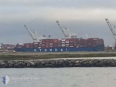
The vessel HYUNDAI EARTH (IMO: 9725110, MMSI: 232024772) is a Cargo It's sailing under the flag of [GB] United Kingdom.
In this page you can find informations about the vessels current position, last detected port calls, and current voyage information. If the vessels is not in coverage by AIS you will find the latest position.
The current position of HYUNDAI EARTH is detected by our AIS receivers and we are not responsible for the reliability of the data. The last position was recorded while the vessel was in Coverage by the Ais receivers of our vessel tracking app.
The current draught of HYUNDAI EARTH as reported by AIS is 12.7 meters
Weather
| Temperature | 18.8°C / 65.84°F |
|---|---|
| Wind Speed | 11 knots |
| Direction | 198° SSW |
| Pressure | 1009.3 hPa |
| Humidity | 88.3 % |
| Cloud Coverage | 78 % |
Featured Company
Last Port Calls
| Port | Arrival | Departure | Time In Port |
|---|---|---|---|
| 2024-05-16 07:37 | 2024-05-18 10:59 | 2 d | |
| 2024-05-08 11:21 | 2024-05-14 18:25 | 6 d | |
| 2024-04-24 13:48 | 2024-04-26 05:49 | 1 d | |
| 2024-04-23 16:45 | 2024-04-24 06:36 | 13 h | |
| 2024-04-13 15:25 | 2024-04-14 19:50 | 1 d | |
| 2024-04-11 10:40 | 2024-04-13 00:27 | 1 d | |
| 2024-03-28 21:03 | 2024-03-30 11:39 | 1 d | |
| 2024-03-22 11:16 | 2024-03-27 16:22 | 5 d | |
| 2024-03-07 12:58 | 2024-03-09 01:47 | 1 d | |
| 2024-03-01 17:28 | 2024-03-02 13:05 | 19 h |
Most Visited Ports (Last year)
| Port | Arrivals | |
|---|---|---|
| 12 | ||
| 11 | ||
| 7 | ||
| 7 | ||
| 2 |
Last Trips
| Origin | Departure | Destination | Arrival | Distance | |
|---|---|---|---|---|---|
| 2024-05-14 11:25 | 2024-05-16 00:37 | 399.81 nm | |||
| 2024-04-26 14:49 | 2024-05-08 04:21 | 5390.23 nm | |||
| 2024-04-24 15:36 | 2024-04-24 22:48 | 99.73 nm | |||
| 2024-04-15 04:50 | 2024-04-24 01:45 | 1377.29 nm | |||
| 2024-04-13 09:27 | 2024-04-14 00:25 | 92.86 nm | |||
| 2024-03-30 04:39 | 2024-04-11 19:40 | 5077.31 nm | |||
| 2024-03-27 09:22 | 2024-03-28 14:03 | 385.01 nm | |||
| 2024-03-09 10:47 | 2024-03-22 04:16 | 5314.02 nm | |||
| 2024-03-02 22:05 | 2024-03-07 21:58 | 926.27 nm | |||
| 2024-03-01 18:09 | 2024-03-02 02:28 | 89.00 nm |
Events
| Time | Event | Details | Position / Dest | Info |
|---|---|---|---|---|
| 2024-05-31 06:38 | Status Changed | Default Under way using engine |
38.40219 / 134.97498
KRPUS
|
Speed: 12.7 kn Course: 236.9° |
| 2024-05-31 06:34 | OUT of Coverage |
38.40901 / 134.98817
Japan Sea
KRPUS
|
Speed: 12.7 kn Course: 236.9° |
|
| 2024-05-31 06:34 | Status Changed | Under way using engine Default |
38.40960 / 134.98930
KRPUS
|
Speed: 12.7 kn Course: 236° |
| 2024-05-31 06:18 | IN Coverage |
38.40901 / 134.98817
Japan Sea
KRPUS
|
Speed: 12.7 kn Course: 236.9° |
|
| 2024-05-31 00:01 | Status Changed | Default Under way using engine |
39.24220 / 136.45421
KRPUS
|
Speed: 12.1 kn Course: 233.8° |
| 2024-05-30 23:55 | Status Changed | Under way using engine Default |
39.25302 / 136.47366
KRPUS
|
Speed: 12 kn Course: 235° |
| 2024-05-30 23:55 | OUT of Coverage |
39.25302 / 136.47366
Japan Sea
KRPUS
|
Speed: 12.1 kn Course: 233.8° |
|
| 2024-05-30 23:38 | Status Changed | Default Under way using engine |
39.28571 / 136.53233
KRPUS
|
Speed: 12 kn Course: 234.2° |
| 2024-05-30 20:55 | Status Changed | Under way using engine Default |
39.61338 / 137.11485
KRPUS
|
Speed: 12.8 kn Course: 234° |
| 2024-05-30 20:02 | Status Changed | Default Under way using engine |
39.72179 / 137.31569
KRPUS
|
Speed: 13.3 kn Course: 229.8° |