
HYUNDAI TECHNOPIA
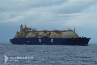
Lng Tanker
Current Trip
| Time Travelled | 5 days |
|---|---|
| Remaining Time | --- |
| Distance Travelled | 1886.05 nm |
| Remaining Distance | --- |
| AVG Speed | 14.5 Knots |
| MAX Speed | 17.2 Knots |
| AVG Wind | 12.3 knots |
| MAX Wind | 25 knots |
| MIN Temp | 20.7°C / 69.26°F |
| MAX Temp | 30.7°C / 87.26°F |
| Draught | 10.1 m |
| Position Received | 5 d ago |
Current Position
| Longitude | 125.68029° |
|---|---|
| Latitude | 36.21504° |
| Status | Under way using engine |
| Speed | 16.3 Knots |
| Course | 206.5° |
| Area | Yellow Sea |
| Station | T-AIS |
| Position Received | 5 d ago |
Info
Information
The current position of HYUNDAI TECHNOPIA is in Yellow Sea with coordinates 36.21504° / 125.68029° as reported on 2024-06-21 07:56 by AIS to our vessel tracker app. The vessel's current speed is 16.3 Knots and is heading at the port of RAS LAFFAN. The estimated time of arrival as calculated by vessel tracking app is 2024-07-08 23:01 LT
The vessel HYUNDAI TECHNOPIA (IMO: 9155145, MMSI: 538009552) is a Lng Tanker that was built in 1999 ( 25 years old ). It's sailing under the flag of [MH] Marshall Is.
In this page you can find informations about the vessels current position, last detected port calls, and current voyage information. If the vessels is not in coverage by AIS you will find the latest position.
The current position of HYUNDAI TECHNOPIA is detected by our AIS receivers and we are not responsible for the reliability of the data. The last position was recorded while the vessel was in Coverage by the Ais receivers of our vessel tracking app.
The current draught of HYUNDAI TECHNOPIA as reported by AIS is 10.1 meters
Weather
| Temperature | 28.5°C / 83.3°F |
|---|---|
| Wind Speed | 3 knots |
| Direction | 189° S |
| Pressure | 1008.7 hPa |
| Humidity | 71.6 % |
| Cloud Coverage | 100 % |
Featured Company
Last Port Calls
| Port | Arrival | Departure | Time In Port |
|---|---|---|---|
| 2024-06-20 04:34 | 2024-06-21 01:51 | 21 h | |
| 2024-05-31 21:44 | 2024-06-01 21:53 | 1 d | |
| 2024-04-26 07:10 | 2024-04-27 05:42 | 22 h | |
| 2024-04-06 23:06 | 2024-04-07 19:42 | 20 h |
Most Visited Ports (Last year)
| Port | Arrivals | |
|---|---|---|
| 8 | ||
| 5 | ||
| 1 |
Last Trips
| Origin | Departure | Destination | Arrival | Distance | |
|---|---|---|---|---|---|
| 2024-06-02 00:53 | 2024-06-20 13:34 | 6815.43 nm | |||
| 2024-04-27 14:42 | 2024-06-01 00:44 | 7144.34 nm | |||
| 2024-04-07 22:42 | 2024-04-26 16:10 | 6718.21 nm | |||
| 2024-03-21 10:48 | 2024-04-07 02:06 | 6386.87 nm |
Events
| Time | Event | Details | Position / Dest | Info |
|---|---|---|---|---|
| 2024-06-21 07:57 | Status Changed | Default Under way using engine |
36.21175 / 125.67822
KRPTK->QARLF
|
Speed: 16.3 kn Course: 206.5° |
| 2024-06-21 07:56 | OUT of Coverage |
36.21504 / 125.68029
Yellow Sea
KRPTK->QARLF
|
Speed: 16.3 kn Course: 206.5° |
|
| 2024-06-21 07:35 | Status Changed | Under way using engine Default |
36.30113 / 125.72770
KRPTK->QARLF
|
Speed: 16 kn Course: 202° |
| 2024-06-21 07:27 | Status Changed | Default Under way using engine |
36.33723 / 125.74504
KRPTK->QARLF
|
Speed: 16 kn Course: 202.2° |
| 2024-06-21 05:47 | Status Changed | Under way using engine Default |
36.74426 / 125.92267
KRPTK->QARLF
|
Speed: 14.8 kn Course: 208° |
| 2024-06-21 05:10 | Status Changed | Default Under way using engine |
36.87507 / 126.01876
KRPTK->QARLF
|
Speed: 14.6 kn Course: 218.7° |
| 2024-06-21 05:00 | Status Changed | Under way using engine Default |
36.90705 / 126.05167
KRPTK->QARLF
|
Speed: 14.5 kn Course: 215° |
| 2024-06-21 04:25 | Status Changed | Default Under way using engine |
37.01042 / 126.16738
KRPTK->QARLF
|
Speed: 14.1 kn Course: 235.9° |
| 2024-06-21 01:51 | PORT DEPARTURE |
|
37.01435 / 126.70775
KRPTK->QARLF
|
Speed: 10.3 kn Course: 325° |
| 2024-06-21 01:25 | START Moving |
37.00224 / 126.77106
[KR] PYEONGTAEK
|
Speed: 3.5 kn Course: 235° |