
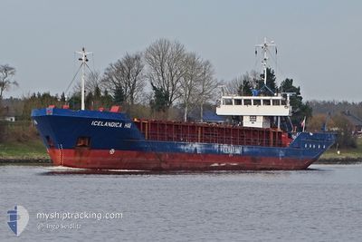
ICELANDICA HAV
General Cargo
Current Trip
| Time Travelled | 1 day |
|---|---|
| Remaining Time | 7 h, 38 mins |
| Distance Travelled | 229.48 nm |
| Remaining Distance | 69.52 nm |
| AVG Speed | 8.7 Knots |
| MAX Speed | 9.5 Knots |
| AVG Wind | 10.6 knots |
| MAX Wind | 19 knots |
| MIN Temp | 16.5°C / 61.7°F |
| MAX Temp | 17.9°C / 64.22°F |
| Draught | 3.3 m |
| Position Received | 1 m ago |
Current Position
| Longitude | -10.08682° |
|---|---|
| Latitude | 38.75338° |
| Status | Under way using engine |
| Speed | 9.1 Knots |
| Course | 178° |
| Area | North Atlantic Ocean |
| Station | T-AIS |
| Position Received | 1 m ago |
Info
Information
The current position of ICELANDICA HAV is in North Atlantic Ocean with coordinates 38.75338° / -10.08682° as reported on 2024-06-06 18:39 by AIS to our vessel tracker app. The vessel's current speed is 9.1 Knots and is heading at the port of SETUBAL. The estimated time of arrival as calculated by vessel tracking app is 2024-06-07 02:18 LT
The vessel ICELANDICA HAV (IMO: 8128884, MMSI: 309175000) is a General Cargo that was built in 1982 ( 42 years old ). It's sailing under the flag of [BS] Bahamas.
In this page you can find informations about the vessels current position, last detected port calls, and current voyage information. If the vessels is not in coverage by AIS you will find the latest position.
The current position of ICELANDICA HAV is detected by our AIS receivers and we are not responsible for the reliability of the data. The last position was recorded while the vessel was in Coverage by the Ais receivers of our vessel tracking app.
The current draught of ICELANDICA HAV as reported by AIS is 3.3 meters
Weather
| Temperature | 17.4°C / 63.32°F |
|---|---|
| Wind Speed | 19 knots |
| Direction | 2° N |
| Pressure | 1012.4 hPa |
| Humidity | 83.6 % |
| Cloud Coverage | 100 % |
Featured Company
Last Port Calls
| Port | Arrival | Departure | Time In Port |
|---|---|---|---|
| 2024-06-05 11:32 | 2024-06-05 16:35 | 5 h | |
| 2024-05-30 18:39 | 2024-05-30 21:37 | 2 h | |
| 2024-05-28 16:09 | 2024-05-29 20:36 | 1 d | |
| 2024-05-28 14:56 | 2024-05-28 15:10 | 14 m | |
| 2024-05-03 20:38 | 2024-05-07 18:40 | 3 d | |
| 2024-05-02 14:33 | 2024-05-02 22:05 | 7 h | |
| 2024-04-24 23:39 | 2024-04-25 01:07 | 1 h | |
| 2024-04-23 03:15 | 2024-04-23 03:30 | 14 m | |
| 2024-04-17 18:57 | 2024-04-19 20:54 | 2 d | |
| 2024-04-14 00:36 | 2024-04-16 19:22 | 2 d |
Last Trips
| Origin | Departure | Destination | Arrival | Distance | |
|---|---|---|---|---|---|
| 2024-05-30 23:37 | 2024-06-05 13:32 | 916.57 nm | |||
| 2024-05-29 22:36 | 2024-05-30 20:39 | 4.80 nm | |||
| 2024-05-28 17:10 | 2024-05-28 18:09 | 8.36 nm | |||
| 2024-05-07 19:40 | 2024-05-28 16:56 | 2524.13 nm | |||
| 2024-05-02 23:05 | 2024-05-03 21:38 | 206.57 nm | |||
| 2024-04-25 03:07 | 2024-05-02 15:33 | 1168.11 nm | |||
| 2024-04-23 05:30 | 2024-04-25 01:39 | 18.54 nm | |||
| 2024-04-19 21:54 | 2024-04-23 05:15 | 205.41 nm | |||
| 2024-04-16 21:22 | 2024-04-17 19:57 | 199.46 nm | |||
| 2024-04-12 22:33 | 2024-04-14 02:36 | 232.08 nm |
Events
| Time | Event | Details | Position / Dest | Info |
|---|---|---|---|---|
| 2024-06-06 10:15 | IN Coverage |
39.96831 / -9.98998
North Atlantic Ocean
SETUBAL
|
Speed: 8.4 kn Course: 196.3° |
|
| 2024-06-06 07:52 | OUT of Coverage |
40.30811 / -9.83878
North Atlantic Ocean
SETUBAL
|
Speed: 9.4 kn Course: 198.8° |
|
| 2024-06-06 07:52 | Detected in Sea | Portuguese part of the North Atlantic Ocean |
40.30811 / -9.83878
North Atlantic Ocean
SETUBAL
|
Speed: 9.4 kn Course: 198.8° |
| 2024-06-06 07:51 | IN Coverage |
40.30811 / -9.83878
North Atlantic Ocean
SETUBAL
|
Speed: 9.4 kn Course: 198.8° |
|
| 2024-06-05 19:03 | OUT of Coverage |
42.15853 / -9.01243
North Atlantic Ocean
SETUBAL
|
Speed: 9.1 kn Course: 199.4° |
|
| 2024-06-05 19:03 | Status Changed | Under way using engine Default |
42.15853 / -9.01243
SETUBAL
|
Speed: 8.9 kn Course: 199° |
| 2024-06-05 19:00 | Status Changed | Default Under way using engine |
42.16602 / -9.00892
SETUBAL
|
Speed: 8.8 kn Course: 196.6° |
| 2024-06-05 17:01 | Draught Changed | 3.3 3.8 |
42.37339 / -8.77331
SETUBAL
|
Speed: 8.8 kn Course: 232.5° |
| 2024-06-05 17:01 | Destination Changed | SETUBAL MARIN |
42.37339 / -8.77331
SETUBAL
|
Speed: 8.8 kn Course: 232.5° |
| 2024-06-05 17:01 | ETA Changed | 2024/06/07 06:00 2024/06/04 17:00 |
42.37339 / -8.77331
SETUBAL
|
Speed: 8.8 kn Course: 232.5° |