
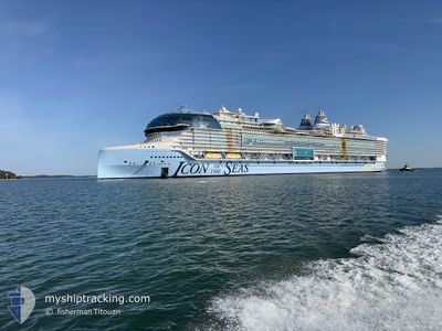
ICON OF THE SEAS
Passenger
Current Trip
| Time Travelled | 1 day |
|---|---|
| Remaining Time | --- |
| Distance Travelled | 459.75 nm |
| Remaining Distance | --- |
| AVG Speed | 17.9 Knots |
| MAX Speed | 22.8 Knots |
| AVG Wind | 11.1 knots |
| MAX Wind | 17 knots |
| MIN Temp | 25.1°C / 77.18°F |
| MAX Temp | 29.1°C / 84.38°F |
| Draught | 9.4 m |
| Position Received | 8 h, 56 m ago |
Current Position
| Longitude | -74.96417° |
|---|---|
| Latitude | 24.78537° |
| Status | Under way using engine |
| Speed | 18.8 Knots |
| Course | 120.5° |
| Area | North Atlantic Ocean |
| Station | T-AIS |
| Position Received | 8 h, 56 m ago |
Info
Information
The current position of ICON OF THE SEAS is in North Atlantic Ocean with coordinates 24.78537° / -74.96417° as reported on 2024-05-19 12:43 by AIS to our vessel tracker app. The vessel's current speed is 18.8 Knots and is heading at the port of BASSETERRE. The estimated time of arrival as calculated by vessel tracking app is 2024-05-21 11:00 LT
The vessel ICON OF THE SEAS (IMO: 9829930, MMSI: 311001178) is a Passenger It's sailing under the flag of [BS] Bahamas.
In this page you can find informations about the vessels current position, last detected port calls, and current voyage information. If the vessels is not in coverage by AIS you will find the latest position.
The current position of ICON OF THE SEAS is detected by our AIS receivers and we are not responsible for the reliability of the data. The last position was recorded while the vessel was in Coverage by the Ais receivers of our vessel tracking app.
The current draught of ICON OF THE SEAS as reported by AIS is 9.4 meters
Weather
| Temperature | 26.9°C / 80.42°F |
|---|---|
| Wind Speed | 4 knots |
| Direction | 79° E |
| Pressure | 1014.3 hPa |
| Humidity | 76.6 % |
| Cloud Coverage | 69 % |
Featured Company
Last Port Calls
| Port | Arrival | Departure | Time In Port |
|---|---|---|---|
| 2024-05-18 06:28 | 2024-05-18 21:34 | 15 h | |
| 2024-05-15 11:38 | 2024-05-15 23:24 | 11 h | |
| 2024-05-13 12:57 | 2024-05-13 23:20 | 10 h | |
| 2024-05-11 06:56 | 2024-05-11 21:32 | 14 h | |
| 2024-05-07 11:28 | 2024-05-07 22:09 | 10 h | |
| 2024-05-04 06:56 | 2024-05-04 22:13 | 15 h | |
| 2024-05-01 11:29 | 2024-05-01 23:23 | 11 h | |
| 2024-04-30 12:37 | 2024-04-30 22:12 | 9 h | |
| 2024-04-29 13:01 | 2024-04-29 23:17 | 10 h | |
| 2024-04-27 07:00 | 2024-04-27 21:22 | 14 h |
Most Visited Ports (Last year)
| Port | Arrivals | |
|---|---|---|
| 22 | ||
| 8 | ||
| 5 | ||
| 4 | ||
| 4 | ||
| 3 |
Last Trips
| Origin | Departure | Destination | Arrival | Distance | |
|---|---|---|---|---|---|
| 2024-05-15 18:24 | 2024-05-18 02:28 | 789.61 nm | |||
| 2024-05-13 17:20 | 2024-05-15 06:38 | 419.05 nm | |||
| 2024-05-11 17:32 | 2024-05-13 06:57 | 759.19 nm | |||
| 2024-05-07 18:09 | 2024-05-11 02:56 | 1112.37 nm | |||
| 2024-05-04 18:13 | 2024-05-07 07:28 | 1091.12 nm | |||
| 2024-05-01 18:23 | 2024-05-04 02:56 | 789.07 nm | |||
| 2024-04-30 17:12 | 2024-05-01 06:29 | 122.61 nm | |||
| 2024-04-29 17:17 | 2024-04-30 07:37 | 166.08 nm | |||
| 2024-04-27 17:22 | 2024-04-29 07:01 | 760.62 nm | |||
| 2024-04-23 17:58 | 2024-04-27 03:00 | 1148.51 nm |
Events
| Time | Event | Details | Position / Dest | Info |
|---|---|---|---|---|
| 2024-05-19 12:47 | Status Changed | Default Under way using engine |
24.77514 / -74.94491
KN BAS
|
Speed: 18.8 kn Course: 120.5° |
| 2024-05-19 12:43 | OUT of Coverage |
24.78537 / -74.96417
North Atlantic Ocean
KN BAS
|
Speed: 18.8 kn Course: 120.5° |
|
| 2024-05-19 12:40 | Status Changed | Under way using engine Default |
24.79316 / -74.97911
KN BAS
|
Speed: 18.6 kn Course: 121° |
| 2024-05-19 12:35 | Status Changed | Default Under way using engine |
24.80463 / -75.00092
KN BAS
|
Speed: 18.2 kn Course: 119.8° |
| 2024-05-19 06:49 | Status Changed | Under way using engine Default |
25.72924 / -76.96688
KN BAS
|
Speed: 22 kn Course: 102° |
| 2024-05-19 06:46 | Status Changed | Default Under way using engine |
25.73333 / -76.98500
KN BAS
|
Speed: 21.2 kn Course: 94.5° |
| 2024-05-19 06:35 | Status Changed | Under way using engine Default |
25.73700 / -77.05457
KN BAS
|
Speed: 21 kn Course: 98° |
| 2024-05-19 06:14 | Status Changed | Default Under way using engine |
25.75493 / -77.19043
KN BAS
|
Speed: 20.8 kn Course: 98.3° |
| 2024-05-19 05:53 | Status Changed | Under way using engine Default |
25.78615 / -77.32207
KN BAS
|
Speed: 21 kn Course: 107° |
| 2024-05-19 05:45 | Status Changed | Default Under way using engine |
25.79833 / -77.36667
KN BAS
|
Speed: 21.1 kn Course: 109.6° |