
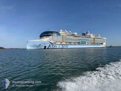
ICON OF THE SEAS
Passenger
Current Trip
| Time Travelled | 2 days |
|---|---|
| Remaining Time | 4 h, 34 mins |
| Distance Travelled | 712.12 nm |
| Remaining Distance | --- |
| AVG Speed | 17.6 Knots |
| MAX Speed | 23.7 Knots |
| AVG Wind | 7.4 knots |
| MAX Wind | 13.4 knots |
| MIN Temp | 27.9°C / 82.22°F |
| MAX Temp | 29.8°C / 85.64°F |
| Draught | 9.4 m |
| Position Received | 52 m ago |
Current Position
| Longitude | -79.02721° |
|---|---|
| Latitude | 26.19851° |
| Status | Under way using engine |
| Speed | 18.3 Knots |
| Course | 270.1° |
| Area | North Atlantic Ocean |
| Station | T-AIS |
| Position Received | 52 m ago |
Info
Information
The current position of ICON OF THE SEAS is in North Atlantic Ocean with coordinates 26.19851° / -79.02721° as reported on 2024-06-29 01:11 by AIS to our vessel tracker app. The vessel's current speed is 18.3 Knots and is heading at the port of MIAMI. The estimated time of arrival as calculated by vessel tracking app is 2024-06-29 06:37 LT
The vessel ICON OF THE SEAS (IMO: 9829930, MMSI: 311001178) is a Passenger It's sailing under the flag of [BS] Bahamas.
In this page you can find informations about the vessels current position, last detected port calls, and current voyage information. If the vessels is not in coverage by AIS you will find the latest position.
The current position of ICON OF THE SEAS is detected by our AIS receivers and we are not responsible for the reliability of the data. The last position was recorded while the vessel was in Coverage by the Ais receivers of our vessel tracking app.
The current draught of ICON OF THE SEAS as reported by AIS is 9.4 meters
Weather
| Temperature | 29.2°C / 84.56°F |
|---|---|
| Wind Speed | 8 knots |
| Direction | 138° SE |
| Pressure | 1016.8 hPa |
| Humidity | 77 % |
| Cloud Coverage | 87 % |
Featured Company
Last Port Calls
| Port | Arrival | Departure | Time In Port |
|---|---|---|---|
| 2024-06-26 11:32 | 2024-06-26 23:02 | 11 h | |
| 2024-06-25 13:18 | 2024-06-25 22:33 | 9 h | |
| 2024-06-24 12:53 | 2024-06-24 23:43 | 10 h | |
| 2024-06-22 06:31 | 2024-06-22 21:57 | 15 h | |
| 2024-06-18 11:43 | 2024-06-18 22:03 | 10 h | |
| 2024-06-15 06:23 | 2024-06-15 21:34 | 15 h | |
| 2024-06-12 11:41 | 2024-06-12 22:59 | 11 h | |
| 2024-06-11 12:57 | 2024-06-11 22:42 | 9 h | |
| 2024-06-10 12:42 | 2024-06-10 23:27 | 10 h | |
| 2024-06-08 06:32 | 2024-06-08 21:47 | 15 h |
Most Visited Ports (Last year)
| Port | Arrivals | |
|---|---|---|
| 27 | ||
| 11 | ||
| 8 | ||
| 7 | ||
| 5 | ||
| 5 |
Last Trips
| Origin | Departure | Destination | Arrival | Distance | |
|---|---|---|---|---|---|
| 2024-06-25 17:33 | 2024-06-26 06:32 | 122.49 nm | |||
| 2024-06-24 17:43 | 2024-06-25 08:18 | 156.05 nm | |||
| 2024-06-22 17:57 | 2024-06-24 06:53 | 757.01 nm | |||
| 2024-06-18 18:03 | 2024-06-22 02:31 | 1146.23 nm | |||
| 2024-06-15 17:34 | 2024-06-18 07:43 | 1133.82 nm | |||
| 2024-06-12 17:59 | 2024-06-15 02:23 | 772.82 nm | |||
| 2024-06-11 17:42 | 2024-06-12 06:41 | 124.50 nm | |||
| 2024-06-10 17:27 | 2024-06-11 07:57 | 165.58 nm | |||
| 2024-06-08 17:47 | 2024-06-10 06:42 | 758.47 nm | |||
| 2024-06-04 18:19 | 2024-06-08 02:32 | 1112.10 nm |
Events
| Time | Event | Details | Position / Dest | Info |
|---|---|---|---|---|
| 2024-06-29 01:16 | Status Changed | Default Under way using engine |
26.19306 / -79.05416
BS COC
|
Speed: 18.3 kn Course: 270.1° |
| 2024-06-29 01:10 | Status Changed | Under way using engine Default |
26.19843 / -79.02391
BS COC
|
Speed: 18.1 kn Course: 285° |
| 2024-06-29 00:48 | Status Changed | Default Under way using engine |
26.16315 / -78.90662
BS COC
|
Speed: 17.7 kn Course: 289.3° |
| 2024-06-29 00:42 | Status Changed | Under way using engine Default |
26.15354 / -78.87733
BS COC
|
Speed: 17.8 kn Course: 290° |
| 2024-06-29 00:31 | IN Coverage |
26.15354 / -78.87733
North Atlantic Ocean
|
Speed: 17.7 kn Course: 289.3° |
|
| 2024-06-28 21:17 | START Moving | 1.22 nm, North of COCOCAY |
25.83919 / -77.93694
BS COC
|
Speed: 7.8 kn Course: 325° |
| 2024-06-28 10:31 | STOP Moving | 0.36 nm, North of COCOCAY |
25.82485 / -77.93622
BS COC
|
Speed: 0.1 kn Course: 21° |
| 2024-06-28 04:40 | Status Changed | Default Under way using engine |
26.19936 / -79.12110
BS COC
|
Speed: 17.9 kn Course: 65° |
| 2024-06-28 04:32 | OUT of Coverage |
26.18892 / -79.15648
North Atlantic Ocean
BS COC
|
Speed: 17.9 kn Course: 65° |
|
| 2024-06-28 01:50 | Change Sea Area | Bahamas part of the North Atlantic Ocean United States part of the North Atlantic Ocean |
25.46350 / -79.69608
North Atlantic Ocean
BS COC
|
Speed: 20.8 kn Course: 17.6° |