
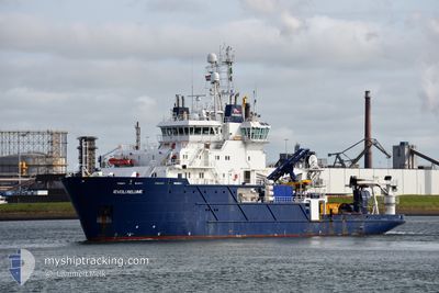
IEVOLI RELUME
Buoy-laying Vessel
Current Trip
| Time Travelled | 5 days |
|---|---|
| Remaining Time | 6 h, 0 mins |
| Distance Travelled | 262.93 nm |
| Remaining Distance | 33.59 nm |
| AVG Speed | 7.8 Knots |
| MAX Speed | 10.5 Knots |
| AVG Wind | 6.6 knots |
| MAX Wind | 16.3 knots |
| MIN Temp | 16.3°C / 61.34°F |
| MAX Temp | 20.3°C / 68.54°F |
| Draught | 4.5 m |
| Position Received | 6 m ago |
Current Position
| Longitude | 10.18350° |
|---|---|
| Latitude | 42.89833° |
| Status | Restricted manoeuverability |
| Speed | |
| Course | 121° |
| Area | Tyrrhenian Sea |
| Station | T-AIS |
| Position Received | 6 m ago |
Info
Information
The current position of IEVOLI RELUME is in Tyrrhenian Sea with coordinates 42.89833° / 10.18350° as reported on 2024-05-23 06:50 by AIS to our vessel tracker app. The vessel's current speed is 0 Knots and is heading at the port of BASTIA. The estimated time of arrival as calculated by vessel tracking app is 2024-05-23 12:56 LT
The vessel IEVOLI RELUME (IMO: 9280720, MMSI: 247483600) is a Buoy-laying Vessel that was built in 2004 ( 20 years old ). It's sailing under the flag of [IT] Italy.
In this page you can find informations about the vessels current position, last detected port calls, and current voyage information. If the vessels is not in coverage by AIS you will find the latest position.
The current position of IEVOLI RELUME is detected by our AIS receivers and we are not responsible for the reliability of the data. The last position was recorded while the vessel was in Coverage by the Ais receivers of our vessel tracking app.
The current draught of IEVOLI RELUME as reported by AIS is 4.5 meters
Weather
| Temperature | 17.9°C / 64.22°F |
|---|---|
| Wind Speed | 9 knots |
| Direction | 105° ESE |
| Pressure | 1016.7 hPa |
| Humidity | 70.2 % |
| Cloud Coverage | 66 % |
Featured Company
Events
| Time | Event | Details | Position / Dest | Info |
|---|---|---|---|---|
| 2024-05-23 06:37 | STOP Moving | 8.82 nm, North West of PORTO FERRAIO |
42.89850 / 10.18300
OFFSHORE BASTIA
|
Speed: Course: 65° |
| 2024-05-23 06:19 | START Moving | 9.06 nm, North of MARINA DI CAMPO |
42.88533 / 10.16350
OFFSHORE BASTIA
|
Speed: 4 kn Course: 46° |
| 2024-05-23 05:54 | IN Coverage |
42.88283 / 10.16117
Tyrrhenian Sea
|
Speed: Course: 62° |
|
| 2024-05-23 04:22 | OUT of Coverage |
42.87300 / 10.15033
Tyrrhenian Sea
|
Speed: 5.7 kn Course: 33.8° |
|
| 2024-05-23 04:22 | START Moving | 8.63 nm, North West of MARINA DI CAMPO |
42.87300 / 10.15033
OFFSHORE BASTIA
|
Speed: 5.7 kn Course: 33.8° |
| 2024-05-23 03:02 | STOP Moving | 8.52 nm, North West of MARINA DI CAMPO |
42.86933 / 10.14633
OFFSHORE BASTIA
|
Speed: 0.3 kn Course: 130° |
| 2024-05-23 02:50 | START Moving | 8.86 nm, North West of MARINA DI CAMPO |
42.86617 / 10.12483
OFFSHORE BASTIA
|
Speed: 4.6 kn Course: 80° |
| 2024-05-23 01:34 | STOP Moving | 8.94 nm, North West of MARINA DI CAMPO |
42.86483 / 10.11933
OFFSHORE BASTIA
|
Speed: 0.3 kn Course: 134° |
| 2024-05-23 01:16 | START Moving | 9.08 nm, North West of MARINA DI CAMPO |
42.84983 / 10.09167
OFFSHORE BASTIA
|
Speed: 3.2 kn Course: 53° |
| 2024-05-23 00:20 | STOP Moving | 9.11 nm, North West of MARINA DI CAMPO |
42.84867 / 10.08917
OFFSHORE BASTIA
|
Speed: 0.2 kn Course: 185° |