
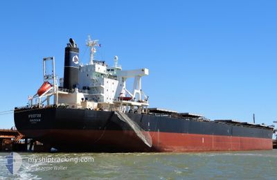
IFESTOS
Bulk Carrier
Current Trip
| Time Travelled | 2 days |
|---|---|
| Remaining Time | --- |
| Distance Travelled | 776.47 nm |
| Remaining Distance | --- |
| AVG Speed | 14.2 Knots |
| MAX Speed | 17.9 Knots |
| AVG Wind | 9.5 knots |
| MAX Wind | 14.8 knots |
| MIN Temp | 11.5°C / 52.7°F |
| MAX Temp | 21.7°C / 71.06°F |
| Draught | 9.1 m |
| Position Received | 1 d ago |
Current Position
| Longitude | 144.43740° |
|---|---|
| Latitude | 37.67035° |
| Status | Under way using engine |
| Speed | 14.1 Knots |
| Course | 48.5° |
| Area | North Pacific Ocean |
| Station | T-AIS |
| Position Received | 1 d ago |
Info
Information
The current position of IFESTOS is in North Pacific Ocean with coordinates 37.67035° / 144.43740° as reported on 2024-05-19 12:19 by AIS to our vessel tracker app. The vessel's current speed is 14.1 Knots and is heading at the port of TSAWWASSEN. The estimated time of arrival as calculated by vessel tracking app is 2024-06-01 23:30 LT
The vessel IFESTOS (IMO: 9574133, MMSI: 311001026) is a Bulk Carrier that was built in 2010 ( 14 years old ). It's sailing under the flag of [BS] Bahamas.
In this page you can find informations about the vessels current position, last detected port calls, and current voyage information. If the vessels is not in coverage by AIS you will find the latest position.
The current position of IFESTOS is detected by our AIS receivers and we are not responsible for the reliability of the data. The last position was recorded while the vessel was in Coverage by the Ais receivers of our vessel tracking app.
The current draught of IFESTOS as reported by AIS is 9.1 meters
Weather
| Temperature | 11.2°C / 52.16°F |
|---|---|
| Wind Speed | 14 knots |
| Direction | 182° S |
| Pressure | 1010.2 hPa |
| Humidity | 99.9 % |
| Cloud Coverage | 100 % |
Featured Company
Most Visited Ports (Last year)
| Port | Arrivals | |
|---|---|---|
| 2 | ||
| 1 | ||
| 1 | ||
| 1 | ||
| 1 | ||
| 1 |
Events
| Time | Event | Details | Position / Dest | Info |
|---|---|---|---|---|
| 2024-05-19 12:25 | Status Changed | Default Under way using engine |
37.68417 / 144.45961
CARTB
|
Speed: 14.1 kn Course: 48.5° |
| 2024-05-19 12:19 | OUT of Coverage |
37.67035 / 144.43740
North Pacific Ocean
CARTB
|
Speed: 14.1 kn Course: 48.5° |
|
| 2024-05-19 12:16 | Status Changed | Under way using engine Default |
37.66186 / 144.42415
CARTB
|
Speed: 14 kn Course: 54° |
| 2024-05-19 12:13 | Status Changed | Default Under way using engine |
37.65502 / 144.41354
CARTB
|
Speed: 14 kn Course: 53° |
| 2024-05-19 11:58 | Status Changed | Under way using engine Default |
37.61856 / 144.35691
CARTB
|
Speed: 14.7 kn Course: 48° |
| 2024-05-19 11:49 | Status Changed | Default Under way using engine |
37.59474 / 144.31848
CARTB
|
Speed: 15.3 kn Course: 49.2° |
| 2024-05-19 11:39 | Status Changed | Under way using engine Default |
37.57149 / 144.28078
CARTB
|
Speed: 15.1 kn Course: 55° |
| 2024-05-19 11:33 | IN Coverage |
37.57331 / 144.28371
North Pacific Ocean
CARTB
|
Speed: 15.3 kn Course: 49.2° |
|
| 2024-05-19 10:38 | Status Changed | Default Under way using engine |
37.41833 / 144.02646
CARTB
|
Speed: 14.9 kn Course: 52.7° |
| 2024-05-19 10:35 | OUT of Coverage |
37.41060 / 144.01364
North Pacific Ocean
CARTB
|
Speed: 14.9 kn Course: 52.7° |