
IMAN BAHRAM MAMMADZA
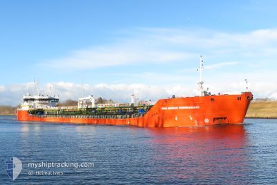
Tanker A
Current Trip
IZMAIL/UA
| Time Travelled | 21 days |
|---|---|
| Remaining Time | --- |
| Distance Travelled | 2008.35 nm |
| Remaining Distance | --- |
| AVG Speed | 8.2 Knots |
| MAX Speed | 8.2 Knots |
| AVG Wind | 10.7 knots |
| MAX Wind | 27.3 knots |
| MIN Temp | 16.7°C / 62.06°F |
| MAX Temp | 38°C / 100.4°F |
| Draught | 4.5 m |
| Position Received | 1 d ago |
Current Position
| Longitude | 29.04972° |
|---|---|
| Latitude | 41.45864° |
| Status | Under way using engine |
| Speed | 8.2 Knots |
| Course | 324.5° |
| Area | Black Sea |
| Station | T-AIS |
| Position Received | 1 d ago |
Info
Information
The current position of IMAN BAHRAM MAMMADZA is in Black Sea with coordinates 41.45864° / 29.04972° as reported on 2024-06-24 21:57 by AIS to our vessel tracker app. The vessel's current speed is 8.2 Knots
The vessel IMAN BAHRAM MAMMADZA (IMO: 9736688, MMSI: 636093084) is a Tanker A It's sailing under the flag of [LR] Liberia.
In this page you can find informations about the vessels current position, last detected port calls, and current voyage information. If the vessels is not in coverage by AIS you will find the latest position.
The current position of IMAN BAHRAM MAMMADZA is detected by our AIS receivers and we are not responsible for the reliability of the data. The last position was recorded while the vessel was in Coverage by the Ais receivers of our vessel tracking app.
The current draught of IMAN BAHRAM MAMMADZA as reported by AIS is 4.5 meters
Weather
| Temperature | 27.1°C / 80.78°F |
|---|---|
| Wind Speed | 15 knots |
| Direction | 166° SSE |
| Pressure | 1015.8 hPa |
| Humidity | 41.3 % |
| Cloud Coverage | 8 % |
Featured Company
Last Port Calls
| Port | Arrival | Departure | Time In Port |
|---|---|---|---|
| 2024-06-04 06:09 | 2024-06-05 13:00 | 1 d | |
| 2024-05-24 18:08 | 2024-05-25 18:24 | 1 d | |
| 2024-05-06 06:35 | 2024-05-07 06:11 | 23 h | |
| 2024-04-24 05:58 | 2024-04-27 16:20 | 3 d | |
| 2024-04-11 04:46 | 2024-04-12 10:54 | 1 d | |
| 2024-04-06 05:08 | 2024-04-08 21:45 | 2 d | |
| 2024-04-01 08:56 |
Last Trips
| Origin | Departure | Destination | Arrival | Distance | |
|---|---|---|---|---|---|
| 2024-05-25 21:24 | 2024-06-04 09:09 | 734.70 nm | |||
| 2024-05-07 09:11 | 2024-05-24 21:08 | 1285.50 nm | |||
| 2024-04-27 19:20 | 2024-05-06 09:35 | 1218.67 nm | |||
| 2024-04-12 13:54 | 2024-04-24 08:58 | 780.39 nm | |||
| 2024-04-09 00:45 | 2024-04-11 07:46 | 325.88 nm | |||
| 2024-04-01 11:56 | 2024-04-06 08:08 | 407.15 nm |
Events
| Time | Event | Details | Position / Dest | Info |
|---|---|---|---|---|
| 2024-06-26 13:01 | STOP Moving | 8.77 nm, North of TULCEA |
45.31785 / 28.86898
IZMAIL/UA
|
Speed: 0.1 kn Course: 271° |
| 2024-06-26 03:17 | START Moving | 7.67 nm, East of SULINA |
45.20146 / 29.81755
IZMAIL/UA
|
Speed: 8.1 kn Course: 360° |
| 2024-06-26 01:57 | STOP Moving | 7.28 nm, East of SULINA |
45.16638 / 29.81891
IZMAIL/UA
|
Speed: 0.3 kn Course: 290° |
| 2024-06-24 22:02 | Status Changed | Default Under way using engine |
41.46830 / 29.04300
IZMAIL/UA
|
Speed: 8.2 kn Course: 324.5° |
| 2024-06-24 21:57 | Status Changed | Under way using engine Default |
41.45864 / 29.04972
IZMAIL/UA
|
Speed: 7.8 kn Course: 324° |
| 2024-06-24 21:57 | OUT of Coverage |
41.45864 / 29.04972
Black Sea
IZMAIL/UA
|
Speed: 8.2 kn Course: 324.5° |
|
| 2024-06-24 21:48 | Status Changed | Default Under way using engine |
41.44344 / 29.06432
IZMAIL/UA
|
Speed: 8.2 kn Course: 324° |
| 2024-06-24 21:46 | Status Changed | Under way using engine Default |
41.43917 / 29.06841
IZMAIL/UA
|
Speed: 8.1 kn Course: 323° |
| 2024-06-24 21:30 | Status Changed | Default Under way using engine |
41.41035 / 29.09933
IZMAIL/UA
|
Speed: 8.3 kn Course: 314.3° |
| 2024-06-24 19:47 | Change Sea Area | Turkish part of the Black Sea Turkish part of the Sea of Marmara |
41.23147 / 29.14558
Black Sea
IZMAIL/UA
|
Speed: 8.1 kn Course: 26.1° |