
INCRA
General Cargo
Current Trip
| Time Travelled | 13 days |
|---|---|
| Remaining Time | --- |
| Distance Travelled | 1964.55 nm |
| Remaining Distance | --- |
| AVG Speed | 7.3 Knots |
| MAX Speed | 11.3 Knots |
| AVG Wind | 20.2 knots |
| MAX Wind | 29.9 knots |
| MIN Temp | 5.4°C / 41.72°F |
| MAX Temp | 14.5°C / 58.1°F |
| Draught | 3.6 m |
| Position Received | 5 d ago |
Current Position
| Longitude | 33.41130° |
|---|---|
| Latitude | 70.18277° |
| Status | Under way using engine |
| Speed | 10.5 Knots |
| Course | 183.5° |
| Area | Barentsz Sea |
| Station | T-AIS |
| Position Received | 5 d ago |
Info
Information
The current position of INCRA is in Barentsz Sea with coordinates 70.18277° / 33.41130° as reported on 2024-06-17 07:39 by AIS to our vessel tracker app. The vessel's current speed is 10.5 Knots and is heading at the port of ONEGA. The estimated time of arrival as calculated by vessel tracking app is 2024-06-19 08:30 LT
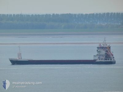
The vessel INCRA (IMO: 9195858, MMSI: 314431000) is a General Cargo that was built in 2000 ( 24 years old ). It's sailing under the flag of [BB] Barbados.
In this page you can find informations about the vessels current position, last detected port calls, and current voyage information. If the vessels is not in coverage by AIS you will find the latest position.
The current position of INCRA is detected by our AIS receivers and we are not responsible for the reliability of the data. The last position was recorded while the vessel was in Coverage by the Ais receivers of our vessel tracking app.
The current draught of INCRA as reported by AIS is 3.6 meters
Weather
| Temperature | 12.8°C / 55.04°F |
|---|---|
| Wind Speed | 17 knots |
| Direction | 111° ESE |
| Pressure | 1002.5 hPa |
| Humidity | 89.7 % |
| Cloud Coverage | 100 % |
Featured Company
Last Port Calls
| Port | Arrival | Departure | Time In Port |
|---|---|---|---|
| 2024-06-05 06:54 | 2024-06-09 21:07 | 4 d | |
| 2024-05-26 12:06 | 2024-05-26 15:52 | 3 h | |
| 2024-05-17 14:24 | 2024-05-22 13:48 | 4 d | |
| 2024-05-12 06:43 | 2024-05-14 05:07 | 1 d | |
| 2024-05-05 07:55 | 2024-05-05 12:42 | 4 h | |
| 2024-04-19 07:21 | 2024-04-26 07:42 | 7 d | |
| 2024-04-15 11:40 | 2024-04-18 12:51 | 3 d | |
| 2024-04-06 15:34 | 2024-04-06 20:50 | 5 h | |
| 2024-04-02 15:05 |
Last Trips
| Origin | Departure | Destination | Arrival | Distance | |
|---|---|---|---|---|---|
| 2024-05-26 17:52 | 2024-06-05 08:54 | 2032.09 nm | |||
| 2024-05-22 15:48 | 2024-05-26 14:06 | 902.11 nm | |||
| 2024-05-14 08:07 | 2024-05-17 16:24 | 751.88 nm | |||
| 2024-05-05 14:42 | 2024-05-12 09:43 | 1394.36 nm | |||
| 2024-04-26 09:42 | 2024-05-05 09:55 | 1950.47 nm | |||
| 2024-04-18 14:51 | 2024-04-19 09:21 | 173.69 nm | |||
| 2024-04-06 22:50 | 2024-04-15 13:40 | 1860.42 nm | |||
| 2024-04-02 17:05 | 2024-04-06 17:34 | 898.55 nm |
Events
| Time | Event | Details | Position / Dest | Info |
|---|---|---|---|---|
| 2024-06-17 07:45 | Status Changed | Default Under way using engine |
70.16666 / 33.40833
RUONG
|
Speed: 10.5 kn Course: 183.5° |
| 2024-06-17 07:39 | OUT of Coverage |
70.18277 / 33.41130
Barentsz Sea
RUONG
|
Speed: 10.5 kn Course: 183.5° |
|
| 2024-06-17 07:36 | Status Changed | Under way using engine Default |
70.19278 / 33.41322
RUONG
|
Speed: 10 kn Course: 186° |
| 2024-06-17 07:02 | Status Changed | Default Under way using engine |
70.28500 / 33.44500
RUONG
|
Speed: 9.7 kn Course: 190.3° |
| 2024-06-17 06:09 | Status Changed | Under way using engine Default |
70.23384 / 33.42843
RUONG
|
Speed: 9 kn Course: 125° |
| 2024-06-17 05:51 | IN Coverage |
70.23384 / 33.42843
Barentsz Sea
RUONG
|
Speed: 8.6 kn Course: 108.7° |
|
| 2024-06-17 04:37 | Status Changed | Default Under way using engine |
70.36538 / 32.83275
RUONG
|
Speed: 9.2 kn Course: 126.1° |
| 2024-06-17 04:25 | OUT of Coverage |
70.38321 / 32.75371
Barentsz Sea
RUONG
|
Speed: 9.2 kn Course: 126.1° |
|
| 2024-06-17 03:25 | Change Sea Area | Russian part of the Barentsz Sea Norwegian part of the Barentsz Sea |
70.47056 / 32.36869
Barentsz Sea
RUONG
|
Speed: 9.5 kn Course: 114.4° |
| 2024-06-16 11:10 | Detected in Sea | Norwegian part of the Barentsz Sea |
71.39303 / 25.29585
Barentsz Sea
RUONG
|
Speed: 9.8 kn Course: 76.7° |