
INDEPENDENCE OTS
Passengers Ship
Current Trip
PCCY
| Time Travelled | 11 h, 42 mins |
|---|---|
| Remaining Time | --- |
| Distance Travelled | 108.51 nm |
| Remaining Distance | --- |
| AVG Speed | 9.5 Knots |
| MAX Speed | 10.3 Knots |
| AVG Wind | 13.5 knots |
| MAX Wind | 16.9 knots |
| MIN Temp | 25.7°C / 78.26°F |
| MAX Temp | 32.2°C / 89.96°F |
| Draught | 9 m |
| Position Received | 8 h, 14 m ago |
Current Position
| Longitude | -79.55053° |
|---|---|
| Latitude | 26.00290° |
| Status | Under way using engine |
| Speed | 10 Knots |
| Course | 57.4° |
| Area | North Atlantic Ocean |
| Station | T-AIS |
| Position Received | 8 h, 14 m ago |
Info
Information
The current position of INDEPENDENCE OTS is in North Atlantic Ocean with coordinates 26.00290° / -79.55053° as reported on 2024-05-19 00:13 by AIS to our vessel tracker app. The vessel's current speed is 10 Knots
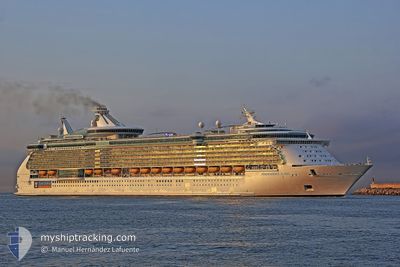
The vessel INDEPENDENCE OTS (IMO: 9349681, MMSI: 309374000) is a Passengers Ship that was built in 2008 ( 16 years old ). It's sailing under the flag of [BS] Bahamas.
In this page you can find informations about the vessels current position, last detected port calls, and current voyage information. If the vessels is not in coverage by AIS you will find the latest position.
The current position of INDEPENDENCE OTS is detected by our AIS receivers and we are not responsible for the reliability of the data. The last position was recorded while the vessel was in Coverage by the Ais receivers of our vessel tracking app.
The current draught of INDEPENDENCE OTS as reported by AIS is 9 meters
Weather
| Temperature | 27.5°C / 81.5°F |
|---|---|
| Wind Speed | 13 knots |
| Direction | 178° S |
| Pressure | 1013.2 hPa |
| Humidity | 85.7 % |
| Cloud Coverage | 17 % |
Featured Company
Last Port Calls
| Port | Arrival | Departure | Time In Port |
|---|---|---|---|
| 2024-05-18 09:17 | 2024-05-18 20:46 | 11 h | |
| 2024-05-16 10:29 | 2024-05-16 22:24 | 11 h | |
| 2024-05-13 08:39 | 2024-05-13 21:46 | 13 h | |
| 2024-05-11 12:06 | 2024-05-11 21:56 | 9 h | |
| 2024-05-09 09:07 | 2024-05-09 20:33 | 11 h | |
| 2024-05-07 10:32 | 2024-05-07 22:12 | 11 h | |
| 2024-05-04 09:31 | 2024-05-04 21:17 | 11 h | |
| 2024-05-01 13:24 | 2024-05-02 04:31 | 15 h | |
| 2024-04-30 11:18 | 2024-04-30 21:44 | 10 h | |
| 2024-04-29 12:41 | 2024-04-29 21:02 | 8 h |
Last Trips
| Origin | Departure | Destination | Arrival | Distance | |
|---|---|---|---|---|---|
| 2024-05-16 17:24 | 2024-05-18 05:17 | 528.13 nm | |||
| 2024-05-13 17:46 | 2024-05-16 05:29 | 758.26 nm | |||
| 2024-05-11 17:56 | 2024-05-13 04:39 | 311.81 nm | |||
| 2024-05-09 16:33 | 2024-05-11 08:06 | 348.53 nm | |||
| 2024-05-07 17:12 | 2024-05-09 05:07 | 527.51 nm | |||
| 2024-05-04 17:17 | 2024-05-07 05:32 | 756.69 nm | |||
| 2024-05-02 00:31 | 2024-05-04 05:31 | 956.84 nm | |||
| 2024-04-30 17:44 | 2024-05-01 09:24 | 276.03 nm | |||
| 2024-04-29 17:02 | 2024-04-30 07:18 | 136.04 nm | |||
| 2024-04-27 22:31 | 2024-04-29 08:41 | 595.32 nm |
Events
| Time | Event | Details | Position / Dest | Info |
|---|---|---|---|---|
| 2024-05-19 00:18 | Status Changed | Default Under way using engine |
26.01059 / -79.53753
PCCY
|
Speed: 10 kn Course: 57.4° |
| 2024-05-19 00:13 | OUT of Coverage |
26.00290 / -79.55053
North Atlantic Ocean
PCCY
|
Speed: 10 kn Course: 57.4° |
|
| 2024-05-19 00:08 | Status Changed | Under way using engine Default |
25.99419 / -79.56525
PCCY
|
Speed: 10.1 kn Course: 56° |
| 2024-05-19 00:05 | Status Changed | Default Under way using engine |
25.99080 / -79.57092
PCCY
|
Speed: 10 kn Course: 57.2° |
| 2024-05-18 23:25 | Detected in Sea | Bahamas part of the North Atlantic Ocean |
25.93520 / -79.68086
North Atlantic Ocean
PCCY
|
Speed: 9.9 kn Course: 64.5° |
| 2024-05-18 20:46 | PORT DEPARTURE |
|
25.76170 / -80.12835
PCCY
|
Speed: 10.5 kn Course: 114° |
| 2024-05-18 20:21 | START Moving |
25.78038 / -80.17511
[US] MIAMI
|
Speed: 3.1 kn Course: 111° |
|
| 2024-05-18 20:15 | Status Changed | Under way using engine Moored |
25.78027 / -80.17735
[US] MIAMI
|
Speed: Course: 115° |
| 2024-05-18 10:10 | Destination Changed | PCCY USMIA |
25.78027 / -80.17731
[US] MIAMI
|
Speed: 0.1 kn Course: 120° |
| 2024-05-18 10:10 | ETA Changed | 2024/05/19 10:30 2024/05/18 09:00 |
25.78027 / -80.17731
[US] MIAMI
|
Speed: 0.1 kn Course: 120° |