
INFINITY
Sailing
Current Trip
| Time Travelled | 5 days |
|---|---|
| Remaining Time | --- |
| Distance Travelled | 490.92 nm |
| Remaining Distance | 0.81 nm |
| AVG Speed | 10.3 Knots |
| MAX Speed | 11.8 Knots |
| AVG Wind | 6.7 knots |
| MAX Wind | 12.8 knots |
| MIN Temp | 16.2°C / 61.16°F |
| MAX Temp | 21.5°C / 70.7°F |
| Draught | 0 m |
| Position Received | 1 m ago |
Current Position
| Longitude | 7.01394° |
|---|---|
| Latitude | 43.53744° |
| Status | At anchor |
| Speed | |
| Course | 316° |
| Area | Mediterranean Sea - Western Basin |
| Station | T-AIS |
| Position Received | 1 m ago |
Info
Information
The current position of INFINITY is in Mediterranean Sea - Western Basin with coordinates 43.53744° / 7.01394° as reported on 2024-05-28 20:24 by AIS to our vessel tracker app. The vessel's current speed is 0 Knots and is heading at the port of CANNES. The estimated time of arrival as calculated by vessel tracking app is 2024-05-25 01:00 LT
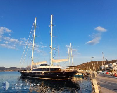
The vessel INFINITY (MMSI: 215723000) is a Sailing It's sailing under the flag of [MT] Malta.
In this page you can find informations about the vessels current position, last detected port calls, and current voyage information. If the vessels is not in coverage by AIS you will find the latest position.
The current position of INFINITY is detected by our AIS receivers and we are not responsible for the reliability of the data. The last position was recorded while the vessel was in Coverage by the Ais receivers of our vessel tracking app.
Weather
| Temperature | 19°C / 66.2°F |
|---|---|
| Wind Speed | 1 knots |
| Direction | 2° N |
| Pressure | 1014.9 hPa |
| Humidity | 79.6 % |
| Cloud Coverage | 66 % |
Featured Company
Last Port Calls
| Port | Arrival | Departure | Time In Port |
|---|---|---|---|
| 2024-05-22 12:24 | 2024-05-23 06:23 | 17 h | |
| 2024-05-18 07:15 | 2024-05-18 11:10 | 3 h | |
| 2024-05-17 06:30 | 2024-05-18 04:29 | 21 h | |
| 2024-05-16 07:05 | 2024-05-17 04:27 | 21 h | |
| 2024-05-13 13:28 | 2024-05-14 16:49 | 1 d | |
| 2024-05-10 03:12 | 2024-05-11 12:34 | 1 d | |
| 2024-05-08 05:47 | 2024-05-10 01:19 | 1 d | |
| 2024-05-06 06:57 | 2024-05-07 16:35 | 1 d | |
| 2024-05-05 07:29 |
Last Trips
| Origin | Departure | Destination | Arrival | Distance | |
|---|---|---|---|---|---|
| 2024-05-18 14:10 | 2024-05-22 14:24 | 548.54 nm | |||
| 2024-05-18 07:29 | 2024-05-18 10:15 | 29.44 nm | |||
| 2024-05-17 07:27 | 2024-05-17 09:30 | 22.14 nm | |||
| 2024-05-14 19:49 | 2024-05-16 10:05 | 87.42 nm | |||
| 2024-05-11 15:34 | 2024-05-13 16:28 | 63.82 nm | |||
| 2024-05-10 04:19 | 2024-05-10 06:12 | 20.29 nm | |||
| 2024-05-07 19:35 | 2024-05-08 08:47 | 146.56 nm | |||
| 2024-05-05 10:29 | 2024-05-06 09:57 | 49.67 nm |
Events
| Time | Event | Details | Position / Dest | Info |
|---|---|---|---|---|
| 2024-05-25 02:54 | Status Changed | At anchor Under way using engine |
43.53750 / 7.01406
CANNES
|
Speed: 0.2 kn Course: 353° |
| 2024-05-25 02:53 | STOP Moving | 0.6 nm, South West of CANNES |
43.53755 / 7.01406
CANNES
|
Speed: Course: 349° |
| 2024-05-25 02:31 | START Moving | 2.67 nm, South of CANNES |
43.49899 / 7.02325
CANNES
|
Speed: 5.6 kn Course: 352.7° |
| 2024-05-25 02:21 | STOP Moving | 2.78 nm, South of CANNES |
43.49716 / 7.02227
CANNES
|
Speed: 0.2 kn Course: 349° |
| 2024-05-24 19:39 | IN Coverage |
42.49210 / 7.93922
Mediterranean Sea - Western Basin
CANNES
|
Speed: 11.1 kn Course: 328.3° |
|
| 2024-05-24 17:51 | OUT of Coverage |
42.20246 / 8.19218
Mediterranean Sea - Western Basin
CANNES
|
Speed: 11.5 kn Course: 325.4° |
|
| 2024-05-24 15:40 | IN Coverage |
41.86742 / 8.49577
Mediterranean Sea - Western Basin
CANNES
|
Speed: 10.6 kn Course: 326.1° |
|
| 2024-05-24 14:20 | OUT of Coverage |
41.66634 / 8.66900
Mediterranean Sea - Western Basin
CANNES
|
Speed: 10.6 kn Course: 326.1° |
|
| 2024-05-24 11:52 | Change Sea Area | French part of the Mediterranean Sea - Western Basin Italian part of the Mediterranean Sea - Western Basin |
41.34064 / 9.08036
Mediterranean Sea - Western Basin
CANNES
|
Speed: 11.5 kn Course: 293.3° |
| 2024-05-24 11:29 | Change Sea Area | Italian part of the Mediterranean Sea - Western Basin Italian part of the Tyrrhenian Sea |
41.30952 / 9.16870
Mediterranean Sea - Western Basin
CANNES
|
Speed: 11.5 kn Course: 289.4° |