
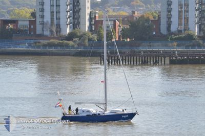
INGOT
Not available
Current Trip
Unknown
| Time Travelled | 7 days |
|---|---|
| Remaining Time | --- |
| Distance Travelled | 36.35 nm |
| Remaining Distance | --- |
| AVG Speed | 5 Knots |
| MAX Speed | 5.8 Knots |
| AVG Wind | 5.5 knots |
| MAX Wind | 8 knots |
| MIN Temp | 11.7°C / 53.06°F |
| MAX Temp | 12.4°C / 54.32°F |
| Draught | --- |
| Position Received | 2 d ago |
Current Position
| Longitude | -6.12159° |
|---|---|
| Latitude | 57.09172° |
| Status | Default |
| Speed | 5.8 Knots |
| Course | 331.2° |
| Area | Inner Seas off the West Coast of Scotland |
| Station | T-AIS |
| Position Received | 2 d ago |
Info
Information
The current position of INGOT is in Inner Seas off the West Coast of Scotland with coordinates 57.09172° / -6.12159° as reported on 2024-06-25 13:01 by AIS to our vessel tracker app. The vessel's current speed is 5.8 Knots
The vessel INGOT (MMSI: 244373735) is a Not available It's sailing under the flag of [NL] Netherlands.
In this page you can find informations about the vessels current position, last detected port calls, and current voyage information. If the vessels is not in coverage by AIS you will find the latest position.
The current position of INGOT is detected by our AIS receivers and we are not responsible for the reliability of the data. The last position was recorded while the vessel was in Coverage by the Ais receivers of our vessel tracking app.
Weather
| Temperature | 12.4°C / 54.32°F |
|---|---|
| Wind Speed | 7 knots |
| Direction | 304° NW |
| Pressure | 1020.1 hPa |
| Humidity | 84.6 % |
| Cloud Coverage | 94 % |
Featured Company
Events
| Time | Event | Details | Position / Dest | Info |
|---|---|---|---|---|
| 2024-06-25 13:01 | OUT of Coverage |
57.09172 / -6.12159
Inner Seas off the West Coast of Scotland
|
Speed: 5.8 kn Course: 331.2° |
|
| 2024-06-25 13:01 | IN Coverage |
57.09172 / -6.12159
Inner Seas off the West Coast of Scotland
|
Speed: 5.8 kn Course: 331.2° |
|
| 2024-06-23 09:54 | OUT of Coverage |
57.06203 / -6.30527
Inner Seas off the West Coast of Scotland
|
Speed: 5.6 kn Course: 102° |
|
| 2024-06-23 09:54 | IN Coverage |
57.06203 / -6.30527
Inner Seas off the West Coast of Scotland
|
Speed: 5.6 kn Course: 102° |
|
| 2024-06-20 10:49 | OUT of Coverage |
56.63219 / -6.42370
Inner Seas off the West Coast of Scotland
|
Speed: 5.2 kn Course: 44.2° |
|
| 2024-06-20 09:37 | PORT DEPARTURE |
|
56.59988 / -6.50415
|
Speed: 2.8 kn Course: 511° |
| 2024-06-20 09:28 | IN Coverage |
56.61217 / -6.51765
Inner Seas off the West Coast of Scotland
[GB] COLL
|
Speed: 2.8 kn Course: 150.4° |
|
| 2024-06-20 08:19 | OUT of Coverage |
56.62071 / -6.52168
Inner Seas off the West Coast of Scotland
[GB] COLL
|
Speed: Course: 335.9° |
|
| 2024-06-20 08:19 | IN Coverage |
56.62071 / -6.52168
Inner Seas off the West Coast of Scotland
[GB] COLL
|
Speed: Course: 335.9° |
|
| 2024-06-20 08:19 | PORT DEPARTURE |
|
56.62071 / -6.52168
|
Speed: Course: 511° |