
INLAND SEA
Cargo
Current Trip
| Time Travelled | 1 day |
|---|---|
| Remaining Time | --- |
| Distance Travelled | 131.18 nm |
| Remaining Distance | 7.26 nm |
| AVG Speed | 9.6 Knots |
| MAX Speed | 14 Knots |
| AVG Wind | 12.8 knots |
| MAX Wind | 29 knots |
| MIN Temp | 16.4°C / 61.52°F |
| MAX Temp | 20.5°C / 68.9°F |
| Draught | 6.8 m |
| Position Received | 3 m ago |
Current Position
| Longitude | 115.56619° |
|---|---|
| Latitude | -33.23900° |
| Status | At anchor |
| Speed | 1.3 Knots |
| Course | 307° |
| Area | Indian Ocean |
| Station | T-AIS |
| Position Received | 3 m ago |
Info
Information
The current position of INLAND SEA is in Indian Ocean with coordinates -33.23900° / 115.56619° as reported on 2024-06-08 19:31 by AIS to our vessel tracker app. The vessel's current speed is 1.3 Knots and is heading at the port of BUNBURY. The estimated time of arrival as calculated by vessel tracking app is 2024-06-08 02:00 LT
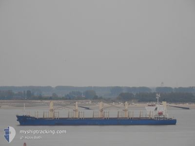
The vessel INLAND SEA (IMO: 9675731, MMSI: 538005430) is a Cargo It's sailing under the flag of [MH] Marshall Is.
In this page you can find informations about the vessels current position, last detected port calls, and current voyage information. If the vessels is not in coverage by AIS you will find the latest position.
The current position of INLAND SEA is detected by our AIS receivers and we are not responsible for the reliability of the data. The last position was recorded while the vessel was in Coverage by the Ais receivers of our vessel tracking app.
The current draught of INLAND SEA as reported by AIS is 6.8 meters
Weather
| Temperature | 19.9°C / 67.82°F |
|---|---|
| Wind Speed | 29 knots |
| Direction | 319° NW |
| Pressure | 1002.7 hPa |
| Humidity | 76.6 % |
| Cloud Coverage | 100 % |
Featured Company
Last Port Calls
| Port | Arrival | Departure | Time In Port |
|---|---|---|---|
| 2024-06-02 22:38 | 2024-06-07 15:10 | 4 d | |
| 2024-05-26 22:45 | 2024-05-31 02:12 | 4 d | |
| 2024-05-13 20:15 | 2024-05-16 04:25 | 2 d | |
| 2024-05-06 15:27 | 2024-05-10 09:09 | 3 d | |
| 2024-04-12 02:47 | 2024-04-24 07:59 | 12 d | |
| 2024-04-03 04:01 |
Most Visited Ports (Last year)
| Port | Arrivals | |
|---|---|---|
| 2 | ||
| 1 | ||
| 1 | ||
| 1 | ||
| 1 | ||
| 1 |
Last Trips
| Origin | Departure | Destination | Arrival | Distance | |
|---|---|---|---|---|---|
| 2024-05-31 10:12 | 2024-06-03 06:38 | 234.06 nm | |||
| 2024-05-16 11:25 | 2024-05-27 06:45 | 1815.78 nm | |||
| 2024-05-10 17:09 | 2024-05-14 03:15 | 1084.10 nm | |||
| 2024-04-24 15:59 | 2024-05-06 23:27 | 670.03 nm | |||
| 2024-04-03 12:01 | 2024-04-12 10:47 | 1366.91 nm |
Events
| Time | Event | Details | Position / Dest | Info |
|---|---|---|---|---|
| 2024-06-08 11:37 | Status Changed | At anchor Default |
-33.24119 / 115.56236
AUBUY
|
Speed: 0.2 kn Course: 357° |
| 2024-06-08 11:34 | Status Changed | Default At anchor |
-33.24118 / 115.56246
AUBUY
|
Speed: Course: 349° |
| 2024-06-08 02:07 | STOP Moving | 6.46 nm, North West of BUNBURY |
-33.23796 / 115.56103
AUBUY
|
Speed: 0.3 kn Course: 123° |
| 2024-06-08 02:07 | Status Changed | At anchor Under way using engine |
-33.23795 / 115.56104
AUBUY
|
Speed: 0.4 kn Course: 118° |
| 2024-06-07 23:33 | Status Changed | Under way using engine Default |
-33.02330 / 115.20975
AUBUY
|
Speed: 11.1 kn Course: 119° |
| 2024-06-07 23:32 | Status Changed | Default Under way using engine |
-33.02176 / 115.20670
AUBUY
|
Speed: 11.1 kn Course: 119.8° |
| 2024-06-07 23:23 | Status Changed | Under way using engine Default |
-33.00720 / 115.17637
AUBUY
|
Speed: 11 kn Course: 122° |
| 2024-06-07 23:04 | Status Changed | Default Under way using engine |
-32.97528 / 115.11944
AUBUY
|
Speed: 10.4 kn Course: 131° |
| 2024-06-07 22:48 | Draught Changed | 6.8 8 |
-32.93841 / 115.06779
AUBUY
|
Speed: 11.1 kn Course: 130° |
| 2024-06-07 22:48 | Destination Changed | AUBUY AUKWI |
-32.93841 / 115.06779
AUBUY
|
Speed: 11.1 kn Course: 130° |