
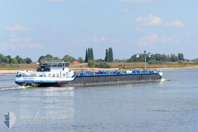
INVADO
Tanker
Current Trip
| Time Travelled | 2 days |
|---|---|
| Remaining Time | --- |
| Distance Travelled | 156.14 nm |
| Remaining Distance | --- |
| AVG Speed | 5.7 Knots |
| MAX Speed | 7.2 Knots |
| AVG Wind | 6.8 knots |
| MAX Wind | 9 knots |
| MIN Temp | 10.3°C / 50.54°F |
| MAX Temp | 19°C / 66.2°F |
| Draught | 0 m |
| Position Received | 23 h, 9 m ago |
Current Position
| Longitude | 8.40912° |
|---|---|
| Latitude | 49.78926° |
| Status | Moored |
| Speed | 3.1 Knots |
| Course | 160° |
| Area | North Sea |
| Station | T-AIS |
| Position Received | 23 h, 9 m ago |
Info
Information
The current position of INVADO is in North Sea with coordinates 49.78926° / 8.40912° as reported on 2024-06-03 10:11 by AIS to our vessel tracker app. The vessel's current speed is 3.1 Knots and is heading at the port of GELSENKIRCHEN. The estimated time of arrival as calculated by vessel tracking app is 2024-06-02 08:26 LT
The vessel INVADO (MMSI: 244921844) is a Tanker It's sailing under the flag of [NL] Netherlands.
In this page you can find informations about the vessels current position, last detected port calls, and current voyage information. If the vessels is not in coverage by AIS you will find the latest position.
The current position of INVADO is detected by our AIS receivers and we are not responsible for the reliability of the data. The last position was recorded while the vessel was in Coverage by the Ais receivers of our vessel tracking app.
Weather
| Temperature | 9.9°C / 49.82°F |
|---|---|
| Wind Speed | 2 knots |
| Direction | 319° NW |
| Pressure | 1017.9 hPa |
| Humidity | 88.5 % |
| Cloud Coverage | 60 % |
Featured Company
Last Port Calls
| Port | Arrival | Departure | Time In Port |
|---|---|---|---|
| 2024-06-01 16:12 | 2024-06-01 17:54 | 1 h | |
| 2024-06-01 13:29 | |||
| 2024-06-01 13:22 | |||
| 2024-06-01 04:30 | 2024-06-01 05:45 | 1 h | |
| 2024-05-29 00:26 | 2024-05-29 04:49 | 4 h | |
| 2024-05-27 18:58 | 2024-05-28 17:33 | 22 h | |
| 2024-05-25 09:59 | 2024-05-27 13:57 | 2 d | |
| 2024-05-23 09:57 | 2024-05-23 10:30 | 33 m | |
| 2024-05-20 18:02 | 2024-05-21 03:00 | 8 h | |
| 2024-05-20 00:21 | 2024-05-20 11:43 | 11 h |
Most Visited Ports (Last year)
| Port | Arrivals | |
|---|---|---|
| 24 | ||
| 16 | ||
| 16 | ||
| 10 | ||
| 9 | ||
| 9 |
Last Trips
| Origin | Departure | Destination | Arrival | Distance | |
|---|---|---|---|---|---|
| 2024-06-01 15:22 | 2024-06-01 18:12 | 11.84 nm | |||
| 2024-06-01 07:45 | 2024-06-01 15:29 | 35.94 nm | |||
| 2024-05-29 06:49 | 2024-06-01 06:30 | 217.89 nm | |||
| 2024-05-28 19:33 | 2024-05-29 02:26 | 44.05 nm | |||
| 2024-05-27 15:57 | 2024-05-27 20:58 | 37.88 nm | |||
| 2024-05-23 12:30 | 2024-05-25 11:59 | 153.49 nm | |||
| 2024-05-21 05:00 | 2024-05-23 11:57 | 175.99 nm | |||
| 2024-05-20 13:43 | 2024-05-20 20:02 | 52.38 nm | |||
| 2024-05-20 02:04 | 2024-05-20 02:21 | 1.55 nm | |||
| 2024-05-18 20:14 | 2024-05-18 20:29 | 1.09 nm |
Events
| Time | Event | Details | Position / Dest | Info |
|---|---|---|---|---|
| 2024-06-03 10:11 | OUT of Coverage |
49.78926 / 8.40912
North Sea
|
Speed: 3.1 kn Course: 159° |
|
| 2024-06-03 09:50 | Status Changed | Moored Default |
49.81880 / 8.38300
GELSENKIRCHEN
|
Speed: 6 kn Course: 176° |
| 2024-06-03 09:44 | Status Changed | Default Moored |
49.82667 / 8.37667
GELSENKIRCHEN
|
Speed: 5.8 kn Course: 188.6° |
| 2024-06-03 06:50 | START Moving | 1.42 nm, West of SCHIERSTEIN |
50.03031 / 8.15872
GELSENKIRCHEN
|
Speed: 3.9 kn Course: 67° |
| 2024-06-02 22:06 | ETA Changed | 2024/06/02 08:26 |
50.03041 / 8.15509
GELSENKIRCHEN
|
Speed: Course: 59° |
| 2024-06-02 22:05 | Status Changed | Moored Under way using engine |
50.03042 / 8.15510
GELSENKIRCHEN
|
Speed: 0.1 kn Course: 58° |
| 2024-06-02 21:47 | STOP Moving | 1.52 nm, West of SCHIERSTEIN |
50.03081 / 8.15578
GELSENKIRCHEN
|
Speed: 0.1 kn Course: 66° |
| 2024-06-02 20:13 | START Moving | 10.93 nm, West of SCHIERSTEIN |
49.97103 / 7.93100
GELSENKIRCHEN
|
Speed: 4.6 kn Course: 90° |
| 2024-06-02 19:58 | STOP Moving | 11.08 nm, West of SCHIERSTEIN |
49.97113 / 7.92657
GELSENKIRCHEN
|
Speed: 0.3 kn Course: 101° |
| 2024-06-02 19:41 | IN Coverage |
49.97286 / 7.88847
North Sea
|
Speed: 4.5 kn Course: 93.4° |