
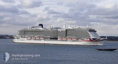
IONA
Passenger
Current Trip
| Time Travelled | 1 h, 53 mins |
|---|---|
| Remaining Time | 10 h, 39 mins |
| Distance Travelled | 19.01 nm |
| Remaining Distance | 166.84 nm |
| AVG Speed | 15.1 Knots |
| MAX Speed | 15.8 Knots |
| AVG Wind | 6.3 knots |
| MAX Wind | 7.3 knots |
| MIN Temp | 5.6°C / 42.08°F |
| MAX Temp | 6.5°C / 43.7°F |
| Draught | 8.8 m |
| Position Received | 3 m ago |
Current Position
| Longitude | 5.94192° |
|---|---|
| Latitude | 61.86320° |
| Status | Under way using engine |
| Speed | 15.1 Knots |
| Course | 279.2° |
| Area | Norwegian Sea |
| Station | T-AIS |
| Position Received | 3 m ago |
Info
Information
The current position of IONA is in Norwegian Sea with coordinates 61.86320° / 5.94192° as reported on 2024-06-11 18:13 by AIS to our vessel tracker app. The vessel's current speed is 15.1 Knots and is heading at the port of HELLESYLT. The estimated time of arrival as calculated by vessel tracking app is 2024-06-12 04:55 LT
The vessel IONA (IMO: 9826548, MMSI: 232025845) is a Passenger It's sailing under the flag of [GB] United Kingdom.
In this page you can find informations about the vessels current position, last detected port calls, and current voyage information. If the vessels is not in coverage by AIS you will find the latest position.
The current position of IONA is detected by our AIS receivers and we are not responsible for the reliability of the data. The last position was recorded while the vessel was in Coverage by the Ais receivers of our vessel tracking app.
The current draught of IONA as reported by AIS is 8.8 meters
Weather
| Temperature | 5.5°C / 41.9°F |
|---|---|
| Wind Speed | 7 knots |
| Direction | 350° N |
| Pressure | 1008.9 hPa |
| Humidity | 82.7 % |
| Cloud Coverage | 99 % |
Featured Company
Last Port Calls
| Port | Arrival | Departure | Time In Port |
|---|---|---|---|
| 2024-06-11 16:11 | 2024-06-11 16:23 | 11 m | |
| 2024-06-10 05:58 | 2024-06-10 15:29 | 9 h | |
| 2024-06-08 04:54 | 2024-06-08 17:08 | 12 h | |
| 2024-06-06 05:39 | 2024-06-06 14:59 | 9 h | |
| 2024-06-05 06:10 | 2024-06-05 14:55 | 8 h | |
| 2024-06-03 05:54 | 2024-06-03 15:30 | 9 h | |
| 2024-06-01 04:55 | 2024-06-01 16:58 | 12 h | |
| 2024-05-30 05:43 | 2024-05-30 14:57 | 9 h | |
| 2024-05-29 03:22 | 2024-05-29 14:56 | 11 h | |
| 2024-05-27 05:37 | 2024-05-27 15:15 | 9 h |
Last Trips
| Origin | Departure | Destination | Arrival | Distance | |
|---|---|---|---|---|---|
| 2024-06-10 17:29 | 2024-06-11 18:11 | 263.79 nm | |||
| 2024-06-08 18:08 | 2024-06-10 07:58 | 656.41 nm | |||
| 2024-06-06 16:59 | 2024-06-08 05:54 | 663.78 nm | |||
| 2024-06-05 16:55 | 2024-06-06 07:39 | 266.08 nm | |||
| 2024-06-03 17:30 | 2024-06-05 08:10 | 432.90 nm | |||
| 2024-06-01 17:58 | 2024-06-03 07:54 | 659.26 nm | |||
| 2024-05-30 16:57 | 2024-06-01 05:55 | 659.53 nm | |||
| 2024-05-29 16:56 | 2024-05-30 07:43 | 267.60 nm | |||
| 2024-05-27 17:15 | 2024-05-29 05:22 | 431.24 nm | |||
| 2024-05-25 18:05 | 2024-05-27 07:37 | 663.62 nm |
Events
| Time | Event | Details | Position / Dest | Info |
|---|---|---|---|---|
| 2024-06-11 17:02 | Destination Changed | NOOLD > NOHSY NO SVG > NO OLD |
61.83910 / 6.54410
NOOLD > NOHSY
|
Speed: 15 kn Course: 211.6° |
| 2024-06-11 17:02 | ETA Changed | 2024/06/12 05:00 2024/06/11 07:00 |
61.83910 / 6.54410
NOOLD > NOHSY
|
Speed: 15 kn Course: 211.6° |
| 2024-06-11 16:44 | START Moving | 5.22 nm, North West of OLDEN |
61.87882 / 6.64038
NO SVG > NO OLD
|
Speed: 14.7 kn Course: 269° |
| 2024-06-11 16:23 | PORT DEPARTURE |
|
61.87882 / 6.64038
NO SVG > NO OLD
|
Speed: 1.4 kn Course: 21° |
| 2024-06-11 16:12 | Status Changed | Under way using engine Default |
61.84461 / 6.80987
[NO] OLDEN
|
Speed: Course: -1° |
| 2024-06-11 16:11 | PORT ARRIVAL |
|
61.84461 / 6.80987
[NO] OLDEN
|
Speed: Course: -1° |
| 2024-06-11 15:59 | IN Coverage |
61.84461 / 6.80987
Norwegian Sea
[NO] OLDEN
|
Speed: 1.4 kn Course: 297.7° |
|
| 2024-06-11 05:12 | OUT of Coverage |
61.82601 / 6.51551
Norwegian Sea
NO SVG > NO OLD
|
Speed: 18.4 kn Course: 66.2° |
|
| 2024-06-10 22:47 | Change Sea Area | Norwegian part of the Norwegian Sea Norwegian part of the North Sea |
61.02184 / 4.25267
Norwegian Sea
NO SVG > NO OLD
|
Speed: 19.5 kn Course: 6.8° |
| 2024-06-10 19:06 | Status Changed | Under way using engine Default |
59.84317 / 4.53624
NO SVG > NO OLD
|
Speed: 20 kn Course: 336° |