
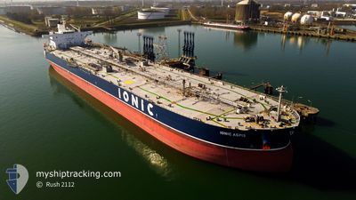
IONIC ASPIS
Crude Oil Tanker
Current Trip
| Time Travelled | 8 days |
|---|---|
| Remaining Time | 1 day |
| Distance Travelled | 1488.76 nm |
| Remaining Distance | 509.79 nm |
| AVG Speed | 11.9 Knots |
| MAX Speed | 13.5 Knots |
| AVG Wind | 6.6 knots |
| MAX Wind | 22.1 knots |
| MIN Temp | 17.9°C / 64.22°F |
| MAX Temp | 27.5°C / 81.5°F |
| Draught | 12.7 m |
| Position Received | Now |
Current Position
| Longitude | 12.91328° |
|---|---|
| Latitude | 36.55030° |
| Status | Under way using engine |
| Speed | 11.4 Knots |
| Course | 320.1° |
| Area | Mediterranean Sea - Eastern Basin |
| Station | T-AIS |
| Position Received | Now |
Info
Information
The current position of IONIC ASPIS is in Mediterranean Sea - Eastern Basin with coordinates 36.55030° / 12.91328° as reported on 2024-06-23 02:46 by AIS to our vessel tracker app. The vessel's current speed is 11.4 Knots and is heading at the port of GENOVA. The estimated time of arrival as calculated by vessel tracking app is 2024-06-25 02:30 LT
The vessel IONIC ASPIS (IMO: 9523287, MMSI: 538007962) is a Crude Oil Tanker that was built in 2011 ( 13 years old ). It's sailing under the flag of [MH] Marshall Is.
In this page you can find informations about the vessels current position, last detected port calls, and current voyage information. If the vessels is not in coverage by AIS you will find the latest position.
The current position of IONIC ASPIS is detected by our AIS receivers and we are not responsible for the reliability of the data. The last position was recorded while the vessel was in Coverage by the Ais receivers of our vessel tracking app.
The current draught of IONIC ASPIS as reported by AIS is 12.7 meters
Weather
| Temperature | 22.3°C / 72.14°F |
|---|---|
| Wind Speed | 19 knots |
| Direction | 325° NW |
| Pressure | 1011.3 hPa |
| Humidity | 84.8 % |
| Cloud Coverage | 10 % |
Featured Company
Last Port Calls
| Port | Arrival | Departure | Time In Port |
|---|---|---|---|
| 2024-06-12 19:42 | 2024-06-14 07:09 | 1 d | |
| 2024-05-24 09:04 | 2024-05-25 18:40 | 1 d | |
| 2024-04-22 19:58 | 2024-04-23 13:10 | 17 h | |
| 2024-04-13 16:20 |
Most Visited Ports (Last year)
| Port | Arrivals | |
|---|---|---|
| 2 | ||
| 2 | ||
| 2 | ||
| 1 | ||
| 1 | ||
| 1 |
Last Trips
| Origin | Departure | Destination | Arrival | Distance | |
|---|---|---|---|---|---|
| 2024-05-25 20:40 | 2024-06-12 21:42 | 3720.89 nm | |||
| 2024-04-23 08:10 | 2024-05-24 11:04 | 5248.81 nm | |||
| 2024-04-13 11:20 | 2024-04-22 14:58 | 321.35 nm |
Events
| Time | Event | Details | Position / Dest | Info |
|---|---|---|---|---|
| 2024-06-23 01:48 | Status Changed | Under way using engine Default |
36.41381 / 13.06583
ITGOA
|
Speed: 11 kn Course: 321° |
| 2024-06-23 01:44 | Status Changed | Default Under way using engine |
36.40513 / 13.07469
ITGOA
|
Speed: 11 kn Course: 321.3° |
| 2024-06-23 01:30 | Status Changed | Under way using engine Default |
36.37047 / 13.10800
ITGOA
|
Speed: 10.8 kn Course: 319° |
| 2024-06-23 01:21 | Status Changed | Default Under way using engine |
36.35177 / 13.12785
ITGOA
|
Speed: 10.7 kn Course: 319.6° |
| 2024-06-23 00:36 | Status Changed | Under way using engine Default |
36.24977 / 13.23432
ITGOA
|
Speed: 10.4 kn Course: 321° |
| 2024-06-23 00:01 | Status Changed | Default Under way using engine |
36.17130 / 13.31318
ITGOA
|
Speed: 10.3 kn Course: 322.2° |
| 2024-06-22 23:55 | Status Changed | Under way using engine Default |
36.15764 / 13.32631
ITGOA
|
Speed: 10.3 kn Course: 323° |
| 2024-06-22 23:46 | IN Coverage |
36.15764 / 13.32631
Mediterranean Sea - Eastern Basin
ITGOA
|
Speed: 10.3 kn Course: 322.2° |
|
| 2024-06-22 22:45 | Status Changed | Default Under way using engine |
36.00080 / 13.47850
ITGOA
|
Speed: 10.2 kn Course: 319.9° |
| 2024-06-22 22:39 | OUT of Coverage |
35.98752 / 13.49264
Mediterranean Sea - Eastern Basin
ITGOA
|
Speed: 10.2 kn Course: 319.9° |