
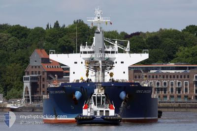
IONIC UNICORN
Cargo
Current Trip
| Time Travelled | 16 days |
|---|---|
| Remaining Time | --- |
| Distance Travelled | 5377.02 nm |
| Remaining Distance | --- |
| AVG Speed | 13.6 Knots |
| MAX Speed | 20 Knots |
| AVG Wind | 17.8 knots |
| MAX Wind | 36.8 knots |
| MIN Temp | 8.9°C / 48.02°F |
| MAX Temp | 18.9°C / 66.02°F |
| Draught | 10 m |
| Position Received | 3 h, 51 m ago |
Current Position
| Longitude | -120.77073° |
|---|---|
| Latitude | 28.95633° |
| Status | Under way using engine |
| Speed | 12.1 Knots |
| Course | 123.5° |
| Area | North Pacific Ocean |
| Station | T-AIS |
| Position Received | 3 h, 51 m ago |
Info
Information
The current position of IONIC UNICORN is in North Pacific Ocean with coordinates 28.95633° / -120.77073° as reported on 2024-06-10 20:27 by AIS to our vessel tracker app. The vessel's current speed is 12.1 Knots and is heading at the port of BALBOA. The estimated time of arrival as calculated by vessel tracking app is 2024-06-19 17:00 LT
The vessel IONIC UNICORN (IMO: 9747429, MMSI: 538006704) is a Cargo It's sailing under the flag of [MH] Marshall Is.
In this page you can find informations about the vessels current position, last detected port calls, and current voyage information. If the vessels is not in coverage by AIS you will find the latest position.
The current position of IONIC UNICORN is detected by our AIS receivers and we are not responsible for the reliability of the data. The last position was recorded while the vessel was in Coverage by the Ais receivers of our vessel tracking app.
The current draught of IONIC UNICORN as reported by AIS is 10 meters
Weather
| Temperature | 17.1°C / 62.78°F |
|---|---|
| Wind Speed | 14 knots |
| Direction | 346° NNW |
| Pressure | 1014.8 hPa |
| Humidity | 86.6 % |
| Cloud Coverage | 17 % |
Featured Company
Events
| Time | Event | Details | Position / Dest | Info |
|---|---|---|---|---|
| 2024-06-10 20:30 | Status Changed | Default Under way using engine |
28.94997 / -120.75954
PA BLB
|
Speed: 12.1 kn Course: 123.5° |
| 2024-06-10 20:27 | Detected in Sea | Mexican part of the North Pacific Ocean |
28.95633 / -120.77073
North Pacific Ocean
PA BLB
|
Speed: 12.1 kn Course: 123.5° |
| 2024-06-10 20:27 | Status Changed | Under way using engine Default |
28.95633 / -120.77073
PA BLB
|
Speed: 12 kn Course: 122° |
| 2024-06-10 20:27 | OUT of Coverage |
28.95633 / -120.77073
North Pacific Ocean
PA BLB
|
Speed: 12.1 kn Course: 123.5° |
|
| 2024-06-10 20:22 | IN Coverage |
28.95633 / -120.77073
North Pacific Ocean
PA BLB
|
Speed: 12.1 kn Course: 123.5° |
|
| 2024-06-10 01:59 | Status Changed | Default Under way using engine |
31.26354 / -124.98135
PA BLB
|
Speed: 14.2 kn Course: 120.1° |
| 2024-06-10 01:52 | OUT of Coverage |
31.27810 / -125.01049
North Pacific Ocean
PA BLB
|
Speed: 14.2 kn Course: 120.1° |
|
| 2024-06-10 00:12 | ETA Changed | 2024/06/19 17:00 2024/06/22 12:00 |
31.48443 / -125.40476
PA BLB
|
Speed: 14.1 kn Course: 121.3° |
| 2024-06-09 23:52 | Detected in Sea | High seas of the North Pacific Ocean |
31.52369 / -125.48105
North Pacific Ocean
PA BLB
|
Speed: 14 kn Course: 121° |
| 2024-06-09 23:52 | Status Changed | Under way using engine Default |
31.52369 / -125.48105
PA BLB
|
Speed: 14 kn Course: 122° |