
IRENES RESOLVE
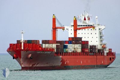
Container Ship
Current Trip
ZADUR =>ZPLZ
| Time Travelled | 11 h, 21 mins |
|---|---|
| Remaining Time | --- |
| Distance Travelled | 164.11 nm |
| Remaining Distance | --- |
| AVG Speed | 15 Knots |
| MAX Speed | 15.6 Knots |
| AVG Wind | 5.7 knots |
| MAX Wind | 9 knots |
| MIN Temp | 14.6°C / 58.28°F |
| MAX Temp | 17.3°C / 63.14°F |
| Draught | 10.3 m |
| Position Received | 4 d ago |
Current Position
| Longitude | 28.82563° |
|---|---|
| Latitude | -32.81908° |
| Status | Under way using engine |
| Speed | 11.2 Knots |
| Course | 224.6° |
| Area | Indian Ocean |
| Station | T-AIS |
| Position Received | 4 d ago |
Info
Information
The current position of IRENES RESOLVE is in Indian Ocean with coordinates -32.81908° / 28.82563° as reported on 2024-06-22 00:47 by AIS to our vessel tracker app. The vessel's current speed is 11.2 Knots
The vessel IRENES RESOLVE (IMO: 9227273, MMSI: 636015524) is a Container Ship that was built in 2001 ( 23 years old ). It's sailing under the flag of [LR] Liberia.
In this page you can find informations about the vessels current position, last detected port calls, and current voyage information. If the vessels is not in coverage by AIS you will find the latest position.
The current position of IRENES RESOLVE is detected by our AIS receivers and we are not responsible for the reliability of the data. The last position was recorded while the vessel was in Coverage by the Ais receivers of our vessel tracking app.
The current draught of IRENES RESOLVE as reported by AIS is 10.3 meters
Weather
| Temperature | 16.5°C / 61.7°F |
|---|---|
| Wind Speed | 6 knots |
| Direction | 133° SE |
| Pressure | 1030.6 hPa |
| Humidity | 68.3 % |
| Cloud Coverage | --- |
Featured Company
Last Port Calls
| Port | Arrival | Departure | Time In Port |
|---|---|---|---|
| 2024-06-25 06:51 | 2024-06-26 05:56 | 23 h | |
| 2024-06-18 08:14 | 2024-06-21 06:23 | 2 d | |
| 2024-05-29 12:03 | 2024-05-29 20:01 | 7 h | |
| 2024-05-20 22:13 | 2024-05-21 16:53 | 18 h | |
| 2024-05-18 20:38 | 2024-05-19 16:47 | 20 h | |
| 2024-05-16 14:08 | 2024-05-17 14:41 | 1 d | |
| 2024-05-02 09:19 | 2024-05-05 22:27 | 3 d | |
| 2024-04-22 01:31 | 2024-04-25 13:19 | 3 d |
Last Trips
| Origin | Departure | Destination | Arrival | Distance | |
|---|---|---|---|---|---|
| 2024-06-21 08:23 | 2024-06-25 08:51 | 420.26 nm | |||
| 2024-05-29 17:01 | 2024-06-18 10:14 | 4269.21 nm | |||
| 2024-05-21 13:53 | 2024-05-29 09:03 | 239.85 nm | |||
| 2024-05-19 13:47 | 2024-05-20 19:13 | 27.21 nm | |||
| 2024-05-17 11:41 | 2024-05-18 17:38 | 179.46 nm | |||
| 2024-05-05 23:27 | 2024-05-16 11:08 | 3768.62 nm | |||
| 2024-04-25 15:19 | 2024-05-02 10:19 | 2463.68 nm | |||
| 2024-03-27 18:14 | 2024-04-22 03:31 | 4600.91 nm |
Events
| Time | Event | Details | Position / Dest | Info |
|---|---|---|---|---|
| 2024-06-26 05:56 | PORT DEPARTURE |
|
-33.94597 / 25.63975
ZADUR =>ZPLZ
|
Speed: 5 kn Course: 351° |
| 2024-06-26 05:53 | START Moving |
-33.95253 / 25.64091
[ZA] PORT ELIZABETH
|
Speed: 5 kn Course: 351° |
|
| 2024-06-25 07:39 | STOP Moving |
-33.95925 / 25.63488
[ZA] PORT ELIZABETH
|
Speed: Course: 83° |
|
| 2024-06-25 06:51 | PORT ARRIVAL |
|
-33.95871 / 25.64223
[ZA] PORT ELIZABETH
|
Speed: 4.7 kn Course: 176° |
| 2024-06-25 05:01 | START Moving | 4.46 nm, South East of COEGA |
-33.86368 / 25.74650
ZADUR =>ZPLZ
|
Speed: 3.7 kn Course: 289° |
| 2024-06-22 18:20 | STOP Moving | 4.4 nm, South East of COEGA |
-33.86489 / 25.74256
ZADUR =>ZPLZ
|
Speed: 0.1 kn Course: 91° |
| 2024-06-22 00:51 | Status Changed | Default Under way using engine |
-32.82873 / 28.81465
ZADUR =>ZPLZ
|
Speed: 11.2 kn Course: 224.6° |
| 2024-06-22 00:47 | Status Changed | Under way using engine Default |
-32.81908 / 28.82563
ZADUR =>ZPLZ
|
Speed: 11.2 kn Course: 224° |
| 2024-06-22 00:47 | OUT of Coverage |
-32.81908 / 28.82563
Indian Ocean
ZADUR =>ZPLZ
|
Speed: 11.2 kn Course: 224.6° |
|
| 2024-06-22 00:35 | Status Changed | Default Under way using engine |
-32.79221 / 28.85646
ZADUR =>ZPLZ
|
Speed: 11 kn Course: 224.9° |