
IRIS
Towing
Current Trip
Unknown
| Time Travelled | 37 mins |
|---|---|
| Remaining Time | --- |
| Distance Travelled | 0.76 nm |
| Remaining Distance | --- |
| AVG Speed | --- |
| MAX Speed | --- |
| AVG Wind | 7 knots |
| MAX Wind | 7 knots |
| MIN Temp | 22.6°C / 72.68°F |
| MAX Temp | 22.8°C / 73.04°F |
| Draught | 0.2 m |
| Position Received | 25 m ago |
Current Position
| Longitude | 6.62281° |
|---|---|
| Latitude | 53.19629° |
| Status | Under way using engine |
| Speed | 1.3 Knots |
| Course | --- |
| Area | North Sea |
| Station | T-AIS |
| Position Received | 25 m ago |
Info
Information
The current position of IRIS is in North Sea with coordinates 53.19629° / 6.62281° as reported on 2024-06-26 08:20 by AIS to our vessel tracker app. The vessel's current speed is 1.3 Knots
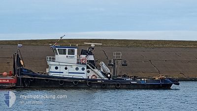
The vessel IRIS (MMSI: 244710356) is a Towing It's sailing under the flag of [NL] Netherlands.
In this page you can find informations about the vessels current position, last detected port calls, and current voyage information. If the vessels is not in coverage by AIS you will find the latest position.
The current position of IRIS is detected by our AIS receivers and we are not responsible for the reliability of the data. The last position was recorded while the vessel was in Coverage by the Ais receivers of our vessel tracking app.
The current draught of IRIS as reported by AIS is 0.2 meters
Weather
| Temperature | 22.9°C / 73.22°F |
|---|---|
| Wind Speed | 7 knots |
| Direction | 100° E |
| Pressure | 1013.3 hPa |
| Humidity | 71.6 % |
| Cloud Coverage | --- |
Featured Company
Last Port Calls
| Port | Arrival | Departure | Time In Port |
|---|---|---|---|
| 2024-06-24 19:30 | 2024-06-26 08:09 | 1 d | |
| 2024-06-24 06:48 | 2024-06-24 19:01 | 12 h | |
| 2024-06-21 07:16 | 2024-06-24 06:44 | 2 d | |
| 2024-06-18 12:09 | 2024-06-20 06:19 | 1 d | |
| 2024-06-17 12:00 | 2024-06-17 14:46 | 2 h | |
| 2024-06-14 07:14 | 2024-06-17 09:05 | 3 d | |
| 2024-06-13 19:32 | 2024-06-14 04:34 | 9 h | |
| 2024-06-13 10:59 | 2024-06-13 16:32 | 5 h | |
| 2024-06-13 07:52 | 2024-06-13 09:12 | 1 h | |
| 2024-06-11 13:08 | 2024-06-12 13:40 | 1 d |
Most Visited Ports (Last year)
| Port | Arrivals | |
|---|---|---|
| 40 | ||
| 27 | ||
| 18 | ||
| 13 | ||
| 12 | ||
| 5 |
Last Trips
| Origin | Departure | Destination | Arrival | Distance | |
|---|---|---|---|---|---|
| 2024-06-24 21:01 | 2024-06-24 21:30 | 0.96 nm | |||
| 2024-06-24 08:44 | 2024-06-24 08:48 | 0.13 nm | |||
| 2024-06-20 08:19 | 2024-06-21 09:16 | 28.55 nm | |||
| 2024-06-17 16:46 | 2024-06-18 14:09 | 19.48 nm | |||
| 2024-06-17 11:05 | 2024-06-17 14:00 | 11.12 nm | |||
| 2024-06-14 06:34 | 2024-06-14 09:14 | 12.57 nm | |||
| 2024-06-13 18:32 | 2024-06-13 21:32 | 12.65 nm | |||
| 2024-06-13 11:12 | 2024-06-13 12:59 | 13.67 nm | |||
| 2024-06-12 15:40 | 2024-06-13 09:52 | 30.88 nm | |||
| 2024-06-11 09:49 | 2024-06-11 15:08 | 22.06 nm |
Events
| Time | Event | Details | Position / Dest | Info |
|---|---|---|---|---|
| 2024-06-26 08:09 | PORT DEPARTURE |
|
53.18850 / 6.64131
|
Speed: 4.8 kn Course: 300.6° |
| 2024-06-26 08:08 | START Moving |
53.18782 / 6.64326
[NL] WATERHUIZEN
|
Speed: 4.9 kn Course: 300.3° |
|
| 2024-06-26 05:10 | IN Coverage |
53.18632 / 6.64722
North Sea
[NL] WATERHUIZEN
|
Speed: Course: 0° |
|
| 2024-06-26 02:44 | OUT of Coverage |
53.18630 / 6.64711
North Sea
[NL] WATERHUIZEN
|
Speed: Course: 0° |
|
| 2024-06-24 19:30 | PORT ARRIVAL |
|
53.18681 / 6.64584
[NL] WATERHUIZEN
|
Speed: 0.4 kn Course: 511° |
| 2024-06-24 19:01 | PORT DEPARTURE |
|
53.18110 / 6.66890
|
Speed: 2.6 kn Course: 511° |
| 2024-06-24 15:40 | IN Coverage |
53.18028 / 6.67234
North Sea
[NL] HOOGEZAND
|
Speed: Course: 0° |
|
| 2024-06-24 10:37 | OUT of Coverage |
53.18025 / 6.67228
North Sea
[NL] HOOGEZAND
|
Speed: Course: 0° |
|
| 2024-06-24 10:37 | IN Coverage |
53.18025 / 6.67228
North Sea
[NL] HOOGEZAND
|
Speed: Course: 0° |
|
| 2024-06-24 09:13 | OUT of Coverage |
53.18022 / 6.67244
North Sea
[NL] HOOGEZAND
|
Speed: Course: 0° |