
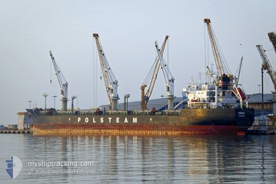
IRMA
Bulk Carrier
Current Trip
| Time Travelled | 18 h, 38 mins |
|---|---|
| Remaining Time | --- |
| Distance Travelled | 213.60 nm |
| Remaining Distance | --- |
| AVG Speed | 11.3 Knots |
| MAX Speed | 13.6 Knots |
| AVG Wind | 10.6 knots |
| MAX Wind | 15.6 knots |
| MIN Temp | 17.3°C / 63.14°F |
| MAX Temp | 28.3°C / 82.94°F |
| Draught | 8.1 m |
| Position Received | 52 m ago |
Current Position
| Longitude | -75.30232° |
|---|---|
| Latitude | 44.84146° |
| Status | Under way using engine |
| Speed | 8.5 Knots |
| Course | 56.7° |
| Area | Gulf of St-Lawrence |
| Station | T-AIS |
| Position Received | 52 m ago |
Info
Information
The current position of IRMA is in Gulf of St-Lawrence with coordinates 44.84146° / -75.30232° as reported on 2024-06-17 18:42 by AIS to our vessel tracker app. The vessel's current speed is 8.5 Knots and is heading at the port of TORRE ANNUNZIATA. The estimated time of arrival as calculated by vessel tracking app is 2024-07-02 12:00 LT
The vessel IRMA (IMO: 9180396, MMSI: 212934000) is a Bulk Carrier that was built in 2000 ( 24 years old ). It's sailing under the flag of [CY] Cyprus.
In this page you can find informations about the vessels current position, last detected port calls, and current voyage information. If the vessels is not in coverage by AIS you will find the latest position.
The current position of IRMA is detected by our AIS receivers and we are not responsible for the reliability of the data. The last position was recorded while the vessel was in Coverage by the Ais receivers of our vessel tracking app.
The current draught of IRMA as reported by AIS is 8.1 meters
Weather
| Temperature | 28.7°C / 83.66°F |
|---|---|
| Wind Speed | 10 knots |
| Direction | 240° WSW |
| Pressure | 1015.2 hPa |
| Humidity | 60.4 % |
| Cloud Coverage | 5 % |
Featured Company
Last Port Calls
| Port | Arrival | Departure | Time In Port |
|---|---|---|---|
| 2024-06-17 00:14 | 2024-06-17 00:57 | 42 m | |
| 2024-06-14 15:50 | 2024-06-14 16:50 | 59 m | |
| 2024-06-08 02:26 | 2024-06-09 23:08 | 1 d | |
| 2024-06-02 01:37 | 2024-06-02 02:11 | 33 m | |
| 2024-05-24 11:42 | 2024-05-31 23:32 | 7 d | |
| 2024-05-23 11:14 | 2024-05-24 02:58 | 15 h | |
| 2024-05-18 05:30 | 2024-05-21 00:54 | 2 d | |
| 2024-05-17 08:04 | 2024-05-17 08:54 | 50 m | |
| 2024-05-15 08:26 | 2024-05-15 22:12 | 13 h | |
| 2024-04-27 22:45 | 2024-05-03 04:30 | 5 d |
Most Visited Ports (Last year)
| Port | Arrivals | |
|---|---|---|
| 3 | ||
| 3 | ||
| 2 | ||
| 2 | ||
| 2 | ||
| 2 |
Last Trips
| Origin | Departure | Destination | Arrival | Distance | |
|---|---|---|---|---|---|
| 2024-06-14 12:50 | 2024-06-16 20:14 | 528.68 nm | |||
| 2024-06-09 19:08 | 2024-06-14 11:50 | 244.75 nm | |||
| 2024-06-01 22:11 | 2024-06-07 22:26 | 256.63 nm | |||
| 2024-05-31 18:32 | 2024-06-01 21:37 | 303.90 nm | |||
| 2024-05-23 21:58 | 2024-05-24 06:42 | 91.04 nm | |||
| 2024-05-20 20:54 | 2024-05-23 06:14 | 672.06 nm | |||
| 2024-05-17 04:54 | 2024-05-18 01:30 | 162.29 nm | |||
| 2024-05-15 18:12 | 2024-05-17 04:04 | 297.89 nm | |||
| 2024-05-03 06:30 | 2024-05-15 04:26 | 3403.72 nm | |||
| 2024-04-25 06:59 | 2024-04-28 00:45 | 769.22 nm |
Events
| Time | Event | Details | Position / Dest | Info |
|---|---|---|---|---|
| 2024-06-17 18:47 | Status Changed | Default Under way using engine |
44.84835 / -75.28575
ITTOA
|
Speed: 8.5 kn Course: 56.7° |
| 2024-06-17 18:42 | Status Changed | Under way using engine Default |
44.84146 / -75.30232
ITTOA
|
Speed: 6.3 kn Course: 29° |
| 2024-06-17 18:39 | START Moving | 3.98 nm, North East of CARDINAL |
44.83705 / -75.30853
ITTOA
|
Speed: 6.3 kn Course: 29° |
| 2024-06-17 18:35 | IN Coverage |
44.84146 / -75.30232
Gulf of St-Lawrence
ITTOA
|
Speed: 8.5 kn Course: 56.7° |
|
| 2024-06-17 18:15 | STOP Moving | 3.55 nm, North East of CARDINAL |
44.83025 / -75.31306
ITTOA
|
Speed: Course: 27° |
| 2024-06-17 17:39 | Status Changed | Default Under way using engine |
44.81547 / -75.32629
ITTOA
|
Speed: 6.6 kn Course: 53.7° |
| 2024-06-17 17:31 | OUT of Coverage |
44.80810 / -75.33867
Gulf of St-Lawrence
ITTOA
|
Speed: 6.6 kn Course: 53.7° |
|
| 2024-06-17 09:58 | Status Changed | Under way using engine Default |
43.84338 / -76.75725
ITTOA
|
Speed: 13 kn Course: 68° |
| 2024-06-17 09:06 | Status Changed | Default Under way using engine |
43.77334 / -77.00333
ITTOA
|
Speed: 13 kn Course: 69.3° |
| 2024-06-17 08:30 | Status Changed | Under way using engine Default |
43.73114 / -77.17201
ITTOA
|
Speed: 13 kn Course: 73° |