
IRYDA
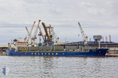
Bulk Carrier
Current Trip
| Time Travelled | 8 days |
|---|---|
| Remaining Time | --- |
| Distance Travelled | 2142.67 nm |
| Remaining Distance | --- |
| AVG Speed | 10.3 Knots |
| MAX Speed | 13.9 Knots |
| AVG Wind | 15.3 knots |
| MAX Wind | 27 knots |
| MIN Temp | 12.1°C / 53.78°F |
| MAX Temp | 21.5°C / 70.7°F |
| Draught | 10 m |
| Position Received | 4 h, 13 m ago |
Current Position
| Longitude | 4.85318° |
|---|---|
| Latitude | 53.63659° |
| Status | Under way using engine |
| Speed | 10 Knots |
| Course | 19.6° |
| Area | North Sea |
| Station | T-AIS |
| Position Received | 4 h, 13 m ago |
Info
Information
The current position of IRYDA is in North Sea with coordinates 53.63659° / 4.85318° as reported on 2024-06-01 00:14 by AIS to our vessel tracker app. The vessel's current speed is 10 Knots and is heading at the port of PORT MORSKI POLICE. The estimated time of arrival as calculated by vessel tracking app is 2024-06-03 16:00 LT
The vessel IRYDA (IMO: 9180384, MMSI: 212891000) is a Bulk Carrier that was built in 1999 ( 25 years old ). It's sailing under the flag of [CY] Cyprus.
In this page you can find informations about the vessels current position, last detected port calls, and current voyage information. If the vessels is not in coverage by AIS you will find the latest position.
The current position of IRYDA is detected by our AIS receivers and we are not responsible for the reliability of the data. The last position was recorded while the vessel was in Coverage by the Ais receivers of our vessel tracking app.
The current draught of IRYDA as reported by AIS is 10 meters
Weather
| Temperature | 13.6°C / 56.48°F |
|---|---|
| Wind Speed | 23 knots |
| Direction | --- N |
| Pressure | 1016 hPa |
| Humidity | 91.7 % |
| Cloud Coverage | 67 % |
Featured Company
Most Visited Ports (Last year)
| Port | Arrivals | |
|---|---|---|
| 3 | ||
| 3 | ||
| 3 | ||
| 2 | ||
| 2 | ||
| 2 |
Events
| Time | Event | Details | Position / Dest | Info |
|---|---|---|---|---|
| 2024-06-01 00:16 | Status Changed | Default Under way using engine |
53.64101 / 4.85597
PLPLC
|
Speed: 10 kn Course: 19.6° |
| 2024-06-01 00:14 | OUT of Coverage |
53.63659 / 4.85318
North Sea
PLPLC
|
Speed: 10 kn Course: 19.6° |
|
| 2024-05-31 20:14 | Status Changed | Under way using engine Default |
53.02748 / 4.35565
PLPLC
|
Speed: 10.3 kn Course: 28° |
| 2024-05-31 20:01 | Status Changed | Default Under way using engine |
52.99646 / 4.32574
PLPLC
|
Speed: 10.2 kn Course: 27.6° |
| 2024-05-31 18:57 | Status Changed | Under way using engine Default |
52.84052 / 4.19670
PLPLC
|
Speed: 9.7 kn Course: 40° |
| 2024-05-31 18:36 | Status Changed | Default Under way using engine |
52.79602 / 4.13561
PLPLC
|
Speed: 9.7 kn Course: 38.7° |
| 2024-05-31 18:24 | Status Changed | Under way using engine Default |
52.77240 / 4.10385
PLPLC
|
Speed: 9.5 kn Course: 38° |
| 2024-05-31 18:16 | Status Changed | Default Under way using engine |
52.75427 / 4.07911
PLPLC
|
Speed: 9.5 kn Course: 39.6° |
| 2024-05-31 17:55 | Status Changed | Under way using engine Default |
52.71156 / 4.02234
PLPLC
|
Speed: 9.6 kn Course: 40° |
| 2024-05-31 17:43 | Status Changed | Default Under way using engine |
52.68729 / 3.99015
PLPLC
|
Speed: 9.6 kn Course: 38.4° |