
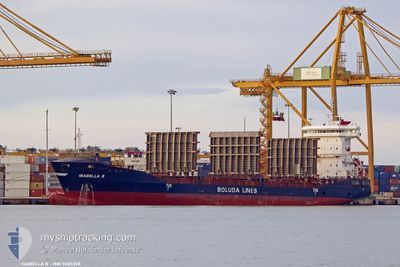
ISABELLA B
Container Ship
Current Trip
| Time Travelled | 1 day |
|---|---|
| Remaining Time | 11 h, 58 mins |
| Distance Travelled | 496.54 nm |
| Remaining Distance | 207.18 nm |
| AVG Speed | 16.4 Knots |
| MAX Speed | 16.9 Knots |
| AVG Wind | 14.4 knots |
| MAX Wind | 18.9 knots |
| MIN Temp | 16.5°C / 61.7°F |
| MAX Temp | 19.4°C / 66.92°F |
| Draught | 8.3 m |
| Position Received | 3 h, 58 m ago |
Current Position
| Longitude | -12.57620° |
|---|---|
| Latitude | 31.50046° |
| Status | Under way using engine |
| Speed | 16.5 Knots |
| Course | 226° |
| Area | North Atlantic Ocean |
| Station | T-AIS |
| Position Received | 3 h, 58 m ago |
Info
Information
The current position of ISABELLA B is in North Atlantic Ocean with coordinates 31.50046° / -12.57620° as reported on 2024-05-29 07:12 by AIS to our vessel tracker app. The vessel's current speed is 16.5 Knots and is heading at the port of TENERIFE. The estimated time of arrival as calculated by vessel tracking app is 2024-05-29 23:09 LT
The vessel ISABELLA B (IMO: 9483358, MMSI: 255805652) is a Container Ship that was built in 2012 ( 12 years old ). It's sailing under the flag of [PT] Portugal.
In this page you can find informations about the vessels current position, last detected port calls, and current voyage information. If the vessels is not in coverage by AIS you will find the latest position.
The current position of ISABELLA B is detected by our AIS receivers and we are not responsible for the reliability of the data. The last position was recorded while the vessel was in Coverage by the Ais receivers of our vessel tracking app.
The current draught of ISABELLA B as reported by AIS is 8.3 meters
Weather
| Temperature | 19.3°C / 66.74°F |
|---|---|
| Wind Speed | 15 knots |
| Direction | 9° N |
| Pressure | 1017.5 hPa |
| Humidity | 80.9 % |
| Cloud Coverage | 95 % |
Featured Company
Last Port Calls
| Port | Arrival | Departure | Time In Port |
|---|---|---|---|
| 2024-05-27 20:15 | 2024-05-28 04:36 | 8 h | |
| 2024-05-24 23:20 | 2024-05-25 23:07 | 23 h | |
| 2024-05-22 07:23 | 2024-05-22 22:32 | 15 h | |
| 2024-05-18 06:43 | 2024-05-18 16:30 | 9 h | |
| 2024-05-16 08:13 | 2024-05-17 23:44 | 1 d | |
| 2024-05-15 23:54 | 2024-05-16 04:35 | 4 h | |
| 2024-05-13 20:12 | 2024-05-14 05:36 | 9 h | |
| 2024-05-11 03:32 | 2024-05-11 21:12 | 17 h | |
| 2024-05-08 04:34 | 2024-05-08 20:32 | 15 h | |
| 2024-05-03 06:03 | 2024-05-03 17:07 | 11 h |
Most Visited Ports (Last year)
| Port | Arrivals | |
|---|---|---|
| 54 | ||
| 51 | ||
| 42 | ||
| 26 | ||
| 3 |
Last Trips
| Origin | Departure | Destination | Arrival | Distance | |
|---|---|---|---|---|---|
| 2024-05-26 01:07 | 2024-05-27 22:15 | 482.35 nm | |||
| 2024-05-23 00:32 | 2024-05-25 01:20 | 7.86 nm | |||
| 2024-05-18 17:30 | 2024-05-22 09:23 | 1136.63 nm | |||
| 2024-05-18 00:44 | 2024-05-18 07:43 | 56.33 nm | |||
| 2024-05-16 05:35 | 2024-05-16 09:13 | 54.45 nm | |||
| 2024-05-14 07:36 | 2024-05-16 00:54 | 701.03 nm | |||
| 2024-05-11 23:12 | 2024-05-13 22:12 | 484.22 nm | |||
| 2024-05-08 22:32 | 2024-05-11 05:32 | 7.65 nm | |||
| 2024-05-03 18:07 | 2024-05-08 06:34 | 1132.74 nm | |||
| 2024-05-03 02:11 | 2024-05-03 07:03 | 55.35 nm |
Events
| Time | Event | Details | Position / Dest | Info |
|---|---|---|---|---|
| 2024-05-29 07:20 | Status Changed | Default Under way using engine |
31.47459 / -12.60776
ESSCT
|
Speed: 16.5 kn Course: 226° |
| 2024-05-29 07:12 | OUT of Coverage |
31.50046 / -12.57620
North Atlantic Ocean
ESSCT
|
Speed: 16.5 kn Course: 226° |
|
| 2024-05-29 07:08 | Status Changed | Under way using engine Default |
31.51290 / -12.56104
ESSCT
|
Speed: 16.6 kn Course: 227° |
| 2024-05-29 07:04 | Status Changed | Default Under way using engine |
31.52599 / -12.54515
ESSCT
|
Speed: 16.6 kn Course: 225.7° |
| 2024-05-29 06:52 | Change Sea Area | Spanish (Canary Islands) part of the North Atlantic Ocean Moroccan part of the North Atlantic Ocean |
31.56300 / -12.50049
North Atlantic Ocean
ESSCT
|
Speed: 16.7 kn Course: 225.6° |
| 2024-05-29 06:52 | Status Changed | Under way using engine Default |
31.56455 / -12.49860
ESSCT
|
Speed: 16.3 kn Course: 224° |
| 2024-05-29 06:36 | IN Coverage |
31.56300 / -12.50049
North Atlantic Ocean
ESSCT
|
Speed: 16.7 kn Course: 225.6° |
|
| 2024-05-29 05:48 | Status Changed | Default Under way using engine |
31.77163 / -12.25486
ESSCT
|
Speed: 16.4 kn Course: 225.4° |
| 2024-05-29 05:39 | OUT of Coverage |
31.80015 / -12.21996
North Atlantic Ocean
ESSCT
|
Speed: 16.4 kn Course: 225.4° |
|
| 2024-05-29 05:30 | Status Changed | Under way using engine Default |
31.82776 / -12.18598
ESSCT
|
Speed: 16.3 kn Course: 225° |